Isle of Wight Walks

Use the links to view full route information including elevation profiles, interactive maps and GPS downloads.
You can also view an overview map of all the routes in the using the Isle of Wight Walk Map>>
| Route Name | Photo | Distance | Description |
| Alum Bay and Headon Warren | 2 miles (3 km) | This walk visits Alum Bay, Headon Warren and Headon Hill in the south western corner of the Isle of Wight. View Full Details>> | |
| Bembridge Trail | 12 miles (19 km) | This trail runs from Newport to Bembridge via the lovely village of Brading. Highlights include splendid views of Arreton and Brading Downs and a pleasant stretch along the River Yar. View Full Details>> | |
| Borthwood Copse | 1 miles (2 km) | Visit this delightful area of woodland near Sandown and look out for red squirrels on this short walk on the Isle of Wight. The shady woodland is owned by the National Trust so there are nice footpaths to follow and an on site car park. The woodland consists of hazel and sweet chestnut with carpets of bluebells in the spring. You can also climb to a viewpoint where you can enjoy views towards the coast and Culver Down. The woods are close to the villages of Queen's Bower and Alverston where you can buy refreshments. If you'd like to walk to the woods then you could follow the Yar River Trail from Sandown to Alverston and then head south. If you are coming by bike then you could follow National Cycle Route 67 from Sandown. View Full Details>> | |
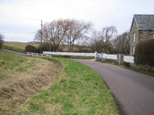
| Brighstone Forest | 5 miles (7.3 km) | This walk explores Brighstone Forest and Brighstone Down on the Isle of Wight. View Full Details>> | |
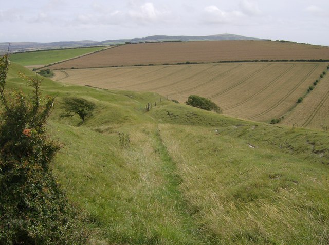
| Culver Down | 2 miles (4 km) | Explore the beautiful Culver Down before visiting Bembridge Fort on this circular walk on the Isle of Wight coast. There are fabulous views over Sandown Bay, Shanklin Bay and the Solent to enjoy on the walk. The downs are also covered in pretty wildflowers such as cowslip, rock rose, Bee orchid and birdsfoot trefoil. These attract many butterflies such as the chalkhill blue. The walk starts at the Culver Cliff car park and heads to Culver Battery and Whitecliff Ledge where there are great views over Whitecliff Bay, Horseshoe Bay and Bembridge. You continue along the coast path before climbing to the hill fort. Here you can explore the remains of 19th-century and First World War fortifications with gun emplacements. From the elevated position there are tremendous views over the downs to the sea. From the fort you descend across Bembridge Down back to the car park. You'll pass the Yarborough Monument, a memorial to Lord Yarborough, the first Commodore of the Royal Yacht Squadron on the way. You can extend your walk by continuing along the Isle of Wight Coast Path in either direction. The Bembridge Trail and the Yar River Trail also pass through the area just north of the hill fort. If you are on a bike then National Cycle Route 67 also runs close to the fort. You can follow the route from Bembridge to Culver Down Road and turn south to reach the downs and the fort. View Full Details>> | |
| Devils Chimney Isle of Wight | 2 miles (3.8 km) | This circular walk visits an interesting geological feature near Ventnor on the Isle of Wight. View Full Details>> | |
| Firestone Copse | 1 miles (1.6 km) | This walk explores the woodland at Firestone Copse near Ryde on the Isle of Wight. View Full Details>> | |
| Godshill Isle Of Wight | 6 miles (9 km) | This quaint village is located on the Isle Of Wight between Newport and Ventnor in the southeast of the island. It's a delightful place with picturesque thatched cottages and the historic All Saints Church which dates from the medieval period. View Full Details>> | |
| Hamstead Trail | 8 miles (13 km) | Cross the western end of the Isle of Wight from north to south, and enjoy spectacular coastal views on this splendid trail. The trail starts at Hamstead Point on the northern coast, and climbs towards Shalcombe Down, passing Cranmore and Wellow on the way. This first section passes through woodland, near Cranmore, where red squirrels are often spotted. As the path climbs through Wellow and Shalcombe Down you will enjoy fabulous views of the Isle of Wight coastline, including The Needles and St Catherines Point. The walk finishes descending to Brook Bay on the southern coast of the island. The Tennyson Trail and the Freshwater Trail from Yarmouth to Freshwater Bay are good options for extending your walking in this part of the island. View Full Details>> | |
| Isle of Wight Coast Path | 70 miles (113 km) | Explore the stunning coastline of this beautiful island on this circular walk. The walk begins at Cowes and passes the lovely Gurnard and Thorness Bays before coming to Newton, with its delightful wildlife Nature Reserve. You continue along the Newton River estuary, passing Newton Bay on your way to the popular town of Yarmouth where the ferry arrives from Lymington. Here you will cross the river Yar and pass the castle before coming to the village of Freshwater. The path then leads you to the south west tip of the island where you will pass the beautiful Alum Bay and the famous Needles rocks. The Needles park is one of the most popular attractions on the island and includes a chairlift which gives fabulous views of the Needles Rocks and Lighthouse. There's also the old National Trust owned batteries to see here. From the Needles you head east towards St Catherine's point, passing Tennyson Down, Freshwater, Brighstone and Chale Bay. After rounding St Catherine's point (the southernmost point of the island) and lighthouse you pass a series of pretty bays and coves on your way to the popular seaside resort at Ventnor. The path then visits two more lovely seaside resorts at Shanklin and Sandown. Shanklin has a picturesque old town and a pretty esplanade with a number of hotels and restaurants. Sandown Bay is also attractive with a popular stretch of golden sand and the interesting Victorian town to explore. You then round the chalk down at Culver Down and Bembridge Fort, before passing Bembridge village with its pretty harbour, bays and beaches. Next stop is the seaside resort at Ryde with beaches and the esplanade to enjoy. The final section takes you from Ryde to Cowes, crossing Wooton creek and passing Osborne House. View Full Details>> | |
| Mottistone Manor | 6 miles (10 km) | Explore the estate, gardens and coastline surrounding this Elizabethan manor house on the Isle of Wight. View Full Details>> | |
| Nunwell Trail | 7 miles (12 km) | This walk crosses the island from Sandown to Ryde, passing water meadows and crossing the chalk downland that runs the length of the island. The walk starts at Sandown station and heads north through Brading Down where there are magnificent views of East Wight and the Solent. You may also see the Isle of Wight Steam Railway on the way as it crosses the trail near Smallbrook. Nature lovers should look out for Sand Martins, Chiffchaff and Willow Warblers using the nature hide on the route. The walk finishes just outside Ryde at St John's railway station, though you can easily continue into Ryde. View Full Details>> | |
| Osborne House | 2 miles (3 km) | Explore the beautiful and extensive grounds of Queen Victoria's royal seaside palace on this lovely walk near Cowes on the Isle of Wight. View Full Details>> | |
| Parkhurst Forest | 4 miles (6 km) | This forest near Newport has a series of good cycling and walking trails to try. View Full Details>> | |
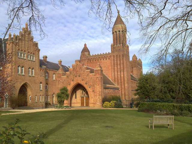
| Quarr Abbey | 1 miles (1 km) | This walk visits the historic Quar Abbey, near Fishbourne and Ryde on the northern coast of the Isle of Wight. View Full Details>> | |
| Ryde to Bembridge Coastal Walk | 6 miles (10 km) | A popular section of the Isle of Wight Coast Path, running from Ryde to Bembridge. View Full Details>> | |
| Shanklin | 2 miles (3 km) | Shanklin is a popular tourist village located on the southern part of the island. With a sandy beach, charming old village, cliff tops trails and a wooded chine it's a popular place for starting or ending a walk. View Full Details>> | |
| Shanklin to Ventnor Coastal Walk | 3 miles (5.5 km) | This is a popular walk using a lovely section of the Isle of Wight Coast Path to take you between these two seaside resorts. It's a signposted 3.5 mile hike with some moderate hill climbs, a woodland section and fabulous views throughout. Most of the walk is on fairly flat paths but there are some climbs so a reasonable level of fitness is required. You can get the bus back or return the same way if you are feeling energetic! Starting on the front in Shanklin head south past the popular Shanklin Chine with its lovely beach. The chine is worth further exploration if you have time. In it you will find interesting geological features, a wooded coastal ravine, waterfalls, trees, lush vegetation, and several footpaths and walkways allowing paid access for visitors. After passing the chine you come to Appley Steps where you begin the steepest climb of the walk. It takes you up towards Luccombe village where there's some spectacular cliffs and scenery. The route then heads through Bonchurch Landslips where there are some nice woodland trails, more interesting geological formations and sea glimpses through the trees. You'll also pass Old St. Boniface Church which is worth a visit. The nave and chancel dates from the 11th century, with the bell dating from the 16th century. The final section takes you past Horseshoe Bay and Wheelers Bay before finishing on the front in Ventnor. The popular seaside resort is located to the south of St Boniface Down, the highest point on the island. Ventnor is built on steep slopes leading down to the sea and enjoys a microclimate which allows sub tropical plants to flourish. Visit the Ventnor Botanic Garden to see examples. You can extend the walk by continuing west along the coast to St Lawrence and St Catherine's Lighthouse, the most southerly point on the Isle of Wight. Above Ventnor you can climb to Ventnor Downs and St Boniface Down, the highest point on the island. There's fabulous views, wildflowers, heather and New Forest Ponies to be seen on St Boniface Down. View Full Details>> | |
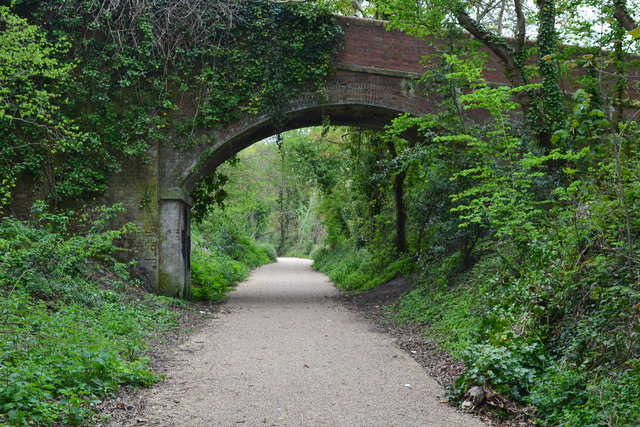
| Shanklin to Ventnor Railway Walk | 5 miles (8.2 km) | This walk follows the old railway line from Shanklin To Ventnor on the Isle of Wight. View Full Details>> | |
| Sheperds Trail | 8 miles (13 km) | This walk starts at the beautiful Shepherd's Chine, on the south coast of the island, and heads to Newport via Whitcombe Cross, Gatcombe, Chillerton, Billingham and Kingston. There are splendid views of the island as you climb the chalk hills on the south west corner. The walk finishes at the splendid Carisbrooke Castle where Charles I was imprisoned. You can enjoy the new Princess Beatrice Garden and the tranquil chapel at this fine historical attraction. Use google street view below to explore the castle. View Full Details>> | |
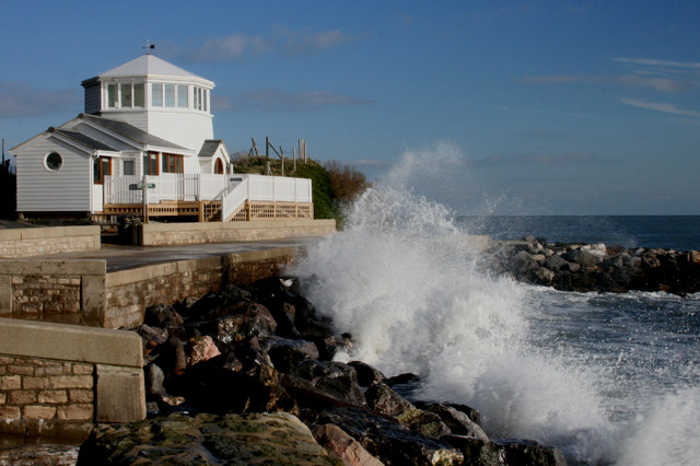
| St Catherine's Lighthouse | 2 miles (4 km) | Visit the most southerly point on the Isle of Wight on this circular walk around St Catherine's Point and St Catherine's Down. It's a particularly lovely part of the island with steep cliffs, attractive woodland, grassland with wildflowers and stunning coastal views. The walk start from the Niton undercliff car park and follows footpaths down to St Catherine's Point via Knowles Farm. In 1901 Guglielmo Marconi, the inventor of the radiotelegraph system, succeeded in transmitting radio signals from Knowles Farm to the Lizard Radio Telegraph Station 186 miles away in Cornwall. The route continues around the impressive 19th century lighthouse, passing along the cliff towards Reeth Bay. Here you climb back to Knowles Farm and the car park passing the 16th century Buddle Inn. It's a charming Oldy Worlde Pub with outdoor seating and great views. It's roughly the half way point on the walk so an ideal place for refreshments! If you'd like to extend your walk you could pick up the Isle of Wight Coast Path and follow it to the nearby Ventnor Downs and St Boniface Down, the highest point on the island. You can visit the lighthouse by bike by following Regional Cycle Route 67 otherwise known as the 'Round the Island' route. View Full Details>> | |
| St Helens Fort | 4 miles (6.5 km) | This walk explores the delightful coastal village of St Helens on the eastern side of the Isle of Wight. View Full Details>> | |
| Stenbury Trail | 10 miles (16 km) | This trail follows bridleways along the river valley from Newport, passing Appuldurcombe, Stenbury and Week Downs before finishing at the delightful Ventnor botanic gardens on the coast. The walk involves a decent climb but you are rewarded with fabulous views of the island and coast. Highlights include the thatched cottages in the pretty village of Godshill and the English Heritage owned Appuldurcombe House. View Full Details>> | |
| Tennyson Down | 4 miles (6.1 km) | A circular walk to Tennyson Down and the Tennyson Mounment on the Isle of Wight Coast. The circular walk also visits The Needles which are just up the coast from the monument. It's a bracing walk with excellent views over the Solent from the cliff tops. View Full Details>> | |
| Tennyson Trail | 14 miles (23 km) | This walk runs from Newport to Alum Bay via Brighstone, Freshwater and Tennyson Down. The walk starts at Carisbrooke, near the fascinating Carisbrooke Castle where Charles I was imprisoned. You can enjoy the new Princess Beatrice Garden and the tranquil chapel at this fine historical attraction. Use google street view below to explore the castle. You then head through the beautiful Brighstone Down and Brighstone Forest before arriving at the coast where there are splendid views over Freshwater towards Alum Bay and The Needles. The final section takes you through the coastal Freshwater Bay Golf course and then through Tennyson Down before finishing at the delightful Alum Bay. This is quite a challenging walk with several climbs through the downs, but there are terrific views of the island to enjoy throughout. To further explore this part of the island you can pick up the Hamstead Trail, Isle of Wight Coast Path or the Freshwater Trail from Yarmouth to Freshwater Bay. View Full Details>> | |
| The Needles | 2 miles (3.5 km) | This circular walk pays a visit to the famous chalk sea stacks on the Isle of Wight Coast. View Full Details>> | |
| Ventnor Downs | 2 miles (4 km) | Visit the highest point on the Isle of Wight and enjoy wonderful views over the island's coast and countryside on this circular walk. Look out for various pretty wildflowers, heather and New Forest Ponies on St Boniface Down. You may also see other wildlife such as skylark, meadow pipit, buzzards, kestrels, various butterflies and a herd of Old English goats which graze on Bonchurch Down and Coombe Bottom. The area also has an interesting military history with various WW2 buildings and the RAF Ventnor Radar Station which played an important role in the Battle of Britain. The walk starts from the Ventnor Down National Trust car park and takes you across Luccombe Down, Bonchurch Down and St Boniface Down. There's some challenging climbing but you are rewarded with fabulous views to Sandown Bay, Culver Cliffs and Portsmouth. You can extend your walk by heading to the nearby Wroxall Down or by following the Isle of Wight Coast Path west to St Catherine's Lighthouse. The Shanklin to Ventnor Coastal Walk is also very popular with more lovely sea views and some interesting woodland trails. View Full Details>> | |
| Ventnor to Steephill Cove Walk | 4 miles (6 km) | This popular circular walk from Ventnor takes you to the picturesque Steephill Cove. View Full Details>> | |
| Worsley Trail | 15 miles (24 km) | This lovely 15 mile walk runs from Brightstone Down through Godshill and on to Shanklin. View Full Details>> | |
| Yar River Trail | 19 miles (31 km) | Follow the Yar River Trail from its source near Niton to Bembridge Harbour. View Full Details>> | |
| Yarmouth to Freshwater Bay | 3 miles (5.5 km) | Cross the western side of the Isle of Wight from north to south on the Freshwater Way trail. It's a 3.5 mile walk taking place on generally flat paths along the pretty estuary of the River Yar. View Full Details>> |