Loch Lomond and the Trossachs Cycle Routes

With miles of woodland trails and wonderful lochside paths Loch Lomond and the Trossachs is a wonderful place for leisure cyclists and mountain bikers.
Use the links to view full route information including elevation profiles, interactive maps and GPS downloads.
You can also view an overview map of all the routes in the using the Loch Lomond and the Trossachs Cycle Map>>
| Route Name | Photo | Distance | Description |
| Aberfoyle to Callander | 13 miles (21 km) | This popular ride takes you from Aberfoyle to Callander in the Loch Lomond and the Trossachs National Park. It's a splendid ride taking you through the Queen Elizabeth Forest Park to Loch Venachar and Loch Drunkie. The route runs for about 13 miles along National Cycle Route 7 on mostly traffic free paths. View Full Details>> | |
| Balloch Castle Country Park | 3 miles (4.5 km) | Enjoy spectacular views of Loch Lomond in this beautiful country park in West Scotland. There are 200 acres to explore with nature trails, guided walks, peaceful woodland, a delightful walled garden and Balloch Castle which now serves as the visitor centre. You can stroll along the shoreline of the loch and then visit the Chinese Garden, Quarry Pond and the Secret Garden before enjoying refreshments at the loch side kiosk. The Three Lochs Way runs past the park so this is a great option if you would like to continue your walk/cycle. View Full Details>> | |
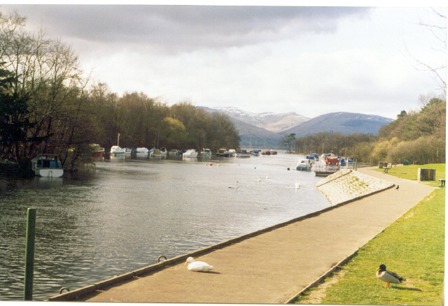
| Callander to Balquhidder | 11 miles (18 km) | Travel from Callander to Balquhidder on this lovely route on National Cycle Route 7. The route runs for just under 13 miles on a mixture of traffic free paths and woodland trails with a short on road section at the end of the route. Much of the route uses a dismantled section of the old Callander & Oban Railway so is also suitable for walkers as well. It's a reasonably flat route with a couple of moderate climbs along the way. There's much to enjoy with river views, stunning lochs and some attractive woodland trails. The first section of the ride takes you north along the Garbh Uisge River to the Falls of Leny and Loch Lubnaig. There's a lovely lochside trail to follow to Strathyre where you pick up a country lane to take you into Balquhidder. View Full Details>> | |
| Dumbarton to Callander | 39 miles (62 km) | Follow National Cycle Route 7 on this incredible cycle ride through Loch Lomond and Trossachs National Park and enjoy fabulous views of Lochs Lomond, Drunkie and Venachar. The ride starts with a great traffic free run along the River Leven from Dumbarton to Balloch where there are splendid views of Loch Lomond and Balloch Castle Country Park. You then continue on road to Drymen, before a lovely run through Queen Elizabeth Forest Park takes you onto Aberfoyle. Here you join a traffic free section that takes you through Achray Forest and past Loch Achray, Loch Venachar and Loch Drunkie. View Full Details>> | |
| Glasgow to Balloch | 21 miles (34 km) | This ride takes you from the city of Glasgow to the village of Balloch in the Loch Lomond and the Trossachs National Park. The route runs for just over 20 miles, using a largely traffic free section of National Cycle Route 7. It's a fairly flat ride taking you along the Clyde River, the Forth and Clyde Canal and finally through the lovely scenery of the Vale of Leven. As such it's a great way to reach the shores of Loch Lomond using your steam. The route starts near Argyle Street Station and the cathedral, on the River Clyde in Glasgow. From here you can pick up a riverside path called the Clyde Walkway which will take you west along the Clyde to Clydebank. The trail continues west along the Forth and Clyde Canal to Dumbarton where you turn north to follow a nice trail along the River Leven into Balloch. View Full Details>> | |
| Glen Ogle | 8 miles (12.8 km) | This lovely cycling and walking trail takes you along National Cycle Route 7 through the beautiful Glen Ogle. The route runs for about 8 miles along a traffic free path following the course of the former Callander and Oban Railway from Killin to Loch Earn. There's a moderate climb in the first half of the route before descending to the loch. On the way you'll enjoy views of the Ogle Burn and the pretty Lochan Lairig Chaile. The route starts on the Bridge of Dochart in the village of Killin, situated at the western head of Loch Tay in Stirling. The village is home to the wonderful Falls of Dochart, a major scenic highlight of the area. From here you can pick up the railway trail heading south west into the woodland of the glen. The trail takes you south, passing the still waters of Lochan Leirig Chaile to Lochearnhead at the foot of Glen Ogle. View Full Details>> | |
| Inverness to Carrbridge | 32 miles (52 km) | Travel along National Cycle routes 1 and 7 on this fascinating cycle ride which takes you past Culloden battlefield and the historic Bronze Age Clava Cairns. The ride starts on the River Ness at Inverness, heading east to the historic village of Culloden. You then pass the famous Culloden Battlefield where the Jacobites were defeated by the British in 1746. View Full Details>> | |
| Inverness to Nairn | 25 miles (40 km) | Travel along National Cycle Route 1 in this fascinating cycle ride which takes you past Culloden battlefield and the historic Bronze Age Clava Cairns. The ride starts on the River Ness at Inverness, heading east to the historic village of Culloden. You then pass the famous Culloden Battlefield where the Jacobites were defeated by the British in 1746. View Full Details>> | |
| Killin to Callander | 25 miles (40 km) | Travel through the beautiful Loch Lomond and Trossachs National Park along National Cycle Route 7 on this stunning cycle ride. The route uses a dismantled railway line for most of the way so is also suitable for walkers. The ride starts at Killin following the River Dochart past the beautiful Falls of Dochart. You continue on the off road track through the scenic Glen Ogle towards Lochearnhead, where there are fantastic views of Loch Earn. From here you pass through Strathyre Forest to Balquhidder where you join a short on road section to Strathyre. The ride then joins a final traffic free section taking you around Loch Lubnaig to Callander. View Full Details>> | |
| Loch Ard | 4 miles (6 km) | Enjoy a walk or cycle along the beautiful Loch Ard, near Aberfoyle in the Loch Lomond and the Trossachs National Park. This circular route starts in the car park at the eastern end of the loch and takes you along the loch and through the surrounding woodland on good paths. On the way there are lovely view points with picnic benches where you can sit and admire the view over Loch Ard to the forests and surrounding hills. The route also passes a number of interesting sculptures with riddles and the pretty Lochan Ghleannain. You can easily extend your outing by continuing west along the miles of cycle and walking trails in the Loch Ard Forest. The Forestry Commision have created a number of fine waymarked trails to try including the Ben Lomond Viewpoint Trail and the Loch Ard Sculpture Trail. There are also great cycling and walking trails to Loch Katrine, Loch Achray and Loch Venachar and Loch Drunkie. View Full Details>> | |
| Loch Katrine | 13 miles (21 km) | This super cycle and walking route takes you on the lochside path around Loch Katrine in the Loch Lomond and the Trossachs National Park. You start off at the Trossachs Pier and Visitor centre at the south eastern end of the loch where cycle hire is available. You then pick up the excellent tarmac path which starts off fairly flat but does have some climbs along the way. There are great views over the loch and to the surrounding hills and mountains. You'll also pass Glengyle House, the birthplace of Robert Roy MacGregor, the Scottish outlaw and folk hero. The path runs for about 13 miles through woodland and countryside to Stronachlachar on the western side of the loch. Here you can catch the ferry back to Trossachs Pier or if you'd like to extend your outing head to the nearby Loch Arklet or Loch Ard. There's also another great cycling and walking trail along Loch Venachar and Loch Drunkie. Just to the east you will find Glen Finglas where you can enjoy a waymarked walk to the Glen's rivers, streams, waterfalls and reservoir. The climb to Ben Venue also starts from the car park at Loch Achray, close to Loch Katrine. It's a popular walk with great views back down to the lochs. View Full Details>> | |
| Loch Lubnaig | 9 miles (15 km) | This cycling and walking route follows National Cycle Route 7 from Callander to Strathyre along Loch Lubnaig. It's a great traffic free path, running for just over 9 miles along the Garbh Uisge river before heading through the woodland of Queen Elizabeth Forest Park alongside the loch. The route finishes at the little village of Strathyre at the northern end of the water. It's a lovely area with the beautiful loch surrounded by attractive forestry and the mountains of the Trossachs. You'll also pass the wonderful Falls of Leny at the Callander end of the loch. The loch is popular with fishermen while canoes can be rented at the north end. Car parks are available at the southern end of the water. It's easy to extend your cycling and walking in this beautiful area. You could head a few miles west of Callander and visit Loch Venachar and Loch Drunkie. . If you are looking for a more challenging walk then you could climb to Ben Ledi for fabulous views back down to the loch. View Full Details>> | |
| Loch Venachar and Loch Drunkie | 19 miles (30 km) | This route in Queen Elizabeth Forest Park follows National Cycle Route 7 through the Achray Forest to two beautiful lochs in the Loch Lomond and the Trossachs National Park. The route starts in the village of Aberfoyle and follows good woodland paths to Lochan Reoidhte and then on to Loch Drunkie. You continue on more forest tracks before a long lochside stretch along Loch Venachar. There's great views across the water to the surrounding woodland, hills and mountains. If you'd like to explore the area further then you can head to the nearby Loch Katrine for more wonderful waterside cycling and walking trails. Loch Ard also has some great woodland cycle and walking trails while the fascinating Inchmahome Priory is only a few miles east of Aberfoyle. Just to the north of Loch Venachar you can pick up a nice waymarked trail through Glen Finglas. Here you will find rivers, streams, waterfalls and the lovely Glen Finglas Reservoir. The walk to Ben Venue also starts from near to Loch Achray, just to the west of Loch Venachar. It's a popular climb with great views back down to the loch. View Full Details>> | |
| Queen Elizabeth Forest Park | 3 miles (5 km) | Enjoy miles of mountain bike trails and footpaths in this expansive forest in Perthshire. This 3 mile circular walk take you around the Lime Craig Trail from the excellent visitor centre in Aberfoyle. There's attractive oak woodland, waterfalls and a steep climb to Lime Craig. From the viewpoint there are excellent views of Ben Lomond, Ben Venue, Ben Ledi, the Carse of Stirling and the Campsie Fells. The area is great for wildlife too. Look out for red squirrels and crossbills as you make your way through the woods. There's lots of other trails to try with more details from the Lodge Visitor Centre. This route is designed for walkers but there's plenty of trails for mountain bikers to try. For example you can follow the National Cycle Route 7 to Loch Venachar and Loch Drunkie through the Archay Forest from the centre. If you head north west you can visit Loch Achray and the wonderful Loch Katrine. A few miles east of Aberfoyle you will find Inchmahome Priory on Lake Mentieth. It's a special place with the 13th century ruins of the priory surrounded by woodland trails. Just to the west of the visitor centre you can pick up the cycling and walking trails along Loch Ard. The Rob Roy Way long distance footpath also passes through Aberfoyle so you can pick this up to head deeper into the forest. If you were to head north east along the path it would take you to Callander where you can visit the beautiful Falls of Leny and Loch Lubnaig. If you are looking for a more challenging walk then you could climb to Ben Ledi for fabulous views over the park. View Full Details>> | |
| Three Lochs Way | 33 miles (53 km) | This super route is suitable for both walkers and mountain bikers. View Full Details>> | |
| West Highland Way | 93 miles (150 km) | This is a fabulous long distance walking and cycling* route from Milngavie, north of Glasgow, to Fort William in the Scottish Highlands. View Full Details>> | |
| West Lomond Cycle Path | 17 miles (27 km) | This splendid cycle route takes you along the western side of Loch Lomond from Balloch to Tarbet via Luss. View Full Details>> |