Northern Ireland Walks

Use the filter to show walks of a certain type such as woods, reservoirs, hills, long distance, country parks, canals and rivers.
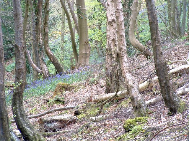
In the spring walkers flock to the beautiful bluebell woods in the Northern Ireland area. Click the 'Woodland' button below to see these.
Use the links to view full route information including elevation profiles, interactive maps and GPS downloads.
You can also view an overview map of all the routes in the using the Northern Ireland Walk Map>>
| Filter: |
| Route Name | Photo | Distance | Description |
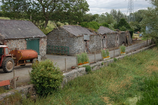
| Ballyboley Forest | 6 miles (9.5 km) | This walk explore Ballyboley Forest near Ballyclare in County Antrim. View Full Details>> | |
| Ballycastle Fair Head Walk | 3 miles (5 km) | This circular walk visits the wonderful cliff tops at Fair Head near Ballycastle in County Antrim. View Full Details>> | |
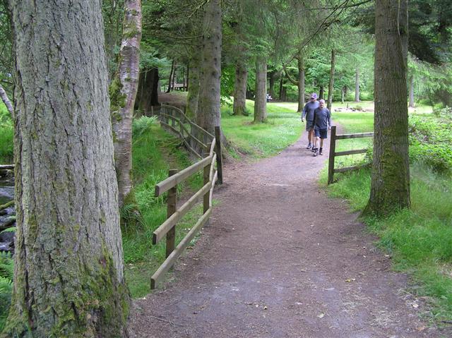
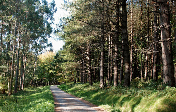
| Ballypatrick Forest | 2 miles (3 km) | This large forest in Northern Ireland has miles of footpaths to try. This 2 mile circular walk follows a waymarked trail from the Horseshoe car park at the north western edge of the woods. It's a lovely trail with broadleaved and conifer trees, a series of small ponds and nice views of the Glenmakeeran River. The forest is located just to the south of the coastal town of Ballycastle. You can extend your walk here by following the coastal path with great views towards Rathlin Island and the Mull of Kintyre. The Ulster Way and the Moyle Way long distance paths pass the western side of the forest. You can pick these up to head toward the coast. To continue your woodland walking head south and visit the splendid Glenariff Forest Park. Here you will find a wonderful waterfall walk and miles of other walking trails. View Full Details>> | |
| Banagher Glen | 5 miles (8 km) | Follow the riverside trail through these ancient oak woodlands and look out for red squirrels on this walk through the beautiful Banagher Glen Nature Reserve. The walk takes you through a steep ravine along the Altnaheglish river leading to the Altnaheglish Reservoir at the end of the route. Along the way you'll pass oak, ash, hazel, hawthorn and holly trees with lots of wildlife to look out for. There's also pretty waterfalls, wonderful views of the Sperrin Mountains and the splendid Banagher Dam to enjoy. You can start the walk from the car park at Strone Hill, a few miles south of Dungiven. From here you pick up the riverside trail heading east towards the reservoir, passing Teeavan Hill and Streeve Mountain. View Full Details>> | |
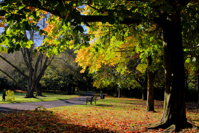
| Belfast | 11 miles (18 km) | This walk takes you on a tour of the best parks, woodland and rivers in around the city centre of Belfast. The walk starts on the River Lagan and follows the Lagan Towpath south to Ormeau Park. The park is the oldest municipal park in Belfast, having been originally opened in 1871. There's nice tree-lined paths and pretty gardens to admire in this popular park. After strolling around Ormeau Park you continue south along the river to the Belfast Botanical Gardens. The 19th century public park contains a wonderful Palm House conservatory with a cool wing and a tropical wing. There's also the Tropical Ravine House, rose garden and a fine statue of Belfast born Physicist Lord Kelvin. The towpath continues south to Belvoir Park Forest. The woods have a number of waymarked trails to try with lots of woodland wildlife to look out for. The park is somewhat unusual as it is rare to find a working forest within a city. The path continues through Lagan Meadows and Clement Wilson Park before coming to the splendid Lagan Valley Regional Park. Here you will find wet meadows, ponds, mixed beech woodland and attractive parkland set next to the river. The route continues along the river, passing Newforge cricket ground and the village of Edenderry before coming to Lady Dixon Park. The expansive 128 acre park park consists of meadows, woodland and gardens with a number of well laid out footpaths to follow. Other features in the park include the 19th century Wilmont House, arboretum, the Azalea Walk, fountains, a walled garden and a delightful a Japanese-style garden with pretty water features. To further extend your walk you can continue along the Lagan Towpath to Lisburn. There are lots of other nice walks to try in and around Belfast. You could visit Belfast Castle, Cave Hill Country Park and Redburn Country Park where you can enjoy great views over the city and Belfast Harbour. There's also the excellent Comber Greenway walking and cycle route. The route runs along a disused railway line between Belfast and Comber with great views of Stormont and Scrabo Tower. View Full Details>> | |
| Belfast Castle | 4 miles (6 km) | This historic castle in Belfast includes a lovely country park with miles of walking trails to try. View Full Details>> | |
| Belvoir Park Forest | 2 miles (3.5 km) | This large park in Belfast has some nice woodland trails and views of the River Lagan which runs right through the forest. It is unusual to find a working forest within a city so the area is well worth a visit. The woods have a number of waymarked trails to try with lots of woodland wildlife to look out for. There are also interesting historic sites including the 12th century Norman motte and Ice House. You can start your walk from the forest car park, off Belvoir Drive. From here you can directly pick up the trails through the woodland, meadows and along the river. To extend your walk simply follow the Ulster Way and the Lagan Towpath along the Lagan to the nearby Lagan Valley Regional Park. The Lagan Towpath will take you through the Lagan Valley to Lisburn. You're also very close to the splendid Lady Dixon Park which includes more nice footpaths taking you to the arboretum, the Azalea Walk, fountains, a walled garden and a delightful a Japanese-style garden with pretty water features. View Full Details>> | |
| Ben Crom Reservoir | 2 miles (4 km) | Enjoy a short hike above this pretty reservoir in the Mourne Mountains. The reservoir was constructed between 1953 and 1957 and supplies water for County Down, the surrounding counties and most of Belfast. Start the walk from the reservoir wall at the southern end. You can catch shuttle busses to here from the Silent Valley. From the top of the wall there are wonderful views to Silent Valley, Slievenaglogh Mountain and Ben Crom Mountain. You can then follow a path east to climb to a fine viewpoint over the water. The path will then lead you up to the pretty Blue Lough before descending back down to the reservoir. View Full Details>> | |
| Black Mountain | 3 miles (4.8 km) | This walk climbs to the Black Mountain above the city of Belfast. The National Trust owned area includes a popular summit walking trail taking you around Divis Mountain to the Black Mountain viewpoint. View Full Details>> | |
| Blackhead Lighthouse | 1 miles (1.5 km) | This short circular walk visits the Blackhead Lighthouse located near Whitehead in County Antrim. The lighthouse sits in a splendid location at the northern end of Belfast Lough where it opens out into the North Channel that separates Northern Ireland and Scotland. View Full Details>> | |
| Blue Lough | 5 miles (8 km) | This walk in the Mourne Mountains takes you along the Carrick Little trail from Blue Lough. View Full Details>> | |
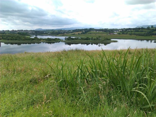
| Camlough Lake | 2 miles (3.2 km) | This walk visits a large reservoir near the village of Camlough in County Armagh. View Full Details>> | |
| Camlough Mountain | 3 miles (4.3 km) | This walk climbs Camlough Mountain near the village of Camlough in County Armagh. View Full Details>> | |
| Carnfunnock Country Park | 2 miles (2.5 km) | Enjoy waymarked trails, pretty gardens and lovely views of the Antrim Coast in this country park near Larne in County Antrim. There's 191 hectares to explore with woodland trails, a maze, a beautiful sculptured walled garden and a wonderful coastline. View Full Details>> | |
| Carrick-a-Rede | 2 miles (2.5 km) | This popular coastal walk crosses the famous rope bridge to visit Carrick-a-Rede Island on Northern Ireland's Causeway Coast. You can start the walk from the car park, just to the north east of Ballintoy. The path then heads east past the beautiful Larrybane Bay, with cliff top views as far as the Scottish Islands. There's also attractive countryside on the other side with lots of wildflowers to look out for on the summer months. The path then descends on a series of steep steps to the rope bridge below. It was built about 350 years ago and spans 20 metres (66 ft) across with a height of 30 metres (98 ft). The exciting crossing leads you onto the island where you can follow a path towards the northern end. There's also an old fisherman's cottage which is sometimes open to the public. After exploring the island following the same path back to the car park. The area is also great for wildlife with large number of seabirds and the possibility of spotting porpoises or dolphins in the sea below. Look out for guillemots, razorbills, kittiwakes and fulmars as you make your way around the site. View Full Details>> | |
| Carrickfergus | 1 miles (2 km) | Carrickfergus sits in a lovely coastal location on Belfast Lough, in County Antrim. View Full Details>> | |
| Castle Archdale | 2 miles (3 km) | This walk explores the historic Castle Archdale Country Park estate on the shores of Lough Erne in County Fermanagh. View Full Details>> | |
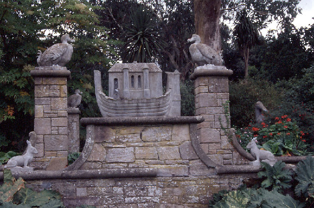
| Castle Ward | 2 miles (4 km) | The Castle Ward estate covers 332 hectares (820 acres) with an 18th-century mansion, landscaped gardens and miles of great cycling and walking trails. The estate overlooks the beautiful Strangford Lough and includes the brilliant Lough Trail walking and cycle route. The National Trust have devised six great trails which expose you to the wonderful scenery around the estate. Features include the woodland trails in Castle Ward Forest, a waterside path along Temple Water and the lovely Walled Garden. You can virtually explore the Castle Ward estate using the google street view link below! To extend your cycling you can pick up the Strangford Lough circuit which takes you around the magnificent body of water. View Full Details>> | |
| Castlewellan Forest Park | 2 miles (4 km) | Enjoy a walk around Castlewellan Lake and Arboretum in County Down. The park contains the national Arboretum of Northern Ireland with a variety of interesting specimens from all over the world. There is also a peace maze and the the Scottish baronial Castlewellan castle. It's a lovely place, with views towards the Mourne Mountains and surrounding countryside to enjoy. The park is also great for mountain biking with green, blue and red grade trails to try. To extend your exercise, just head to the south and visit the lovely Tollymore Forest Park. The expansive 1600 acre park contains an arboretum, the Shimna River and two forested hills known as the Drinns. You can also pick up the popular Trassey Track which will take you to a spectacular mountain pass. Also nearby is the splendid Murlough Bay National Nature Reserve where there is a beautiful sand dune system, woodland trails and a wonderful beach. View Full Details>> | |
| Cave Hill Country Park | 3 miles (5 km) | Visit this wonderful country park and enjoy fabulous views over Northern Ireland on this circular walk in Belfast. On a clear day you can see as far as the Isle of Man and Scotland from the high points. This walk starts at the Belfast Castle car park. The fine 19th century Scottish baronial castle sits in an elevated position at 400 feet (120 m) above sea level with fine views over the city below. The grounds of the castle are very attractive with wide lawns and pretty gardens to enjoy before the climb. After heading through the castle estate you start the challenging climb up to the 370 metres (1200 ft) high hill. On the way you will pass the three large man made caves and interesting geological formations including 'Napoleon's Nose'; a basaltic outcrop which resembles the profile of the famous emperor Napoleon. At the summit you will find McArt's Fort and stunning views of the Mourne Mountains, Scrabo Tower and Slieve Croob. You can descend the same way or follow more footpaths across the hill to turn it into a longer circular walk. At the end of your descent you can enjoy refreshments at the Belfast Castle restaurant and learn about the history of the area in the visitor centre. On the other side of Belfast Harbour you can visit Redburn Country Park for more nice walking trails and another great viewpoint. You can virtually explore the park's trails using the google street view link below! View Full Details>> | |
| Cladagh Glen and Marble Arch Caves | 4 miles (6.2 km) | This walk visits a series of natural limestone caves in County Fermanagh, Northern Ireland. The area also includes the beautiful Cladagh Glen where you can enjoy a walk along the Cladagh River. View Full Details>> | |
| Comber Greenway | 7 miles (12 km) | This cycling and walking trail runs along National Cycle Network route 99 and a disused railway line from Belfast to Comber. It makes for a great traffic free cycle along a nice tree lined tarmac path. As such it's great for families or anyone looking for an easy introduction to cycling. The route runs for about 7 miles from Dee Street in East Belfast to the town of Comber in County Down. You'll pass the C. S. Lewis statue at the Holywood Arches, and the Bloomfield Walkway in Belfast before enjoying nice views of Stormont, Scrabo Tower, the Harland & Wolff cranes and the Belfast Hills. To extend your cycle you can continue along National Route 99 towards Scrabo Hill, and Newtownards. This takes you to the tip of the beautiful Strangford Lough. To extend your walking in the area you could climb to Scrabo Tower which is not far from the route. You can follow footpaths to the top of the hill where you will find the well known landmark. View Full Details>> | |
| Crawfordsburn Country Park | 1 miles (1 km) | Follow the waymarked walking trails through this large country park in County Down. The park is located near Bangor on the coast with beautiful beaches, views across Belfast Lough, meadows, streams, wooded glens and a stunning waterfall. Look out for wildlife including seals, herons, shags and guillemots. View Full Details>> | |
| Cuilcagh Mountain | 13 miles (21 km) | This challenging circular walk climbs to the summit of Cuilcagh Mountain, the highest point in the Breifne Mountains. The mountain sits on the border between County Fermanagh (in Northern Ireland) and County Cavan (in the Republic of Ireland). It's a very popular hike with the route to the summit taking place on the waymarked Cuilcagh Way. The trail climbs through one of the largest expanses of blanket bog in Northern Ireland, using a boardwalk for part of the route. The walk starts from the car park at Cladagh Bridge on the Marble Arch Road, a few miles north of the summit. From here you can pick up the trails heading south along the Cladagh River. You'll soon come to the Marble Arch Caves Global Geopark. The Geopark features various sites which demonstrate the geological and wider natural heritage of the area, as well as the cultural heritage relating to 7,000–8,000 years of recorded human occupation since the last ice age. This includes a number of show caves which exhibit a wide range of classic cave features. The natural limestone caves are named after the nearby Marble Arch, a natural limestone arch at the upstream end of Cladagh Glen under which the Cladagh River flows. See the Cladagh Glen and Marble Arch Caves Walk for more details. The route continues past the caves along the Aghinrawn River to Skea Hill and Lough Atona along the splendid Stairway to Heaven. This area supports numbers of rare, vulnerable or endangered species. It is one of the most important upland breeding sites in Northern Ireland for Eurasian golden plover, and the Merlin. Near the lough you turn east to climb to the 666 m (2,185 ft) summit of Cuilcagh. There's wonderful views across Ireland and Northern Ireland with the Irish Sea and Atlantic coast visible on clear day. After taking in the views the route descends north east to Florence Court Forest Park. The forest has colour coded, waymarked trails with attractive woodland and riverside paths to enjoy. In the park there's a walled garden and a fine viewpoint where you can see much of Fermanagh, Upper Lough McNean, Belomore mountain, Enniskillen, Brougher Mountian, Upper Lough Erne and Knockninny. There's also the Florence Court yew tree, known as the 'mother' of all Irish yew trees. From the forest head west to Gortmcconnell Rock before descending back to Marble Arch Caves. The final section leads you along the river to return to the car park. View Full Details>> | |
| Cushendall | 2 miles (2.9 km) | This walk takes you along a lovely section of the Antrim coast in the delightful Georgian village of Cushendall. View Full Details>> | |
| Davagh Forest | 6 miles (9 km) | This expansive forest is located near Cookstown in the Sperrin Mountains of County Tyrone. View Full Details>> | |
| Derry Walls | 1 miles (1.6 km) | This walk takes you along the historic walls in the city of Londonderry. Derry is noteworthy as the only remaining completely walled city in Ireland and one of the finest examples of a European Walled City. The Walls were built from 1613-1618 by the Irish Society as defences for early 17th century settlers from England and Scotland. View Full Details>> | |
| Dromore | 1 miles (1.8 km) | This riverside walk takes you along the River Lagan in the pretty market town of Dromore in County Down. View Full Details>> | |
| Drumkeeragh Forest | 3 miles (5.5 km) | This expansive area of woodland is located near Ballynahinch on the slopes of Slieve Croob. View Full Details>> | |
| Garvagh Forest | 4 miles (6.1 km) | This walk visits Garvagh Forest in the village of Garvagh in County Londonderry. View Full Details>> | |
| Giant's Causeway | 2 miles (3.5 km) | This spectacular coastal causeway in Northern Ireland has a unique polygonal landscape feature. View Full Details>> | |
| Glenariff Forest Park | 1 miles (2 km) | This 1185 hectare (2928 acre) forest has miles of walking trails including the waterfall walk and scenic trail. The waterfall walk is particularly lovely with footpaths leading you through steep wooded gorges with a series of beautiful falls to enjoy. There are some steep sections but it is a fairly easy climb and the footpaths are well maintained. There are some wonderful views of the surrounding area to enjoy from the high points. The park is located in Glenariff County Antrim. There are good facilities with a car park, tea room and gift shop. The Ulster Way long distance trail passes through the forest so you could pick this up to extend your walking. Heading north will take you to Breen Forest and the lovely Ballypatrick Forest where there are some nice waymarked trails to try. View Full Details>> | |
| Glenarm | 4 miles (6.1 km) | This walk explores the picturesque village of Glenarm in County Antrim. View Full Details>> | |
| Glenoe Waterfall | 1 miles (1.2 km) | This walk visits the lovely Glenoe Waterfall in the hamlet of Glenoe in County Antrim. View Full Details>> | |
| Gobbins Cliff Path | 1 miles (2 km) | The Gobbins Cliff Path is considered one of the most dramatic coastal walks in Europe. The path is located on the rugged coastline at Islandmagee, County Antrim, Northern Ireland. View Full Details>> | |
| Gortin Glen | 3 miles (5.5 km) | This expansive area of woodland near Omagh includes miles of good footpaths and mountain bike trails. View Full Details>> | |
| Gosford Forest Park | 4 miles (6 km) | Follow the waymarked trails through this large park near the village of Markethill in County Armagh. It's a great place for walking with miles of woodland trails, streams, waterfalls, ponds, grassland and a lovely arboretum to visit. Features of the park include an area of open parkland with deer and rare breeds. There is also a lovely Arboretum with attractive conifer and broadleaf trees with a pretty walled garden. There are several colour coded walking trails to try and also a cycling trail. These are of varying lengths and difficulty and take you to the impressive 19th century Gosford Castle, the Drumlack River and Draper's Hill. See the maps below for details of the trails. View Full Details>> | |
| Kilbroney Forest Park | 5 miles (8 km) | This fantastic forest park in Rostrevor has miles of good walking trails to try. This walk takes you along the pretty Glen Stream before climbing to Slieve Martin for great views over the area. Carlingford Lough, the Norman Narrowwater Castle and the surrounding Mourne Mountains are clearly visible from the summit. You can also enjoy easier footpaths along the Kilbroney River and through the Fairy Glen in Kilbroney Park at the start of the route. In Rostrevor Forest there are also a series of great mountain bike trails. This route is designed for walkers but the cycling trail are also highlighted on the map in blue. They take you north from near Slieve Martin to Slieve Meel and around Crenville. With a 27km red trail and a hair raising 19km black trail Rostrevor is believed by many to be the top spot for mountain biking in Ireland. For more great sites with mountain biking and walking on the east coast head to Tollymore Forest Park, Castle Ward and Castlewellan Forest Park. View Full Details>> | |
| Lady Dixon Park | 2 miles (2.5 km) | This 128 acre park in Belfast is a great place for an afternoon stroll. The park consists of meadows, woodland and gardens with a number of well laid out footpaths to follow. Highlights in the park include the 19th century Wilmont House, arboretum, the Azalea Walk, fountains, a walled garden and a delightful a Japanese-style garden with pretty water features. The primary attraction, though is the splendid City of Belfast International Rose Garden. In the summer it contains over 40,000 roses, divided into trial and display beds, a historical section and a heritage garden that displays the best roses from local breeders. It also has a Diana, Princess of Wales memorial garden. The park also has woodland sections where you can look out for red and grey squirrels. Facilities are also very good with a car park, toilets and cafe. To extend your walking in Belfast you could head to the nearby Belvoir Park Forest and Lagan Valley Regional Park. Here you will find woodland trails and riverside paths along the pretty River Lagan. The Lagan Towpath also passes through the park, so you could pick this up to explore the Lagan Valley and head to Lisburn. View Full Details>> | |
| Lagan Towpath | 21 miles (34 km) | This cycle and walking route follows the towpath of the River Lagan from Belfast to Lisburn along National Cycle Network routes 9 and 93. It's a nice surfaced path making it ideal for families or anyone looking for a safe traffic free ride. You start off in the centre of Belfast and head south west passing Ormeau Park, Lady Dixon Park and Belvoir Park Forest before coming to the lovely Lagan Valley Regional Park. In this park there are a variety of habitats including wet meadows, ponds, mixed beech woodland and attractive parkland. After leaving the city centre you continue through the beautiful Lagan Valley, passing the villages of Edenderry and Drumbeg before coming to the city of Lisburn. This route finishes in Lisburn but if you want to extend your cycling you can continue west along National Cycle route 9 which will take you towards the Down Royal Racecourse and the villages of Halfpenny Gate and Broomhedge in County Antrim. The route eventually reaches the beautiful Lough Neagh. View Full Details>> | |
| Lagan Valley Regional Park | 2 miles (3 km) | Starting from the Shaw's Bridge car park follow the Lagan towpath along the river Lagan on this lovely walk in Belfast. In the park there are a variety of habitats including wet meadows, ponds, mixed beech woodland and attractive parkland. The towpath makes for a nice, easy waterside cycle or walk. You can extend your exercise by continuing along the Lagan Towpath to Lisburn. Also nearby is the pretty Belvoir Park Forest. The woods have a number of waymarked trails to try with lots of woodland wildlife to look out for. You're also very close to the splendid Lady Dixon Park which includes more nice footpaths taking you to the arboretum, the Azalea Walk, fountains, a walled garden and a delightful a Japanese-style garden with pretty water features. View Full Details>> | |
| Lough Erne | 2 miles (3.7 km) | This circular walk takes you around the Collop area Lough Erne Golf Resort in County Fermanagh, Northern Ireland. View Full Details>> | |
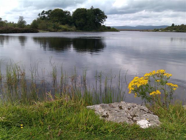
| Lough Fea | 3 miles (4.2 km) | This circular walk takes you around Lough Fea in the Sperrin Mountains of Northern Ireland. View Full Details>> | |
| Lough Navar Forest | 4 miles (6 km) | This circular walk visits the Blackslee Waterfall in the Lough Navar Forest in County Fermanagh. View Full Details>> | |
| Loughmacrory Lough | 1 miles (2 km) | This waterside walk takes you around Lough Macrory in the village of Loughmacrory, County Tyrone. View Full Details>> | |
| Montalto Estate | 3 miles (4.5 km) | This walk visits the Montalto Estate in Ballynahinch in County Down. View Full Details>> | |
| Mount Stewart | 1 miles (1.5 km) | Enjoy the woodland trails, lakeside paths and beautiful gardens surrounding this 19th-century house in County Down. View Full Details>> | |
| Mourne Way | 23 miles (37 km) | This waymarked long distance trail takes you through the beautiful Mourne Mountains from Newcastle on the Irish Sea to Rostrevor on Carlingford Lough. View Full Details>> | |
| Murlough Bay | 4 miles (6.6 km) | This walk explores the beautiful Murlough National Nature Reserve near Newcastle in Northern Ireland. The reserve is managed by the National Trust so there's a car park, visitor centre, and a network of well laid out footpaths. The reserve consists of a 6000 year old sand dune system, woodland, heath and a wonderful beach. The views across Dundram Inner Bay towards the Mourne Mountains are also exceptional. The reserve is great for wildlife watching with a wide variety of wintering wildfowl and waders to look out for on the coast. There's also 720 species of butterflies and moths to look out for around the pretty wildlflowers meadows. There's lots of good options for extending your walking in the Newcastle area. You could head to Tollymore Forest Park just to the south west of the reserve. The fantastic 1600 acre park contains an arboretum, the Shimna River and two forested hills known as the Drinns. Also nearby are the splendid climbs to Slieve Donard, Slieve Binnian in the Mourne Mountains. Castlewellan Forest Park is also not far away. View Full Details>> | |
| Mussenden Temple | 1 miles (1.6 km) | This circular walk visits the precariously positioned Mussenden Temple in Castlerock, County Londonderry. View Full Details>> | |
| Newry Canal | 20 miles (32 km) | Enjoy a walk or cycle along the Newry Canal on this waterside route in Northern Ireland. The route follows National Cycle Network Route 9 along the canal towpath from Newry to Portadown. It's about 20 miles and makes for a nice, easy cycle or walk. The route passes a series of old stone bridges and pretty locks. The views of the surrounding countryside are great and you should also see lots of water loving wildlife along the way. The route begins in Newry town centre and heads north to Jerretspass, Poyntzpass and Scarva before finishing in Portadown. Highlights on the route include Lough Shark and Brackagh Nature Reserve near Portadown. A good place for refreshments is the lovely village of Scarva. The canalside village is well known for its park with a bandstand and prize winning floral displays. You can enjoy a snack at the tea rooms and visitor centre. At Portadown this route links with the Lough Neagh circuit which runs around the largest freshwater lake in Britain and Ireland. View Full Details>> | |
| Oxford Island | 1 miles (2 km) | Visit this beautiful nature reserve on the shores of Lough Neagh on this easy circular walk. There's 282 acres (113 hectares) to explore on a series of good footpaths and walking trails. Habitats in the reserve include reed beds, open water, species rich wet grassland, wildlife ponds and wildflower meadows. There's lots of wildlife to look out including a variety of butterflies and birds such as Lapwing, Curlew and Goldeneye. You can also have a stroll along the pretty Kinnego Marina and enjoy wonderful views over Lough Neagh. National Cycle Network route 9 runs right to the reserve so it's easy to visit by bike. The Loughshore Trail which runs right around the Lough also passes Oxford Island on the way. To extend your walking in the area you could visit the nearby Peatlands Park. View Full Details>> | |
| Peatlands Park | 3 miles (5.5 km) | Follow the walking trails around this large park in County Armagh. The park is located near Lough Neagh and Dungannon. There's a number of good waymarked, colour coded walks taking you around the 680 acre site. The park consists of peatlands, orchards, woodland, boardwalks and two nature reserves. You can park at the car park and then follow the trails east through woodland to the pretty Derryadd Lake. There's lots of wildlife to look out for with butterflies, damselflies and birds such as meadow pipits and cuckoos. If you would like to continue your walking in the area then you could visit the nearby Oxford Island Nature Reserve. View Full Details>> | |
| Portballintrae to Ballintoy Coastal Walk | 13 miles (20.8 km) | This coastal walk takes you along the spectacular Causeway coast from Portballintrae to Ballintoy via Dunseverick. View Full Details>> | |
| Portglenone Fisherman's Walk | 4 miles (6 km) | This route takes you along the Fisherman's Walk in the village of Portglenone, County Antrim. View Full Details>> | |
| Portglenone Forest | 1 miles (1.8 km) | This circular walk explores the Portglenone Forest Park in the village of Portglenone, County Antrim. View Full Details>> | |
| Portrush to Portstewart Cliff Walk | 5 miles (8.8 km) | This popular coastal walk follows a section of the Causeway Coast from Portrush to Portstewart. View Full Details>> | |
| Redburn Country Park | 2 miles (3 km) | This country park in Belfast has miles of nice footpaths to try. In the park you'll find woodland trails and moderate hill climbs with splendid views towards the city and the Antrim Hills. The park is something of a hidden gem of the city, located just to the north east of the city centre, near Belfast Lough RSPB. In the park you will find lovely leafy glens with narrow flowing streams, fern gullies, hedges, and high deciduous woodland. From the wonderful viewpoint you can see over Belfast Lough, Belfast Harbour, George Best City Airport, Cave Hill Country Park and Belfast Castle. The park is also great for flora and fauna. Look out for wildlife including red squirrels, tits, finches, willow warblers and blackcaps. In springtime you can see carpets of bluebells, wood sorrel and anemones. The Ulster Way long distance footpath passes through the park so you can easily pick this up to extend your walk. Head south and you will soon join with the Comber Greenway. The excellent cycling and walking trail runs along a disused railway line between Belfast and Comber. You can pick it up in Dundonald, just a mile or so to the south of the park. Other nice walks around Belfast include Cave Hill Country Park on the opposite side of Belfast Harbour, and the splendid Lagan Valley Regional Park on the River Lagan. View Full Details>> | |
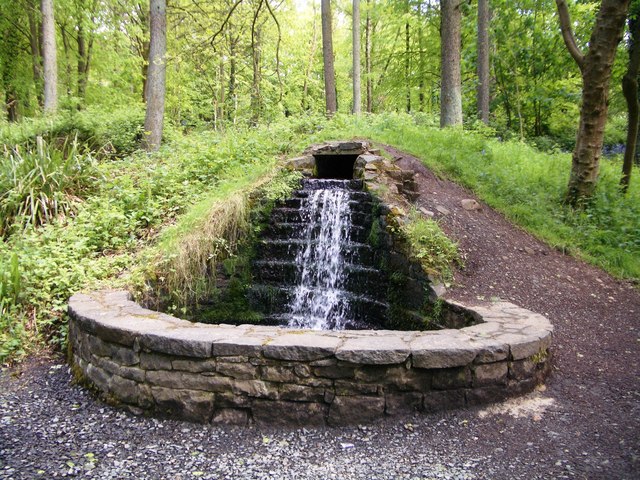
| Roe Valley Country Park | 2 miles (3 km) | Enjoy a waterside walk along the River Roe in this country park near Limavady. You can start your walk from the visitor centre next to the ornamental lake. The footpaths then follow the River Roe which meanders pleasantly through the park. Along the way there are pretty waterfalls, spectacular gorges and attractive woodland. In the warmer months the park is covered with pretty wildlflowers. You can learn about the area's interesting industrial heritage in the museum and visit the remains of industrial buildings and the restored water wheel. National Cycle Network Route 93 runs past the park so you could pick it up from Limavady and head south to visit by bike. View Full Details>> | |
| Rostrevor Forest | 6 miles (9.8 km) | This walk visits Rostrevor Forest, on the edge of the Mourne Mountains. The expansive forest has miles of waymarked footpaths and a challenging red grade mountain bike trail for cyclists to try. View Full Details>> | |
| Scrabo Tower | 1 miles (1 km) | Scrabo Hill and country park is located near Newtownards in County Down, Northern Ireland. You can follow footpaths to the top of the hill where you will find the well known landmark Scrabo Tower. The 19th century tower is 125 feet (38 m) high and visible for miles around. The views from the summit of Scrabo Hill extend to Strangford Lough, the Mourne Mountains and the Scottish coast. You can pick up the footpath from the car park. It's a short climb of less than half a mile but quite steep. After descending the hill you can continue to explore Scrabo Country Park. There are nice woodland trails through Killynether Woods with lots of bluebells in the springtime. To extend your walking in the area you pick up the Comber Greenway from nearby Comber. This cycling and walking trail runs along National Cycle Network route 99 and a disused railway line from Belfast to Comber. View Full Details>> | |
| Silent Valley Reservoir | 2 miles (3.7 km) | This walk takes you through the beautiful Silent Valley in the Mourne Mountains. There's lovely woodland trails to follow along the River Kilkeel to the Silent Valley Dam, with views across the water to the surrounding mountains. It's about a 2 mile stroll on fairly flat paths so suitable for most abilities. Start the walk from the car park to the south of the water. From here you can pick up the trails heading north past the ornamental lake to the dam wall. Here you'll find a visitor information centre and a cafe for refreshments. The walk then passes along the dam before turning south to follow nice woodland paths past another small lake and along the River Kilkeel. Near Cooligan Bridge you turn around to return to the car park. View Full Details>> | |
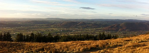
| Slemish Mountain | 1 miles (1.5 km) | Follow the Slemish Path to the 1437 ft summit of this mountain in County Antrim. The challenging path starts from the Carnstroan Lane car park near Broughshane and climbs steeply to the summit. Here you are rewarded with fine views over Antrim, the Scottish coast, Ballymena town, Lough Neagh and the Sperrin Mountains. View Full Details>> | |
| Slieve Binnian | 7 miles (11 km) | This challenging loop walk climbs to Slieve Binnian in the Mourne Mountains. View Full Details>> | |
| Slieve Croob | 3 miles (4.6 km) | This walk climbs to Slieve Croob in the Dromara Hills area of the Mourne Mountains in County Down. View Full Details>> | |
| Slieve Donard | 5 miles (8 km) | Climb to the highest peak in Northern Ireland on this challenging walk in the Mourne Mountains. It's a beautiful area with a waterside section along the Glen River a real highlight of the walk. The river has rocky pools, pretty waterfalls and surrounded by attractive woodland. The climb to the summit passes along the Mourne Wall which runs for 22 miles over 15 mountains. It was constructed in the early part of the 20th century. The walk starts from the attractive coastal town of Newcastle in County Down. After leaving the car park in Donard Park the route heads through the Scots Pine and Oak of Donard Forest. You'll follow the lovely Glen River Path to the Mourne Wall where you turn left to reach the 850m (2,789 ft) summit. From here the views are spectacular with Newcastle Beach, the Isle of Man, Scotland and Wales all visible on a clear day. Also at the summit you will find a small stone tower and two prehistoric burial cairns. If you would like to extend your walking in the area then you could visit the nearby Tollymore Forest Park with its riverside walks and waymarked, woodland walking trails. Also nearby is the splendid Murlough Bay National Nature Reserve where there is a beautiful sand dune system, woodland trails and a wonderful beach. For an easy stroll around Newcastle head to the pretty Islands Park in the town. It lies on the banks of the Shimna and Tullybrannigan Rivers, between the Bryansford Road, Bryansford Avenue and the Shimna Road. View Full Details>> | |
| Slieve Gullion | 1 miles (2.2 km) | This walk climbs to Slieve Gullion the highest point in County Armagh. It's the short route to the summit, approaching from the western side. View Full Details>> | |
| Spelga Dam | 1 miles (1.5 km) | This walk explores the Spelga Reservoir in the Mourne Mountains of County Down. Park at the Deer Meadow car park at the southern end of the lake to start your walk. From here you head north to the water where it's then possible to follow the lake shore for some distance on foot, although the footpaths are not surfaced so good footwear is required. There's terrific views over the water to the surrounding mountains. You could also park at the Spelga Dam car park at the northern end of the water. There is a nice picnic area with a short walking trail here. When there's been a dry period the Spelga Dam runs low in water unveiling old roads and bridges that have been buried for a long time. View Full Details>> | |
| Stairway to Heaven | 4 miles (6.4 km) | This popular walk follows the Cuilcagh Boardwalk or 'Stairway to Heaven' on Cuilcagh Mountain in Enniskillen, Northern Ireland. View Full Details>> | |
| Tollymore Forest Park | 6 miles (10 km) | Enjoy miles of woodland trails and a waterside stroll along the beautiful Shimna River on this circular walk in the Mourne Mountains. There are 1,600 acres to explore with the park surrounded by mountains and located close to the coastal town of Newcastle in County Down. In the park there are four colour code trails to follow of varying lengths. The trails are all signposted and visit the arboretum, the Shimna River and the two forested hills known as the Drinns. This walk starts from the car park near Bryansford and passes along the river with its series of pretty bridges, rocky outcrops and waterfalls. One of the bridges dates from the early 18th century. The walk then passes along a series of woodland trails with a variety of interesting trees such as monkey puzzle, eucalyptus and impressive giant redwoods. There are also some viewpoints to climb where you can enjoy fantastic views over the surrounding area. From the Curraghard viewpoint in the south eastern corner of the park there are views over the Northern Mournes, Dundrum Bay, Newcastle and the Irish Sea. This is a walking route but the forest is also great for mountain biking with lots of fine mtb trails to try. If you would like to extend your walking in the area then you could climb the nearby Slieve Donard or Slieve Binnian. Also nearby is the splendid Murlough Bay National Nature Reserve where there is a beautiful sand dune system, woodland trails and a wonderful beach. At Rostrevor you will find the excellent Kilbroney Forest Park where there are some great mountain bike trails and walks to Slieve Martin. View Full Details>> | |
| Trassey Track | 4 miles (6.5 km) | This walk in the Mourne Mountains takes you along the Trassey Track to the spectacular mountain pass of Hare's Gap. View Full Details>> | |
| Woodburn Forest and Reservoirs | 5 miles (8 km) | This circular walk explores the Woodburn Forest and its reservoirs in Carrickfergus, County Antrim. View Full Details>> |