 |
Exe Estuary Trail |
 |
|
Description |
 This splendid, largely traffic free ride takes you around the beautiful Exe Estuary on the south Devon coast. It runs along National Cycle Network route 2 from Exmouth to Dawlish. The ride takes place on mostly well surfaced, flat cycle paths so it is quite an easy ride. Most sections are suitable for families or beginners looking for a nice introduction to cycling. This splendid, largely traffic free ride takes you around the beautiful Exe Estuary on the south Devon coast. It runs along National Cycle Network route 2 from Exmouth to Dawlish. The ride takes place on mostly well surfaced, flat cycle paths so it is quite an easy ride. Most sections are suitable for families or beginners looking for a nice introduction to cycling.
The route starts off in Exmouth and heads north along the river with splendid views of the Exe Estuary Nature Reserve. The RSPB reserve is great for birdwatching so look out for lapwings, redshanks and Cetti's warblers as you go. You soon come to the village of Lympstone with its pretty harbour and the 19th century Italianate riverfront brick clock tower known as Peter's Tower. You continue to Exton, passing Nutwell Park and the Georgian neo-classical Grade II listed mansion house of Nutwell Court. The next stage takes you through Topsham, passing the Exe Reedbeds Nature Reserve before coming to Lower Wear. Here you cross a bridge over the river to the western side where you pass the Riverside Valley Park and the Exeter Canal.


|
|
|
Distance | 16 miles (26 km) |
|
|
Difficulty | ** |
|
|
Joining Routes | Exmouth to Budleigh Salterton Railway Path, Exeter Canal, Exmouth to Lympstone Walk, Topsham Goat Walk, Starcross to Powderham Castle Walk, Darts Farm |
|
|
Memory Map Route | Exe Estuary Trail.mmo (right click - 'Save As') |
|
|
GPX File | Exe Estuary Trail.gpx (right click - 'Save As')
| |
|
Route Photos |
 Photos are copyrighted by their owners Photos are copyrighted by their owners
|
|
|
Map (Route in Red)
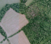
Aerial Photo View of this route
|
|
|
|
Video | |
|