 |
Camber Sands |
 |
|
Description |
 Enjoy a walk or cycle along National Cycle Network Route 2 from Rye to the beautiful Camber Sands. You can pick up the trail in the centre of Rye near to the train station. It's about a 3 mile ride to the beach, passing alongside Camber Road. There are lovely views of Northpoint Water and Rye Bay before passing Rye Golf Club and entering the village of Camber. It's a beautiful and popular beach with the only sand dune system in East Sussex. If you continue your cycle along the coast road you will come to Broomhill Sands and Lydd. Enjoy a walk or cycle along National Cycle Network Route 2 from Rye to the beautiful Camber Sands. You can pick up the trail in the centre of Rye near to the train station. It's about a 3 mile ride to the beach, passing alongside Camber Road. There are lovely views of Northpoint Water and Rye Bay before passing Rye Golf Club and entering the village of Camber. It's a beautiful and popular beach with the only sand dune system in East Sussex. If you continue your cycle along the coast road you will come to Broomhill Sands and Lydd.
To extend your outing you could pick up the Saxon Shore Way long distance footpath and walk to the Rye Harbour Nature Reserve just south of Rye. The reserve a variety of habitats such as saltmarsh, lagoons, grazing marsh, shingle and reedbeds. You can also visit the ruins of Henry VIII's Camber Castle. The Device Fort was built to protect the Sussex coast against French attack in the 16th century.
The Sussex Border Path also passes through Rye. You can follow the path north from the town centre and enjoy a waterside walk along the River Rother.
You can also follow the England Coast Path east and visit the wonderful Dungeness RSPB Nature Reserve. The large reserve boasts lakes, lagoons and an expansive section of shingle beach with a wide variety of wildlife.


|
|
|
Distance | 3 miles (5 km) |
|
|
Difficulty | * |
|
|
Joining Routes | Dungeness, Rye Harbour, Sussex Border Path, Saxon Shore Way, Dymchurch, Camber Castle |
|
|
Memory Map Route | Camber Sands.mmo (right click - 'Save As') |
|
|
GPX File | Camber Sands.gpx (right click - 'Save As')
| |
|
Route Photos |
 Photos are copyrighted by their owners Photos are copyrighted by their owners
|
|
|
Map (Route in Red)
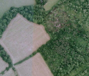
Aerial Photo View of this route
|
|
|
|
Video | |
|