 |
Morecambe Bay |
 |
|
Description |
 Enjoy a visit to the Morecambe Bay Nature Reserve and a stroll along the Lancaster Canal on this circular cycle or walk in Lancashire. Enjoy a visit to the Morecambe Bay Nature Reserve and a stroll along the Lancaster Canal on this circular cycle or walk in Lancashire.
The walk starts in the town centre of Morecambe near to the train station. You then pick up the Lancashire Coastal Way to take you along the promenade towards Hest Bank and Bolton-le-Sands. You'll pass the Eric Morecambe statue with great views over the bay towards the Lake District. There's also a great deal of coastal wildlife to look out for including Cormorants, Curlews, Lapwings and Oystercatchers. The area is a RSPB reserve with sandflats and saltmarshes that attract thousands of birds. As such it is considered the second most important estuary in the UK.
From Hest Bank you turn inland and follow the Lancaster Canal into Lancaster before another waterside sectoin along the River Lune. A shared footpath and cycleway then returns you to Morecambe though White Lund.
To continue your walking in the area you can head along the Lancashire Coastal Way to Bolton le Sands and Carnforth.
You can also head south of Heysham and visit the delightful Sunderland Point. It's a lovely place for a walk with coastal views, salt marsh, beach, mud flats, farmland and lots of wildlife to look out for. There's also a series of attractive Georgian houses by the quay.
Morecambe Bay Postcode LA4 4BU
N.B Postcode may be approximate for some rural locations


|
|
|
Distance | 12 miles (19 km) |
|
|
Difficulty | * |
|
|
Joining Routes | Sunderland Point, Lancashire Coastal Way, Carnforth Canal Walk, Bolton le Sands |
|
|
Memory Map Route | Morecambe Bay.mmo (right click - 'Save As') |
|
|
GPX File | Morecambe Bay.gpx (right click - 'Save As')
| |
|
Route Photos |  |  |  |  | Midland Hotel | Eric Morecambe Statue | Fishing Boats | Morecambe Promenade |  |  |  |  | Venus and Cupid, by Shane Johnstone | Cormorant and Oystercatchers | Lancaster Canal 1 | Lancaster Canal 2 |
 Photos are copyrighted by their owners Photos are copyrighted by their owners
|
|
|
Map (Route in Red)
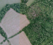
Aerial Photo View of this route
|
|
|
|
Video | |
|