 |
London to Paris |
 |
|
Description |
 This ride takes you along the proposed route for the Avenue Verte - a traffic-free cycle path, safe enough for a child, linking London and the French capital. This ride takes you along the proposed route for the Avenue Verte - a traffic-free cycle path, safe enough for a child, linking London and the French capital.
The ride includes some climbs - the toughest being the North Downs for people cycling the route from south to north. Most of the route is rolling countryside, apart from Redhill to Crawley (via Gatwick airport!) in the UK, and the capital cities themselves. There are some pleasant waterside stretches to enjoy too, notably a run along the Wandle Trail in London and then a lovely spell along the wooded banks of the Seine in France.
The route starts in central London and heads to Newhaven on the south coast. From here you can catch the ferry to Dieppe in France and proceed to Paris.
The English part of the route heads south through London passing Clapham, Merton, Wallington and Coulsdon. You then enter the North Downs, passing Redhill, Horley and Crawley with a section along the Worth Way. Here you turn east to East Grinstead, picking up a nice traffic free section to Groombridge. Shortly after you turn south to Rotherfield, Mayfield, Heathfield and Hailsham. The final English section takes you through the South Downs, passing Alfriston before coming to the ferry at Newhaven. On the other side you head south east through the beautiful French countryside to the capital in Paris.
Please click here for more information


|
|
|
Distance | 314 miles (506 km) |
|
|
Difficulty | ** |
|
|
Joining Routes | Crawley, Wandle Trail |
|
|
Memory Map Route | London to Paris.mmo (right click - 'Save As') |
|
|
GPX File | London to Paris.gpx (right click - 'Save As')
| |
|
Route Photos |  |  |  |  | St Paul's Cathedral at the start of the ride | Merton Abbey Mills on the River Wandle, London | Along the Worth Way Bridleway from Crawley to East Grinstead | Newhaven, where you will catch the ferry to Dieppe, France |  |  |  |  | Dieppe | Approaching Paris | The Seine, Paris | End of the Route at Notre Dame |
 Photos are copyrighted by their owners Photos are copyrighted by their owners
|
|
|
Map (Route in Red)
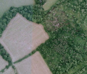
Aerial Photo View of this route
|
|
|
|
Video | |
|