Billingham to Hartlepool
10 miles (16 km)

 Starting near Billingham rail follow National Cycle Route 14 first through Cowpen Bewley Woodland Park before finishing on a lovely coastal stretch along Tees Bay.
The end point of this short easy ride is Hartlepool rail just south of the Quay.
Billingham to Hartlepool Ordnance Survey Map  - view and print off detailed OS map
Billingham to Hartlepool Open Street Map  - view and print off detailed map
Billingham to Hartlepool OS Map  - Mobile GPS OS Map with Location tracking
Billingham to Hartlepool Open Street Map  - Mobile GPS Map with Location tracking
Cycle Routes and Walking Routes Nearby
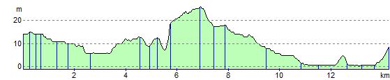
Elevation Profile