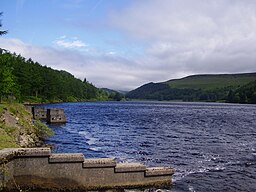
Howden Derwent and Ladybower Reservoirs
16 miles (25 km)

 This super cycle route takes you around three beautiful reservoirs in the Derbyshire Peak District. The route starts at the information centre at the top of Ladybower Reservoir where cycle hire is available. You then follow a series of waterside roads and traffic free paths around Derwent Reservoir and Howden Reservoir before returing to the start point.
There's some spectacular scenery to enjoy including the Upper Derwent Valley with its mixture of water, woodlands, open moors and the dramatic Victorian dams. The area is well know for its birds of prey so look out for goshawk, sparrowhawk, buzzard, merlin and peregrine falcon.
The route is around 4 miles from Hope train station and 12 miles from Sheffield.


