Leicester to Oakham

 Follow National Cycle Route 63 through Leicestershire and into Rutland. You start near the tourist information centre in Leicester and head east to Goadby where you turn north towards Tugby. You then continue to the village of Owston along country roads, with pleasant views of wooded areas. The route then turns east towards Oakham, finishing near the train station.
The main highlight on this route is the splendid Rutland Water near Oakham with its variety of wildlife.
Leicester to Oakham Ordnance Survey Map  - view and print off detailed OS map
Leicester to Oakham Open Street Map  - view and print off detailed map
Leicester to Oakham OS Map  - Mobile GPS OS Map with Location tracking
Leicester to Oakham Open Street Map  - Mobile GPS Map with Location tracking
Pubs/Cafes
The Harbour Cafe is in a lovely spot overlooking Whitwell Harbour on Rutland Water. It's a great place to stop on the route and rest your legs. The cafe is open 7 days a week from March until November then they open Friday, Saturday and Sunday through the Winter. They offer a wide variety of, cooked breakfasts, home cooked lunches, snacks, great coffee and cakes in a relaxed family friendly environment. There's a great outdoor seating area with fine views of the water. You can find the cafe on Bull Brigg Lane with a postcode of LE15 8BL for your sat navs.
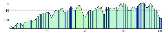
Elevation Profile