GPS Cycle and Walking Routes

Neath Canal

3 miles (5 km)

This section of the Neath Canal makes for a lovely waterside cycle or walk. It runs along the National Cycle Network route from the parking area at Craig Nedd, Resolven to Glynneath. You'll pass pretty locks and bridges with views of the River Neath along the way.
St Illtyd's Walk runs through Resolven so you could pick this up and head to the nearby Melincourt Falls to extend your walk.
At the western end of the route you can pick up the Tennant Canal and follow it west towards Swansea. This area also includes the lovely Aberdulais Falls, a popular beauty spot with rushing waterfalls and a woodland park.

Neath Canal OS Map - Mobile GPS OS Map with Location tracking

Neath Canal Open Street Map - Mobile GPS Map with Location tracking

Cycle Routes and Walking Routes Nearby

Photos

Neath Canal - geograph.org.uk - 563763

Neath Canal

Bridge on Neath Canal - geograph.org.uk - 549579

 Bridge on Neath Canal. One of several bridges on the restored part of Neath canal, between Resolven and Blaengwrach.

Lock on Neath Canal - geograph.org.uk - 549590

Lock on Neath Canal

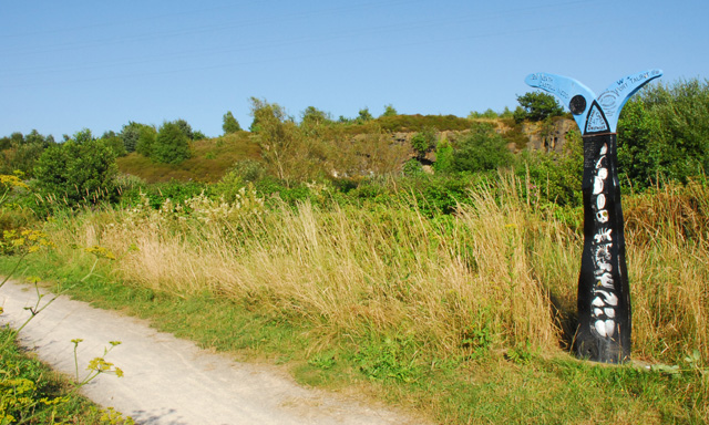
National Cycle Network Sign on Neath Canal Towpath - geograph.org.uk - 206794

National Cycle Network Sign on Neath Canal Towpath. This sign is situated on the towpath of the Neath Canal at Giant's Grave, Briton Ferry. In the background is a disused quarry.

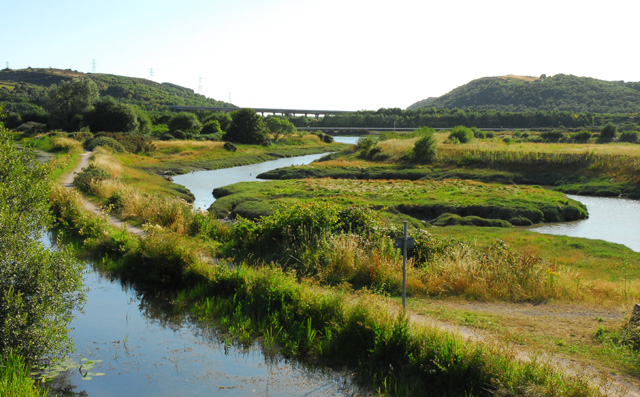
The Neath Canal and the River Neath - geograph.org.uk - 206800

 The Neath Canal and the River Neath. The Neath Canal near Giant's Grave with a tidal inlet of the River Neath to the right. The bridge in the background is the A48T Briton Ferry Bridge.

Bridge over Neath canal at Giants Grave - geograph.org.uk - 657361

Bridge over Neath canal at Giants Grave. This bridge is near the Old Ship inn

GPS Files

GPX File

Neath Canal.gpx (On Desktop:Right Click>'Save As. On Ipad/Iphone:Click and hold>Share>Save to Files')

Memory Map Route

Neath Canal.mmo (On Desktop:Right Click>'Save As. On Ipad/Iphone:Click and hold >Share>Save to Files)