Northwich to Winsford
7 miles (11 km)

 This pleasant short route follows the Weaver Valley Cycleway along the Weaver Navigation Canal.
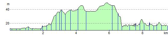
The ride is good for families as it is almost exclusively off road and fairly flat. The route runs from Northwich to Winsford, passing along the Weaver Way.
Northwich to Winsford Ordnance Survey Map  - view and print off detailed OS map
Northwich to Winsford Open Street Map  - view and print off detailed map
Northwich to Winsford OS Map  - Mobile GPS OS Map with Location tracking
Northwich to Winsford Open Street Map  - Mobile GPS Map with Location tracking
Further Information and Other Local Ideas
The popular Whitegate Way starts/finishes in Winsford. The shared cycling and walking trail follows a disused railway line north to Cuddington. A car park and the old station can be found at the Winsford end.
Cycle Routes and Walking Routes Nearby
Elevation Profile