Speyside Way

 This splendid route is one of the four official Long Distance Routes in Scotland. It follows the River Spey from Buckie, on the Moray Firth, to Aviemore.
You will pass Craigellachie, Grantown on Spey and Boat of Garten with coastal and riverside sections to enjoy. There are also terrific views of the Cairngorm Mountains as you approach Aviemore.
The trail is often completed in the following sections:
Section 1 - Buckie to Spey Bay
Section 2 - Spey Bay to Fochabers
Section 3 - Fochabers to Craigellachie
Section 4 - Craigellachie to Ballindalloch
Section 5 - Ballindalloch to Grantown
Section 6 - Grantown On Spey to Nethy Bridge
Section 7 - Nethy Bridge to Boat of Garten
Section 8 - Boat of Garten to Aviemore
This route has been classified as a walking and cycle route but not all of the trail is suitable for cycling. The off road sections between Ballindalloch and Tomintoul, and between Ballindalloch and Cromdale should be avoided on bikes. However the sections between Fochabers and Ballindalloch and between Nethybridge and Aviemore make for excellent cycling. The final section from Boat of Garten to Aviemore, is actually part of the Sustrans millennium cycle way so is also suitable for cycling.
Please click here for more information
Speyside Way Ordnance Survey Map  - view and print off detailed OS map
Speyside Way Open Street Map  - view and print off detailed map
Speyside Way OS Map  - Mobile GPS OS Map with Location tracking
Speyside Way Open Street Map  - Mobile GPS Map with Location tracking
Pubs/Cafes
In Aberlour The Mash Tun is in a great riverside location next to the pretty Alice Little Park. Built in 1896 as the Station Bar, you can now enjoy refreshments on the former station platform and enjoy the view of the old railway line running past the door, which is now the Speyside Way long distance trail. The pub includes a garden area with fine views over the fields and car parking. You can find them at postcode AB38 9QP for your sat navs. The pub is dog friendly.
In the village you could also visit the picturesque Linn Falls which lies just to the south of the village.
Further Information and Other Local Ideas
At Boat of Garten you could take a small detour from the route to visit a couple of local lochs. Loch Garten is just to the east of the trail and includes an RSPB Osprey centre where you can learn about the local wildlife. The smaller Loch Vaa lies just west of the trail and has particularly beautiful clear waters.
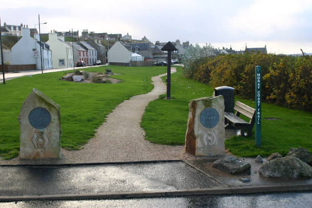
At Spey Bay you'll find a wildlife rich nature reserve where you can look out for wildfowl and dolphins. Here the route also links up with the Moray Coast Trail. This splendid walking trail will take you along the coast to Forres in the west or Cullen in the east. You can pick up the Buckie to Findochty and Cullen Coastal Walk at the start of the route.
For more walking ideas in the area see the Cairngorms Walks page.


