Blakeney Circular Walk

 This circular walk explores the coast and countryside around the village of Blakeney on the Norfolk Coast. The route runs for just under 9 miles with a small hill climb on the way.
Start the walk from the public car park in the centre of the village. The trail then heads north through the village to pick up the Peddars Way and Norfolk Coast Path. You can follow the waymarked trail west along Morston Marshes to Morston. There's lovely views of Morston Creek and the marshes where there's lots of wildlife to see. In the village there is a visitor centre and the option of picking up a boat trip.
After strolling around Morston the route heads back to Morston Downs before turning south to climb along Blakeney Downs to Kettle Hill. Trail continue south east towards Wiveton Downs where you pick up a country lane heading east towards the village of Wiveton. Here you cross the River Glaven on the 15th century Wiveton Bridge before turning north to visit Cley Next the Sea.
After passing through the village you continue north past Cley Windmill to reach the coast at the site of the former Blakeney Chapel. Here the coast path turns to the west before turning to the south to return you to Blakeney.
Blakeney Circular Walk Ordnance Survey Map  - view and print off detailed OS map
Blakeney Circular Walk Open Street Map  - view and print off detailed map
Blakeney Circular Walk OS Map  - Mobile GPS OS Map with Location tracking
Blakeney Circular Walk Open Street Map  - Mobile GPS Map with Location tracking
Pubs/Cafes
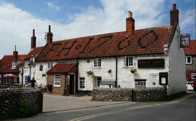
Head to the 18th century Kings Arms in Blakeney for some post walk refreshments. The Georgian Inn has an interior with bags of character including cosy little alcoves and interesting pictures, photos and posters on the walls. Outside there's a nice garden area where you can enjoy your meal on a fine day. The pub is located in a wonderful spot just yards from Blakeney Quay. You can find the pub on Westgate Street at a postcode of NR25 7NQ for your sat navs.
Dog Walking
The area around the village is a lovely place to walk the dog. The King's Arms pub mentioned above is also dog friendly.
Further Information and Other Local Ideas
To continue your walking in the area try the Blakeney Seal Walk visits the Blakeney Point Nature Reserve. It's located just to the north west of the village and includes a four-mile-long sand and shingle spit with sand dunes, salt marshes, tidal mudflats and farmland.
You could also visit the Cley Marshes Nature Reserve just to the north of Cley. It's another great bird spotting site with 430 acres of reed beds, freshwater marsh, pools and wet meadows.
At Morston you can pick up the Cockthorpe Circular Walk which visits Stiffkey Marshes, the River Stiffkey and the green fields around Cockthorpe Common away from the coast. To the south of Cockthorpe there's also some interesting local history at Binham Priory. Here you can explore substantial monastic ruins dating back to the 11th century.
Just south of Wiveton village there's the lovely Wiveton Downs to explore. The nature reserve is a delightful place for a peaceful stroll in the area. From the elevated position of the Downs there's fine views towards the coast and countryside.
Head south west to Great Walsingham and you could pick up the Walsingham Way. This long distance trail runs from the mediaeval abbey at Great Walsingham to the city of Norwich, passing several fascinating historic sites on the way. The abbey in Walsingham is one of the highlights of the area and well worth a visit. There's some lovely grounds with the snowdrop and bluebell walks particularly popular.
For more walking ideas in the area see the Norfolk Walks page.


