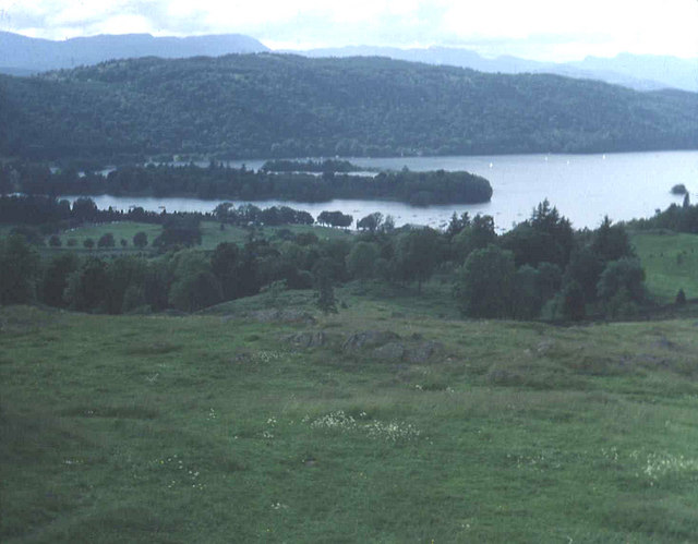
Brant Fell Walk

 Enjoy a climb to Brant Fell on this walk in Bowness on Windermere. It's a fairly easy 2 mile walk, readily accessible from the village centre and with splendid views from the fell top.
The walk starts in Bowness village on Brantfell road which is located off the Kendal Road near St Martin's Church and the Belsfield Hotel. From here you can pick up the start of the Dales Way long distance trail to take you up Brantfell Road. After a few minutes you turn right on a footpath to take you up to Post Knott and then on to the Brant Fell viewpoint. From the 629 feet (192 m) summit there are really lovely views over the lake to the surrounding fells.
After taking in the views the route descends eastwards to Lindeth Lane before turning north to pick up the Dales Way again. This will then lead you back down into the village centre.
To extend your walking in the area try our Bowness Walk which takes you along Lake Windermere to the marina where you can catch the ferry to the other side of the water. From here you can walk to Hill Top, the former home of children's author Beatrix Potter, and then climb to Claife Heights and Moss Eccles Tarn. You could also head up the hill to the town of Windermere where you can enjoy a similar climb to the Orrest Head viewpoint.
Brant Fell Ordnance Survey Map  - view and print off detailed OS map
Brant Fell Open Street Map  - view and print off detailed map
Brant Fell OS Map  - Mobile GPS OS Map with Location tracking
Brant Fell Open Street Map  - Mobile GPS Map with Location tracking
Pubs/Cafes
The Belsfield Hotel is located in a wonderful spot above Lake Windermere in the town. You could enjoy afternoon tea and enjoy a wonderful view over the lake. They are located at LA23 3EL for your sat navs.


