Congleton Walks - Canal and The Cloud

 This Cheshire based town is great for waterside walking with a delightful local mere and canalside paths to enjoy. There's also several waymarked long distance trails running into the surrounding hills and countryside.
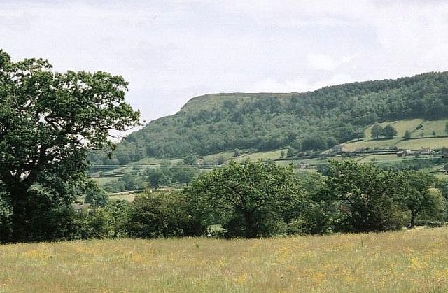
This circular walk from the town climbs to Bosley Cloud before a long waterside stretch along the Macclesfield Canal. It makes uses of a few of the waymarked footpaths to the east of the town.
The walk starts at the train station in the town centre where you can pick up the canal towpath along the Cheshire Ring Canal Walk. Head east towards Brookhouse Farm where you leave the canal to pick up the Staffordshire Way and Gritstone Trail. Follow the waymarked paths east to Timbersbrook before climbing north east to the cloud summit.
After taking in the views the route continues east to meet with the Dane Valley Way at Cloudwood End Farm. Follow the trail north and it will link up with the canal. Near here you can take a detour to visit Bosley village, Bosley Locks and the Bosley Reservoir which lies just to the east. This route picks up the canal towpath again and follows it west back into Congleton.
Congleton Ordnance Survey Map  - view and print off detailed OS map
Congleton Open Street Map  - view and print off detailed map
Congleton OS Map  - Mobile GPS OS Map with Location tracking
Congleton Open Street Map  - Mobile GPS Map with Location tracking
Walks near Congleton
- Bosley Cloud - This short circular walk visits the Bosley Cloud hill, near Congleton, on the edge of the Peak District
- Astbury Mere Country Park - Enjoy a waterside walk around the peaceful Astbury Mere in Congleton, Cheshire
- Gritstone Trail - This beautiful, challenging walk runs through the Peak District from Disley to Kidsgrove.
The walk begins at the train station at Disley and soon comes to the wonderful Lyme Park (video below) with its mansion house and Medieval deer park - Brereton Heath Country Park - Explore 50 acres of silver birch and oak woodland in this country park and nature reserve in Davenport
- South Cheshire Way - This is a splendid walk along canals and through wonderful Shropshire and Cheshire countryside from Grindley Brook, near Whitchurch, to Mow Cop near Congleton.
The walk starts on the Shropshire Union Canal at Grindley Brook and heads to Marbury - Mow Cop - Visit Mow Cop Castle and the Old Man of Mow on this short circular walk on the Cheshire–Staffordshire border
- Biddulph Grange Country Park - This circular walk runs for a distance of about 2 miles on a series of well laid out footpaths in this lovely country park in Biddulph
- Macclesfield Canal - Follow the towpath of the Macclesfield Canal from Marple to Kidsgrove on this waterside walk in Cheshire
- Cheshire Ring Canal Walk - This nice easy walk follows six historic canals through Cheshire, Greater Manchester and Staffordshire
- Staffordshire Way - Travel through Staffordshire, Cheshire, Derbyshire, Worcestershire and enjoy canals, lakes, country parks and a series of pretty towns and villages
- Dane Valley Way - Follow the River Dane through Derbyshire and Cheshire on this fabulous walk from Buxton to Middlewich.
Highlights on the route include the wonderful Three Shires Head where the counties of Cheshire, Derbyshire and Staffordshire meet - Bosley Reservoir - This reservoir in the Cheshire village of Bosley has a nice waterside walking trail running along it's southern and eastern shore
- Biddulph Valley Way - This circular route starts in Congleton and first follows the Biddulph Valley Way (a traffic free disused railway path) before turning round to return to Congleton
- Redesmere Lake - This easy walk visits the pretty Redesmere Lake and the adjacent Capesthorne Hall around Siddington in Cheshire
- Bosley Locks - This waterside walk visits the impressive Bosley Locks on the Macclesfield Canal in Cheshire.
- Timbersbrook - This village in Cheshire is a great place to start a walk
- Swettenham - This walk starts from the popular Swettenham Arms pub in Cheshire.
Pubs/Cafes
The Queens Head is a good choice for post walk refreshments. They're located in a fine spot next to the canal with a nice garden area for warmer days. You can find them on Park Lane at postcode CW12 3DE for your sat navs.
Dog Walking
The waterside, country and woodland trails on the route make for a fine dog walk. The Queens Head mentioned above is also dog friendly.
Further Information and Other Local Ideas
On the western side of the town there's the popular Astbury Mere Country Park to visit. There's a lovely circular trail running around the perimeter of the pretty lake.
Head south of the town and you can enjoy a climb to Congleton Edge. There's more great views here and the option of continuing on to the popular Mow Cop.
A few miles to the north there's the worthy village of Gawsworth to visit. The village includes three noteworthy historic buildings including the 15th century Gawsworth Hall. The house and grounds of the historic Tudor house are well worth exploring.
For more walking ideas in the area see the Cheshire Walks page.


