Conisbrough Viaduct

 This south Yorkshire town is a fine place for a walk with a historic ruined castle, riverside trail and an impressive disused viaduct to visit.
This circular walk visits the Conisbrough Viaduct before heading to the nearby Sprotbrough Falls and the medieval castle.
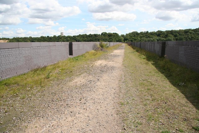
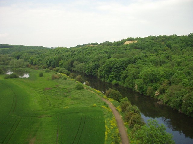
You can start the walk from the train station and then cross the river to the opposite side on the footbridge. Here you can pick up the Trans Pennine Trail and follow the waymarked trail east along the River Don to the viaduct. The structure was opened in 1909, and is 1,527 feet in length with 21 arches. From the top of the viaduct there are excellent views over the surrounding Don Valley countryside.
The route then continues along the Don, passing Cadeby and the Dolomite Quarry before coming to the Pot Ridings Wood Nature Reserve where there are woodland trails and wildlife spotting opportunities. Near here you'll also pass Sprotbrough Falls where there's locks and rushing weirs to admire.
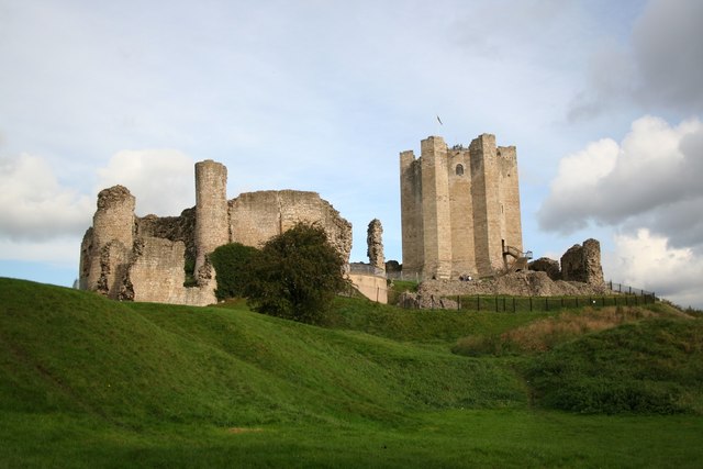
The walk then crosses Sprotbrough Bridge to the other side of the river before heading south past Levitthagg Wood and Warmsworth. The route continues past Butterbusk Green and the viaduct to take you to the medieval ruins of Conisbrough Castle. From the elevated position of the castle keep there are excellent views back to the viaduct.
From the castle it is then a short walk back to the train station where the walk finishes.
Conisbrough Viaduct Ordnance Survey Map  - view and print off detailed OS map
Conisbrough Viaduct Open Street Map  - view and print off detailed map
Conisbrough Viaduct OS Map  - Mobile GPS OS Map with Location tracking
Conisbrough Viaduct Open Street Map  - Mobile GPS Map with Location tracking
Pubs/Cafes
Back in the town you could enjoy some post walk refreshments at The Red Lion. They have a good menu and a nice garden area for warmer days. You can find them at 8 Sheffield Road with a postcode of DN12 2BY.
Further Information and Other Local Ideas
To continue your walking in the area you could try the Doncaster River Walk or pick up the long distance Doncastrian Way. If you continue along the Don you could visit Cusworth Country Park where there's the Grade I listed Cusworth Hall, lakes, plantations and pleasure ground with dramatic views across the town. The river walk forms part of the Don Valley Way, a long distance route which can be followed all the way to Sheffield.
To the south there's the interesting village of Tickhill to investigate. The historic village includes a 12th century castle with a moat and pretty millpond.
Also to the south of the town there's Potteric Carr Nature Reserve to visit. Here you'll find 500 acres of marsh, scrub, waterways, grassland and woodland with lots of wildlife to see as well. The peaceful woodland trails in Sandall Beat Wood on the eastern fringe of the town is another good option.
Just a couple of miles south of Old Denaby there's a lovely lakeside trail and lots of wildlife to see in Thrybergh Country Park. The peaceful woodland trails in Wickersley Woods are also located near here.


