Copper Trail

 Visit some of the most beautiful parts of Bodmin moor on this circular route which takes you on a tour of the historic Cornish Copper mines.
The Trail begins at Minions village and visits St. Neot, Bodmin, St. Breward, Camelford, Five Lanes and back to Minions.
The first section takes you from Minions and heads towards the delightful village of St Neot, passing the River Fowey and the photogenic Golitha Falls.
You continue from St Neot to Bodmin with lovely waterside sections along the River St Neot and past Colliford Lake. Just outside Bodmin there is a peaceful wooded section through Devlock Wood. At Bodmin you join the delightful Camel Trail, following the River Camel to St Breward and onto Camelford.
From Camelford you head through Davidstow Moor, passing Crowdy Reservoir, Davidstow Woods and the old WW2 Control Tower.
The path continues through Stonaford and Henwood before returning to Minions.
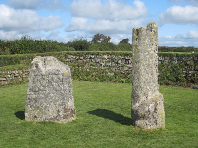
As well as the beautiful countryside scenery you will also pass a series of ancient stone structures including King Doniert's Stones, Hurlers Stone Circle and the Cheesewring Tor near Minions. The walk also visits several historic mines including the Prince of Wales Mine and South Caradon mine.
Please click here for more information
Copper Trail Ordnance Survey Map  - view and print off detailed OS map
Copper Trail Open Street Map  - view and print off detailed map
Copper Trail OS Map  - Mobile GPS OS Map with Location tracking
Copper Trail Open Street Map  - Mobile GPS Map with Location tracking
Pubs/Cafes
At the start in Minions there's the Cheesewring Hotel. This 19th century freehouse is the highest pub in Cornwall at 303m above sea level. They do a fine Sunday roast and have a garden area to sit outside in. You can find them in the village at postcode PL14 5LE for your sat navs. If you fancy a delicious cream tea then you could head across the street to the Minions Shop & Tearoom.
In Camelford there's a few good refreshment options. The Masons Arms does good food and has a lovely garden area to sit in when the weather is good. The interior is full of character with a ceiling full of old bottles, mugs, cups, tankards and old newspaper clippings. You can find the pub in the market place at a postcode of PL32 9PB for your sat navs. It's also dog friendly if you have your canine friend with you.
In Blisland be sure to make a pit stop at the excellent Blisland Inn. It's an award winning pub of some note, having been voted three times Cornwall CAMRA Pub of the Year and in 2001 becoming the campaign's national Pub of the Year. The interior is full of character with items such as pumps, barometers, toby jugs and coffee mugs to admire. They serve good quality homemade food and also have a nice garden to sit out in. You can find them at postcode PL30 4JF for your sat navs.
In the town of Camelford there's the Masons Arms to consider. The 18th century pub includes a restaurant and a nice garden area which backs onto the River Camel. They serve a good selection of Cornish Ales and have a decent food menu as well. You can find them in the Market Place at postcode PL32 9PB for your sat navs. The Camelford Way long distance footpath can also be picked up in the town. The trail explores the River Camel Valley to the south of the riverside settlement.
Further Information and Other Local Ideas
Near the start of the walk you'll pass close to the Cheesewring which is well worth a short detour. The distinctive granite tor sits atop Stowe's Hill just to the west of the path near Minions.
For more walking ideas in the area see the Bodmin Moor Walks page.


