Cwm Idwal Walk

 Explore this hanging valley in Snowdonia and enjoy some of the most spectacular mountainous scenery in the country. In a Radio Times poll in 2005, Cwm Idwal was ranked the 7th greatest natural wonder in Britain.
This circular walk begins at the car park next to the western end of Lllyn Ogwen. You then pick up a footpath which ascends to the beautiful Llyn Idwal. It's a simply wonderful spot with the crystal clear lake and surrounding mountains forming a spectacular natural amphitheatre. The footpath runs along the edge of the lake to the Darwin Idwal Boulders and then to the Idwal Slabs. The slabs were used as a training ground for Mount Everest conqueror Edmund Hillary.
As you pass the lake you close in on the impressive headwall of Cwm Idwal know as 'The Devil's Kitchen'. From here the route descends on the western side of Llyn Idwal to Llyn Ogwen and the finish point.
If you would like to continue your walking in the area then you could climb the challenging Tryfan mountain. The route starts from the eastern end of Llyn Ogwen which is a great place to extend your walk.
Postcode
LL24 0EU - Please note: Postcode may be approximate for some rural locationsCwm Idwal Ordnance Survey Map  - view and print off detailed OS map
Cwm Idwal Open Street Map  - view and print off detailed map
Cwm Idwal OS Map  - Mobile GPS OS Map with Location tracking
Cwm Idwal Open Street Map  - Mobile GPS Map with Location tracking
Explore the Area with Google Street View 
Pubs/Cafes
The Ogwen Snack Bar is located at the western end of Llyn Ogwen and a good option for some post walk refreshments. It's open seven days per week for most of the year – opening only at weekends during the winter months. The popular snack bar can trace its history back to the early 1900’s when it was precariously perched on rocks at the head of the waterfall from which it takes its name. Known throughout the world it has its place in the mountaineering history in this part of Snowdonia and has been run by the same family since 1953. It moved to its current location over forty years ago to the newer premises incorporating Snowdonia National Park warden office and public toilets. It sells a range of drinks, snacks, pasties, paninis and locally baked cakes. There's an outdoor seating area where you can enjoy your food with fine views of the surrounding mountains. You can find the snack bar between Llyn Ogwen and Llyn Idwal at postcode of LL57 3LZ for your sat navs.
Further Information and Other Local Ideas
The Lon Las Ogwen cycle route starts/finishes at the western side of Llyn Ogwen. The off road trail will take you north to the coast at Bangor, passing the splendid Penrhyn Quarry at Bethesda on the way. It runs mostly along old railway paths and the River Ogwen before finishing on the coast. The route is also suitable for walkers.
For more walking ideas in the area see the Snowdonia Walks page.
Cycle Routes and Walking Routes Nearby
Photos

Gate into Cwm Idwal NNR

Idwal Cottage car park. The car park is already busy as walkers head up the nature trail path into stunning Cwm Idwal.

The popular path leading to the Idwal slabs and beyond to the Devil's kitchen. The area is geologically fascinating, an incredible result of thousands of years of glaciation. The site is surrounded by high crags, screes, moraines and rounded rocks. Due to its high elevation and north-facing orientation, Cwm Idwal represents the most southerly location in Britain where Arctic vegetation, including moss campion and certain alpine saxifrages like tufted saxifrage (Saxifraga cespitosa) and Micranthes nivalis, can thrive. Additionally, it serves as a habitat for the Snowdon lily, a plant exclusive to Snowdon and its surrounding regions within the UK. Evan Roberts, a notable botanist and explorer hailing from Capel Curig, played a significant role, perhaps more than any other self-taught botanist, in documenting the area. Furthermore, the Snowdonia hawkweed, known scientifically as Hieracium snowdoniense, is found exclusively within Cwm Idwal.

Llyn Idwal is a memorable place at any time. The Twll Du climb is right of centre. Some of the boulders that have spilled out in the distant past are the size of small houses. It takes its name from Prince Idwal Foel, a descendant of Rhodri Mawr, an ancient King of Wales. According to legend, the unfortunate prince met his demise by drowning in the lake, although historical records suggest he actually perished in battle against the Saxons in 942. An alternative version suggests he was cremated beside the lake, following the burial customs of Celtic nobility. Several small streams feed into Llyn Idwal from various points around Cwm Idwal. One of these streams flows out and merges with the Afon Ogwen river at Pont Pen-y-Benglog near Ogwen Cottage, just above the Rhaeadr Ogwen waterfall.

Boulders in the Devil's Kitchen area. An old rockfall has deposited massive rocks here, which the path climbs past. Llyn Idwal laid out below. The lake is easily reachable by foot via a 900-metre long stone-paved pathway from Ogwen Cottage on the main A5 road. Another path encircles the lake, while two paths from opposite sides of the lake lead to the ridge near Twll Du (Devil's Kitchen), although these paths become steep in places as they ascend towards Glyder Fach and Glyder Fawr. At the northwest edge of Llyn Idwal, there is a small pebble beach occasionally used by visitors for recreational activities, including bathing during the summer months. As a mountain lake, the waters can be cold, and swimmers should exercise caution not to venture beyond their depths. While the lake lies entirely within Gwynedd County, its eastern edge forms the boundary between the counties of Gwynedd and Conwy.

Sunset over Devil's Kitchen. Taken from the roadside (A5) looking back up to Cwm Idwal and Devil's Kitchen with the stream flowing past down to Nant Francon Pass.

Descent to Idwal Cottage car park. The path here runs through a deep rock chasm to the roadside. Rhiwiau Caws (Idwal Slabs) and the cliffs surrounding the head of Cwm Idwal are well-known spots for rock climbing, with Rhiwiau Caws on the eastern side of the Cwm being particularly favoured by novice climbers honing their skills. These cliffs were initially ascended in 1897 by Rose and Moss. During the winter months, Twll Du offers excellent opportunities for ice climbing. The Cwm is also a popular destination for hill walking and scrambling, thanks to its proximity to Tryfan, Glyder Fach, and Glyder Fawr, along with their abundance of rocky ridges. In the mid-to-late 1950s and into the 1960s, this area served as the gathering site for the first ascenders of Mount Everest and Kangchenjunga, who held reunion excursions at Pen-y-Gwryd. Many of these individuals were enthusiastic geologists and botanists.

Nant Ffrancon from the head of Cwm Bual. Cwm Bual leads down from the slopes of Foel-goch and provides a steady if tedious descent to the side road which leads from Idwal Cottage down the west side of Nant Ffrancon. It is actually a lot further than it looks here.
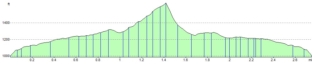
Elevation Profile