Feizor Walks

 This little hamlet in the Yorkshire Dales is known for some splendid limestone scenery. As such it's a popular place for walkers with some peaceful and beautiful countryside to explore. In the village there's also a delightful tea room and a falconry where there's a hands on birds of prey experience.
This circular walk from the hamlet visits the neighbouring village of Austwick before heading to Stainforth Force Waterfall.
The walk starts in Feizor and follows trails north west to Austwick. The area surrounding this historic village has many ancient remains including extensive walls and structures constructed of slate, limestone, and sandstone.
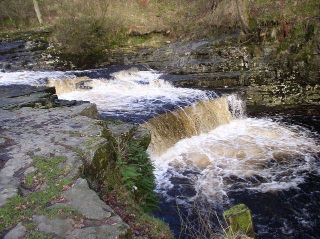
From the village you head east to Flascoe Bridge, Jop Ridding, Wharfe Wood and Swarth Moor where you turn south. Follow the country lane south and it will then lead you to Stainforth where you can enjoy views of the Stainforth Force Waterfall. It's a lovely spot where the River Ribble falls over a series of limestone ledges into a deep, broad pool. In October you can see leaping Salmon on their annual migration up the River Ribble.
After enjoying the falls you follow paths south west and then north west to Feizor Thwaite where there's nice views towards Ingleborough. Shortly after you return to Feizor where you can enjoy some refreshments at the fine local tea rooms.
Feizor Ordnance Survey Map  - view and print off detailed OS map
Feizor Open Street Map  - view and print off detailed map
Feizor OS Map  - Mobile GPS OS Map with Location tracking
Feizor Open Street Map  - Mobile GPS Map with Location tracking
Pubs/Cafes
In the village you will find the lovely Elaine's Tea Rooms. The lovely tea rooms have outdoor seating with fine views of the surrounding hills. They do good home-cooked food, homemade cakes and scones, with a daily special board. It's a popular stop off point for walkers and cyclists passing through the area.
On the route you could have a pit stop at The Craven Heifer Hotel in Stainforth. They have three real fires indoors for colder days. Outside there's a covered beer garden with a flowing stream feeding into the River Ribble. You can find the pub in the village on the Main Road with a postcode of BD24 9PB for your sat navs.
Dog Walking
The area is a nice place to bring your dog for a walk and the tea rooms mentioned above are also dog friendly.
Further Information and Other Local Ideas
Head north and you can visit the noteworthy Norber Erratics. Here you'll find a set of glacial erratic boulders which were probably deposited by melting ice sheets at the end of the last ice age, around 12,000 years ago. Also nearby is the popular village of Clapham.
For more walking ideas in the area see the Yorkshire Dales Walks page.


