Hanley Swan

 This Worcestershire based village is located in a pleasant rural spot in the Malvern Hills area of the county.
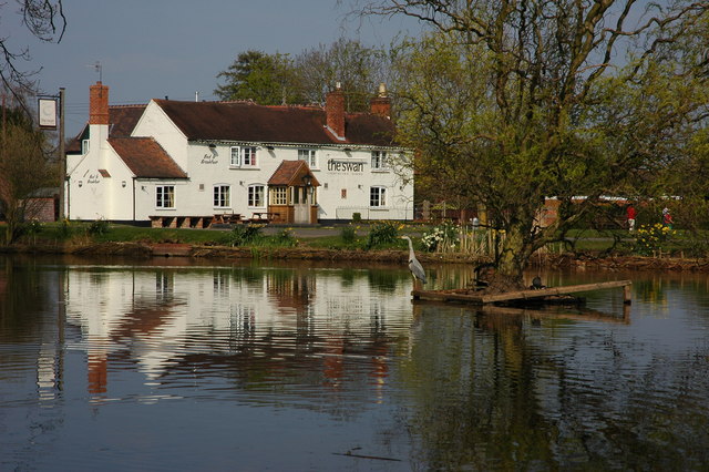
It's an attractive place with a pretty village green, a pond, a 17th century pub and lots of country footpaths branching out for its centre.
This circular walk from the village takes you to the trig point to the north before heading to the neighbouring village of Hanley Castle. Here you can see the site of the ancient castle and enjoy a view of the River Severn which runs to the east of the settlements.
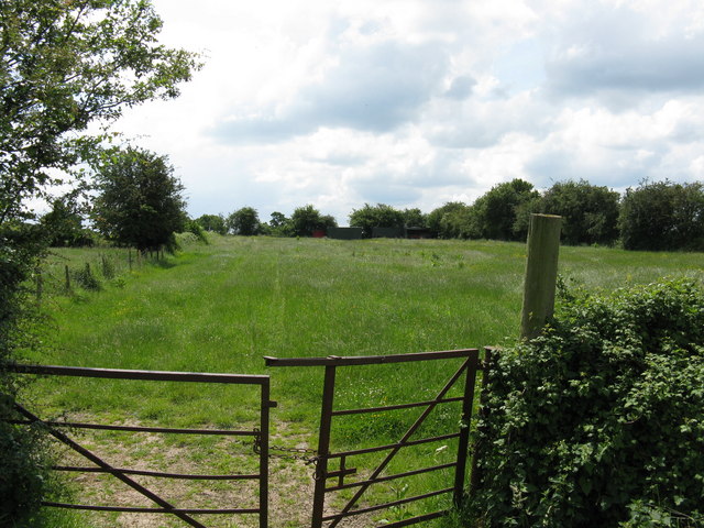
The walk starts in the village and first follows footpaths north to the hill and trig point above the settlement. There's some nice country trails and views to enjoy from here. You then head east and south through the countryside to visit Hanley Castle. There's the site of the old castle and moat here and the option to visit the River Severn as well. To the south of here you can head to Upton Upon Severn and pick up the long distance Severn Way if you would like to extend the walk. There's some pleasant riverside sections to enjoy here.
This route heads west passing along the old dismantled railway through Brotheridge Green to Gilvers Lane. Here you turn north to follow footpaths back to the village.
Postcode
WR8 0EA - Please note: Postcode may be approximate for some rural locationsHanley Swan Ordnance Survey Map  - view and print off detailed OS map
Hanley Swan Open Street Map  - view and print off detailed map
Hanley Swan OS Map  - Mobile GPS OS Map with Location tracking
Hanley Swan Open Street Map  - Mobile GPS Map with Location tracking
Walks near Hanley Swan
- Croome Court - Explore the extensive landscaped parkland surrounding this mid 18th century Neo-Palladian mansion near Pershore.
- Tewkesbury - This riverside circular walk explore the town of Tewkesbury in Gloucestershire
- Worcestershire Beacon - This circular walk takes you to the high point of the Malvern Hills at Worcestershire Beacon
- Malvern Hills - This walk takes you the full length of the Malvern Hills from End Hill in North Malvern to Chase End Hill at the southern end
- Malvern Common - This route takes you across the Peachfield and Malvern Commons in the Malvern Hills AONB
- Herefordshire Beacon and British Camp - This walk climbs to Herefordshire Beacon in the Malvern Hills Area of Outstanding Natural Beauty
- Eastnor Deer Park - This walk follows a section of the Geopark Way long distance trail through the beautiful Eastnor Deer Park
- Twyning - A circular walk around the Gloucestershire village of Twyning, visiting the River Avon and the River Severn
- Pershore - This circular walk from the market town of Pershore visits some of the highlights of the area
- Worcester Riverside Walk - An easy riverside walk along the River Severn from Worcester Cathedral to the nearby village of Hallow
- Old Hills and Stanbrook Abbey - This circular walk climbs to the viewpoint at Old Hills before visiting Stanbrook Abbey where you'll find a family fun trail.
- Upton Upon Severn - This small town in Worcestershire is ideally positioned for river and country walks
- Castlemorton Common - This walk explores Castlemorton Common near the village of Castlemorton in Worcestershire.
Pubs/Cafes
Back in the village you can enjoy some rest and refreshment at The Swan Inn. The historic inn dates back to the 17th century and is located in a lovely spot next to the village green. The inn serves good quality dishes and has a nice garden area to relax in on warmer days. You can find them on the Worcester Road at postcode WR8 0EA for your sat navs.
Dog Walking
The country trails are ideal for dog walking and the Swan Inn mentioned above is also dog friendly.
Further Information and Other Local Ideas
Head west towards Great Malvern and you could pick up the Malvern Hills Walk and enjoy a climb to the excellent viewpoints at Worcestershire Beacon and Herefordshire Beacon and British Camp. Malvern Common can also be explored in this area.
To the east there's the splendid landscaped parkland surrounding Croome Court. The mid 18th century Neo-Palladian mansion is one of the highlights of the area and located near the worthy village of Pershore.
Just to the south west you'll find Castlemorton Common. The expansive common is another popular local place for a walk with miles of trails, woodland, wildlife and great views to the Malverns.


