Hastings to Winchelsea Coastal Walk

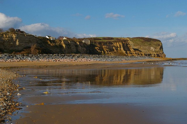
 This lovely walk follows the Saxon Shore Way and the Royal Military Canal Path from Hastings to Winchelsea. It's an 8 mile route, running along two good waymarked trails with some moderate cliff top climbs along the way. It's a really beautiful part of the country with splendid views of the High Weald from the wonderful cliff tops.
The walk starts on the seafront in Hastings and heads east to Hastings Country Park. The park is located in the High Weald Area of Outstanding Natural Beauty, with most of the site designated as a Special Area of Conservation and a Local Nature Reserve. It's a great place for wildlife watching with Peregrines, black redstarts and fulmars on the coastal cliffs, while Dartford warblers, stonechats and yellowhammers can be seen on the gorse covered hills.
After leaving the park you continue to the picturesque Fairlight Cove where there's a nice beach and more stunning cliffs. The route then passes Cliff End where you pick up a flat section along the Royal Military Canal to Winchelsea.
The walk can be extended by continuing along the Saxon Shore Way through Rye Harbour to Rye.
Hastings to Winchelsea Coastal Walk Ordnance Survey Map  - view and print off detailed OS map
Hastings to Winchelsea Coastal Walk Open Street Map  - view and print off detailed map
Hastings to Winchelsea Coastal Walk OS Map  - Mobile GPS OS Map with Location tracking
Hastings to Winchelsea Coastal Walk Open Street Map  - Mobile GPS Map with Location tracking
Pubs/Cafes
Right next to Hastings Country Park you'll find the the Coastguards Tea Rooms. There's a new conservatory with a beautiful coastal view with France visible on a clear day. The Tearoom seats 50 people inside and they have additional seating for 30 outside. It's a great place to relax and enjoy a cake when the weather is good. They also have a nice shop with gifts, paintings and arts and crafts. You can find them a short distance from the car park on Coastguards Lane with a postcode of TN35 4AB for your sat navs.
At the end of the walk in Winchelsea there's the New Inn for rest and refreshment.
The pub dates back to 1778 and includes a beamed interior and a nice walled garden area outside. They also provide rooms if you would like to stay in the area.
You can find them on German Street at a postcode of TN36 4EN for your sat navs.
The pub is dog friendly.
Further Information and Other Local Ideas
The Hastings Circular Walk is a good way to continue your walking in the area, visiting the coast and countryside to the east of the town.
Just west of Hastings you could visit St. Leonards Gardens where there's some lovely footpaths, an ornamental pond, herbaceous plants, shrubs, bulbs, formal flower beds and trees. There's also some interesting architecture with villas surrounding the gardens, in Regency Gothic and cottage styles. It's a very pleasant place for a stroll and can be found at postcode TN38 0HQ. The Hastings To Bexhill route will take you past the gardens along a waterfront cycling and walking trail.


