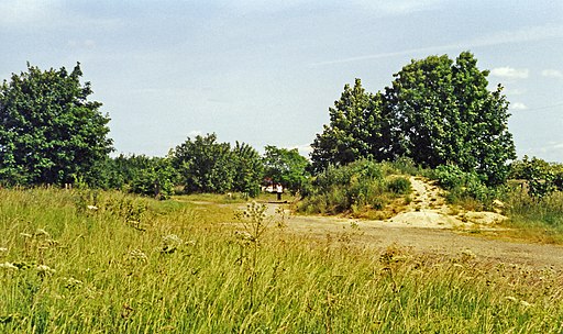
Haverhill Railway Walk

 This Suffolk based town has some nice local trails along the Stour Brook and the River Stour which run through the area.
This walk takes you along a disused railway line which runs through the town. It is designated as a local nature reserve and includes a nice flat footpath with lots of flora and fauna to look out for.
Start the walk from the East Town Park on Coupals Road at postcode CB9 7UR for your sat navs. It's a pretty park with river views, flower beds and picnic tables. The railway path also passes through it so you can pick it up and follow it north west through the town. It runs along a nice surfaced path so it's suitable for most abilities.
After exploring the railway path you can enjoy a stroll around the town where there are some interesting old buildings including Anne of Cleves House which was built in 1540 by Henry VIII.
Postcode
CB9 7UR - Please note: Postcode may be approximate for some rural locationsHaverhill Ordnance Survey Map  - view and print off detailed OS map
Haverhill Open Street Map  - view and print off detailed map
Haverhill OS Map  - Mobile GPS OS Map with Location tracking
Haverhill Open Street Map  - Mobile GPS Map with Location tracking
Pubs/Cafes
The Rose & Crown dates from the 1500s and does a great Sunday Roast. You can find it at Withersfield Road with a postcode of CB9 8AA for your sat navs.
Further Information and Other Local Ideas
The Stour Valley Path runs just to the east of the town and is a great way of exploring the surrounding countryside on a waymarked trail. You can pick it up in the village of Kedlington and then follow it north along the river to the nearby village of Great Thurlow. Heading south and then east will take you to Clare where you could pay a visit to Clare Castle Country Park.
Also in Clare you can pick up the The Bury to Clare Walk and follow it to Bury St Edmunds.
A few miles to the west you can pick up the Harcamlow Way at Horseheath. This long distance footpath then links with the epic Icknield Way Path around Balsham. Both of these trails provide a good opportunity for exploring the countryside to the west of Haverhill.
Just a few miles to the south there's the noteworthy village of Castle Hedingham. Here you'll find the splendid Hedingham Castle with its significant 12th century Norman Keep, pretty lake and beautiful landscaped gardens. Near here there's also Gosfield Hall and Gosfield Lake where there's some nice waterside trails and a good lakeside cafe. The 16th century hall is designated as a Grade I listed building and is now used for weddings.
For more walking ideas in the area see the Suffolk Walks page.


