Horning Walks

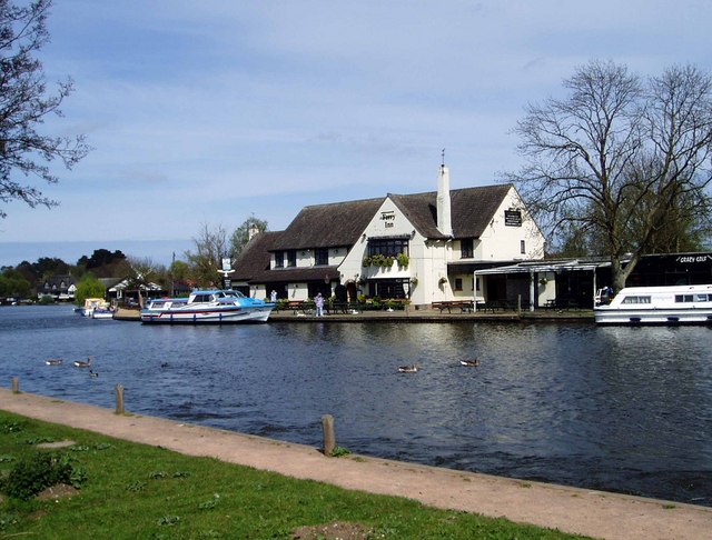
 This Norfolk Broads village has some lovely waterside walks along the River Bure and the surrounding broads. It's one of the finest Broads villages with waterside pubs, shops, restaurant, tea-rooms and boat trips making it very popular with tourists.
This walk from the village takes you to the Horning Ferry before heading to Bure Marshes, Woodbastwick and Salhouse Broad. Look out for lots of water loving birds as you make your way along the waterways of this lovely area.
The walk starts by heading through the village towards Horning Ferry, just to the south east. Here you'll find a fine riverside pub and a ferry service to take you across the River Bure. Check the website for running times. The route then takes a small detour to visit the boardwalk which runs along the Cockshoot Dike to Cockshoot Broad.
You then head through Bure Marshes before following Ferry Road to Woodbastwick. From here follow Salhouse Road west before picking up a footpath heading north to the pretty Salhouse Broad.
Postcode
NR12 8PS - Please note: Postcode may be approximate for some rural locationsHorning Ordnance Survey Map  - view and print off detailed OS map
Horning Open Street Map  - view and print off detailed map
Horning OS Map  - Mobile GPS OS Map with Location tracking
Horning Open Street Map  - Mobile GPS Map with Location tracking
Walks near Horning
- Wroxham - This delightful Norfolk town has some nice walking trails to follow along the River Bure in the town centre
- Bure Valley Path - This walk and cycle track runs along Bure Valley Railway, and the River Bure from Aylsham to Wroxham
- Weavers' Way - Follow the Weavers' Way through the beautiful Norfolk Broads from Cromer to Great Yarmouth via North Walsham
- Blickling Hall - The Blickling Hall estate in Aylsham has five thousand acres of parkland, farmland and woodland to explore on foot or by bike.
- Marriot's Way - This wonderful cycle and walking path runs from Aylsham to Norwich along the trackbeds of two former railway lines
- How Hill - This walk takes you through the area around How Hill House in the Norfolk Broads
- Ranworth Broad - This circular walk in the Norfolk Broads visits the lovely village of Ranworth and its adjacent broad.
- Coltishall - This pretty riverside village is located in a lovely spot on the River Bure in the Norfolk Broads
- Barton Broad Boardwalk - This walk takes you to the lovely Barton Broad Boardwalk where you can follow the accessible path through swampy woodland and enjoy wonderful views across Barton Broad.
- Hoveton - This pretty village is located in the Norfolk Broads, on the other side of the River Bure to its near neighbour of Wroxham.
- Salhouse Broad - This walk visits Salhouse Broad in the Norfolk Broads National Park
- Heydon Hall - This walk visits the delightful Norfolk village of Heydon
- Mannington Hall - This circular walk visits Mannington Hall and Gardens near Itteringham in Norfolk.
Pubs/Cafes
The Ferry Inn is the ideal place for some post walk refreshment. Here you can sit outside and watch the boats go by on the water. You can find them at postcode NR12 8PS. They are dog friendly if you have your canine friend with you.
Further Information and Other Local Ideas
Head west towards neighbouring Wroxham and you can pick up the Bure Valley Path to visit Coltishall. In Wroxham you can also pick up the Hoveton Walk which visits the nearby Hoveton Hall. The 19th century house includes some beautiful grounds with stunning gardens, a pretty lake and popular snowdrop walks in February.
Just to the east there's Ranworth Broad where there's a boardwalk and a Wildlife Centre where you can learn all about the birdlife that visits the area.
For more walking ideas in the area see the Norfolk Broads Walks page.


