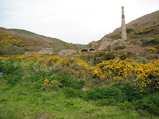
Kenidjack Valley Walk

 This walk explores the steep sided Kenidjack Valley, near St Just in west Cornwall.
On the walk you will see remaining evidence of the valley's interesting tin mining history. There's also views of the Tregeseal River which flows through the valley into the sea.
The walk starts from the National Trust car park at the Counting House, just to the north of the valley. From here follow footpaths south west past the Botallack Mines to the valley. You can then enjoy a circular walk through the area, visiting the old Wheal Owles, Wheal Castle, Boswedden Mine and the Kenidjack arsenic works. There's also a nice coastal stretch past the ancient Kenidjack Castle which dates from the Iron Age and sits in an exposed position on the edge of dramatic cliffs. This area is great for spotting sea birds with Peregrines and Choughs often found here. On a clear day there are also far reaching views over the sea to the Isles of Scilly.
Kenidjack Valley Ordnance Survey Map  - view and print off detailed OS map
Kenidjack Valley Open Street Map  - view and print off detailed map
Kenidjack Valley OS Map  - Mobile GPS OS Map with Location tracking
Kenidjack Valley Open Street Map  - Mobile GPS Map with Location tracking
Further Information and Other Local Ideas
Just to the south is the lovely Cot Valley at Porth Naven. The secluded valley is a fine place for a stroll with a picturesque stream and lots of wildlife to see.
To the north is the Geevor Mine and Levant Mine near Pendeen. Levant mine is notable as the only Cornish beam engine that is still in steam on its original mine site. The Levant engine sits in a small engine house in a dramatic location on the edge of the cliffs.
A few miles to the east you can pick up the Penwith Moors and Men-An-Tol Walk. This fascinating walk visits several ancient sites including Men-An-Tol standing stones and the Lanyon Quoit dolmen. You'll also pass the remains of the old Ding Dong Mines and climb to the fine viewpoint at Carn Galver.


