GPS Cycle and Walking Routes

Kirkintilloch to Bishopbriggs Canal Walk

4 miles (6.5 km)

This walk runs along a pleasant section of the Forth and Clyde Canal from Kirkintilloch to Bishopbriggs. It's about a 4 mile walk along the flat towpath, passing several bridges, old stables and the site of Roman Forts on the way.
The walk starts in Kirkintilloch and follows the towpath west to Westermains and Cadder where you pass the Hungryside Bridge. Shortly after passing Cadder you come to Farm Bridge at Bishopbriggs where the route finishes.

Kirkintilloch to Bishopbriggs Canal Walk OS Map - Mobile GPS OS Map with Location tracking

Kirkintilloch to Bishopbriggs Canal Walk Open Street Map - Mobile GPS Map with Location tracking

Pubs/Cafes

The Stables is a good choice for refreshments on the walk. This Georgian canalside pub has a great menu and an outdoor seating area with views of the canal. The Stables was built to serve the watermen and horses using the Forth and Clyde Canal. When the canal was first built the boats that used it were pulled by horses, as a horse could go a few miles before needing a rest stables were built along the route. You can find the pub at Kirkintilloch with a postcode of G66 1RH for your sat navs.

Dog Walking

The towpath is a nice place to take your dog for a walk and the Stables pub mentioned above is also very dog friendly. They will provide water and treats for your four legged friend.

Further Information and Other Local Ideas

To extend the walk continue west along the canal to Glasgow, passing the Possil Loch on the way. In the city you can pick up the Clyde Walkway and the Kelvin Walkway and enjoy more waterside walking along these two rivers.

Cycle Routes and Walking Routes Nearby

Photos

Luggie Water, Kirkintilloch - geograph.org.uk - 434129

Luggie Water, Kirkintilloch. This part of Kirkintilloch was previously highly industrialised, and this brownfield site has been given a 'green' makeover. Just past the bend in the Luggie, was the Lion Foundry, famous as one of the UK suppliers to the GPO of the K6 Telephone Box. The Luggie Water eventually flows under the nearby Forth & Clyde canal before joining with the Glazert Water north of the town to form the River Kelvin, which then flows to join the River Clyde at Glasgow.

Townhead Bridge, Kirkintilloch - geograph.org.uk - 422250

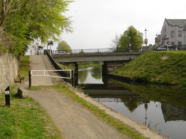
Townhead Bridge, Kirkintilloch. This bridge over the Forth & Clyde canal used to be a lifting bridge, but after the canal was cut by the building of the A80 dual carriageway at Castlecary, councils took great delight in infilling sections of the canal, and Townhead was no exception. The canal was culverted at this point and the gap infilled. When news of the reopening became a reality some 35 years later, the culvert was removed and a new bridge built to span the canal once more. To save money, no provision was made for the towpath to remain with the canal alignment, and walkers and cyclists must now use the ramp to reach road level to cross it. The only saving grace is that the council did provide a set of pedestrian crossing lights here.

Hillhead Swing Bridge - geograph.org.uk - 422498

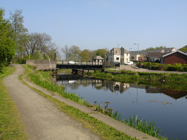
Hillhead Swing Bridge. This 1930’s former swing bridge on the Forth & Clyde Canal at Kirkintilloch was refurbished and re-commissioned as an opening bridge. Work on the re-opening project started in April 2000 and was completed in January 2001. The mechanical and electrical operating equipment and the control system were reinstated and the control building was rebuilt in its original style. The bridge pivots ('swings') out of the way to let boats pass.

Twechar Stables - geograph.org.uk - 422560

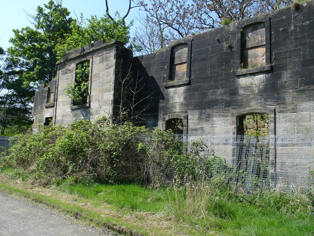
Twechar Stables. Along the length of the Forth & Clyde canal - and spaced at regular intervals - were these imposing buildings to allow the horses to be changed when required. Some are demolished or in bad repair, as here, but in other locations they have been turned into private homes (Cadder) or popular country pubs (Glasgow Bridge, Kirkintilloch).

Forth and Clyde Canal at Westermains - geograph.org.uk - 422228

Forth & Clyde Canal at Westermains. This tranquil setting shows the canal at its best. In the distant mist can be seen one of Kirkintilloch's many church towers.

Hungryside Bridge - geograph.org.uk - 422216

Hungryside Bridge. Originally a lifting bridge on the canal, the road deck hinged on the right to allow the masts of boats and sailing ships passage along the canal. Closed in 1962, the canal was reopened again after Millennium funding. The bridge however does not open, it was decided that the clearance from water level to the bridge deck was high enough for recreational purposes.

Wild flowers by canal path - geograph.org.uk - 1336565

Wild flowers by canal path to the north of Bishopbriggs.

Bend in the Forth and Clyde Canal - geograph.org.uk - 1627140

The canal in winter at Cadder. A pretty snowy scene.

GPS Files

GPX File

Kirkintilloch to Bishopbriggs Canal Walk.gpx (On Desktop:Right Click>'Save As. On Ipad/Iphone:Click and hold>Share>Save to Files')

Memory Map Route

Kirkintilloch to Bishopbriggs Canal Walk.mmo (On Desktop:Right Click>'Save As. On Ipad/Iphone:Click and hold >Share>Save to Files)