Norland Moor Walk

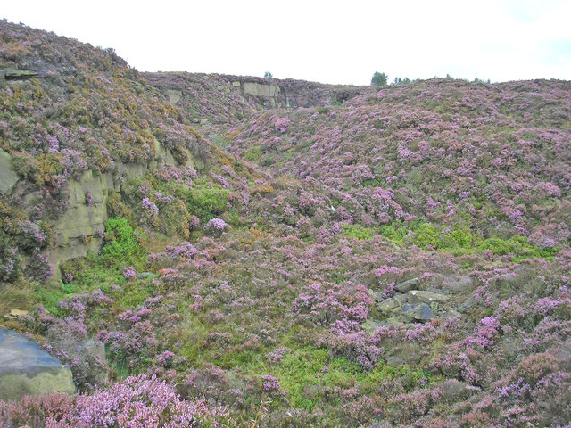
 This large open space near Sowerby Bridge has some nice footpaths to try. The area includes heather moorland and pockets of woodland with lots of wildlife to look out for. It's particularly lovely in late summer when the area is covered in purple heather. The moor is surrounded by a number of pubs so you can easily enjoy refreshments after your walk.
There's a car park at the north eastern end of the moor near Norland village. From here you can pick up the paths across the moor. Look out for wildlife including grouse and little owl on the way.
The moor is in an elevated position with the high point reaching 932 feet (284 m) at the trig point at the southern end. From here there are great views to the surrounding hills and towns. Norland is also home to a annual scarecrow festival. It takes place around the first weekend in September.
The Calderdale Way long distance path crosses the moor so you can extend your walk along the waymarked trail. Just to the north of the site you will find the Calder and Hebble Navigation Canal where you can pick up the towpath.
N.B Please note cycling is not permitted on the moor.
Postcode
HX6 3RL - Please note: Postcode may be approximate for some rural locationsNorland Moor Ordnance Survey Map  - view and print off detailed OS map
Norland Moor Open Street Map  - view and print off detailed map
Norland Moor OS Map  - Mobile GPS OS Map with Location tracking
Norland Moor Open Street Map  - Mobile GPS Map with Location tracking
Pubs/Cafes
Just to the south of the moor there's the Spring Rock Inn in Greetland. There's a cosy interior with a pine furnished bar area and an adjacent lounge, which is more comfortable and is warmed by a solid fuel stove. They have a good food menu and a nice outdoor area with views. You can find them at postcode HX4 8PT.
Dog Walking
The expansive moor is great for dog walking so expect to see other owners with their pets on a fine day.
Further Information and Other Local Ideas
The moor is located close to the interesting village of Ripponden where you can enjoy a stroll along the River Ryburn to the nearby Ryburn Reservoir and Baitings Reservoir.
For more walks in the county see the Yorkshire Walks page.


