Osmaston Walks

 This estate village is located in the beautiful Derbyshire Dales just south of Ashbourne.
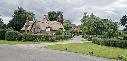
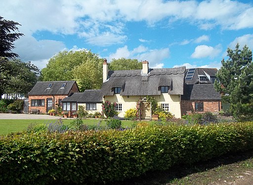
It's an attractive place with a pretty village pond, historic church, quaint thatched cottages and some lovely trails through the Osmaston Hall Park Estate. There's also a splendid 18th century pub to relax in after your exercise.
This circular walk from the village uses sections of the Bonnie Prince Charlie Walk and the Centenary Way to explore the park and visit the neighbouring village of Shirley.
On the way you will follow waymarked paths around the estate which includes scenic lakes and peaceful woodland trails.
Postcode
DE6 1LW - Please note: Postcode may be approximate for some rural locationsOsmaston Ordnance Survey Map  - view and print off detailed OS map
Osmaston Open Street Map  - view and print off detailed map
Osmaston OS Map  - Mobile GPS OS Map with Location tracking
Osmaston Open Street Map  - Mobile GPS Map with Location tracking
Walks near Osmaston
- Ashbourne - The Derbyshire Dales town of Ashbourne is a fantastic base for walkers looking to explore the southern end of the Peak District
- Carsington Water - This route follows the circular cycling and walking trail around Carsington Water in Ashbourne, Derbyshire
- Ilam Park - Ilam Country Park is a delightful open space owned by the National Trust
- Thorpe Cloud - This short walk climbs to the top of Thorpe Cloud in the Peak District
- Tissington Trail - The Tissington trail is a 13 mile off road path following the trackbed of a disused railway line through the stunning Peak District National Park.
The trail is shared by walkers and cyclists offering fabulous views of the Derbyshire countryside - Limestone Way - Travel through the beautiful Peak District National Park on this walk through Derbyshire and into Staffordshire.
The walk starts at Castleton, passing through the scenic Cave Dale and past the remains of Peverill Castle - Bonnie Prince Charlie Walk - Follow in the footsteps of Bonnie Prince Charlie on this walk which traces the route of his march from Ashbourne to Derby in 1745
- Centenary Way - Follow the Centenary Way from Ilkeston to Ashbourne on this 25 mile walk through the Derbyshire countryside
- Dovedale - The beautiful Dovedale is one of the must see areas in the Peak District
- Sudbury Hall - This wonderful 17th century mansion in Derbyshire boasts a superb Great Staircase, fine Long Gallery, exquisite plasterwork, wood carvings, classical story-based murals and portraits by John Michael Wright, and of Charles II's mistresses.
- Ashbourne to Dovedale Circular Walk - This circular walk takes you from the popular town of Ashbourne to the beautiful Dovedale in the Peak District
- Wetton - This pretty Peak District village is in a fine location for exploring the mills and caves of the River Manifold Valley and the White Peak .
- Thor's Cave - This walk takes you to the stunning natural cavern of Thor's Cave in the Manifold Valley area of the Peak District
- Brassington - This attractive Derbyshire Dales village is close to a number of popular waymarked trails and a major local reservoir
Pubs/Cafes
Back in the village head to the Shoulder of Mutton for some post walk refreshment. The pub dates back to at least 1783 and serves good quality dishes. They have a particularly lovely, large lawned garden area with views of the surrounding countryside. You can find them on Moor Lane at postcode DE6 1LW for your sat navs.
Dog Walking
The parkland and woodland make for a fine dog walk. The local pub mentioned above is also dog friendly.


