Rannerdale Knotts Walk

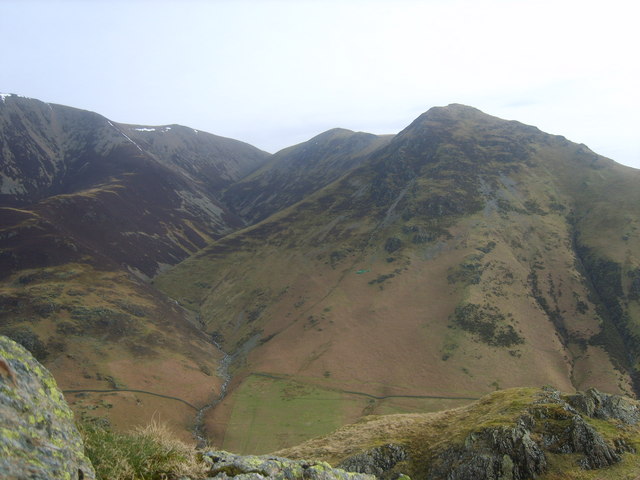
 Visit Rannerdale Knotts and Whiteless Pike on this circular walk in the beautiful Rannerdale valley. It's a small fell but its proximity to Buttermere and Crummock Water make it an attractive option for walkers. There's also good footpaths, fine views and a section through the lovely bluebell valley.
You can start the walk from the small car park off the B5289, next to Crummock Water. Then head north through the bluebell valley. The area is managed by the National Trust and is a stunning sight in the spring months, when carpets of bluebells cover the hills. You then head east through High Rannerdale, passing along Squat Beck. Near Whiteless Breast you turn west and ascend to the 355 m (1,165 ft) summit of Rannerdale Knotts. It's a wonderful spot with views back down to Crummock Water and Buttermere Lake.
To extend your walking in the area you could try the Crummock Water and Buttermere walks. Both lakes have lovely waterside paths to try.
For a more challenging climb you could try the Grasmoor walk which starts from the nearby Rannerdale Bridge.
Rannerdale Knotts Ordnance Survey Map  - view and print off detailed OS map
Rannerdale Knotts Open Street Map  - view and print off detailed map
Rannerdale Knotts OS Map  - Mobile GPS OS Map with Location tracking
Rannerdale Knotts Open Street Map  - Mobile GPS Map with Location tracking
Pubs/Cafes
The Fish Inn in Butteremere village is a lovely place to go for some post walk refreshment. The inn has an interesting history being one of the oldest inns in the Lake District. They do good food and there's a comfy lounge with sofas and a fireplace to relax in indoors. There's also seating outside with fabulous views of the surrounding fells. You can easily find it in the village at postcode CA13 9XA.
The Bridge Inn is also located right in the village. There's another fine garden area with one of the best views in England here.
Further Information and Other Local Ideas
For more walking ideas in the area see the Lake District Walks page.


