GPS Cycle and Walking Routes

Rest Bay Circular Walk

4 miles (7 km)

This circular walk explores the area around the lovely Rest Bay in Porthcawl. There's a lovely beach here and great views over the bay to the Bristol Channel and the coast of North Devon.
You can start the walk from the Rest Bay car park on the western side of Porthcawl. Then pick up the coastal footpaths heading north to Sker Point. Near here you could take a detour to visit the nearby Kenfig Pool Nature Reserve where there's lots of wildlife to see. This route heads north east past Sker House towards Parc Newydd Farm. Here you can pick up Moor Lane and follow the pleasant country lane south east before turning west to pass through Porthcawl.

Postcode

CF36 3UP - Please note: Postcode may be approximate for some rural locations

Rest Bay OS Map - Mobile GPS OS Map with Location tracking

Rest Bay Open Street Map - Mobile GPS Map with Location tracking

Further Information and Other Local Ideas

To continue your walking in the area you could head to Ogmore by Sea and visit the splendid Merthyr Mawr Sand Dunes.
The splendid Margam Country Park and the unusual Brombil Reservoir area also nearby.

Photos

North end of Rest Bay - geograph.org.uk - 440429

North end of Rest Bay. Taken from the coast path which runs along the golf course just to the right, the top end of the bay is less frequented because there are no car parks within easy reach of this excellent beach and there is a scramble over large pebbles and jagged limestone rocks.

Royal Porthcawl Golf Club - geograph.org.uk - 447501

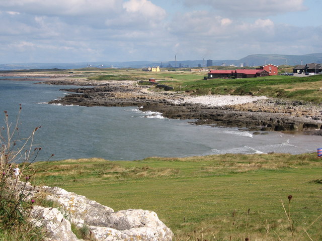
Royal Porthcawl Golf Club. The royal Porthcal golf Club viewed from Locks common, with Rest Bay in the foreground and Sker House and Port Talbot steel works in the distance.

View over Sker Rocks - geograph.org.uk - 2313779

View over Sker Rocks

Rest Bay coastline - geograph.org.uk - 1006057

Rest Bay coastline. Looking north-west towards the expanse of the flat Ffynnon-wen Rocks. Sker Point is in the distance.

Sker Point and Kenfig Sands - geograph.org.uk - 440447

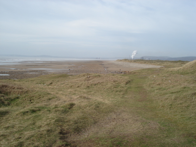
Sker Point and Kenfig Sands. Practically at seal level, Sker Point is just a grassy knoll. The vast expanse of Kenfig Sands is in the middle distance leading to Margam Sands and the Port Talbot steel works. The hills at the back mark the coastline of Swansea Bay.

The Miners' Rest at Porthcawl - geograph.org.uk - 375800

The Miners' Rest at Porthcawl. The Rest was established as a seaside convalescent hospital for the working classes, particularly miners, in 1862, in Porthcawl, Glamorgan. To stay at the ‘Rest’ you needed a ticket from a subscribing organisation, such as a trade union, welfare association, or Co-operative Society.

Rest Bay, Porthcawl - geograph.org.uk - 218138

This is the Lifeguard Station at Rest Bay, Porthcawl. Across the Bristol Channel the coast of North Devon can be seen in the background.

Looking South from the North end of Rest Bay - geograph.org.uk - 440439

Looking South from the North end of the bay. Very flat grassy banks mark the end of the bay. In the distance is the golf course and the large building is The Rest.

Video

GPS Files

GPX File

Rest Bay.gpx (On Desktop:Right Click>'Save As. On Ipad/Iphone:Click and hold>Share>Save to Files')

Memory Map Route

Rest Bay.mmo (On Desktop:Right Click>'Save As. On Ipad/Iphone:Click and hold >Share>Save to Files)