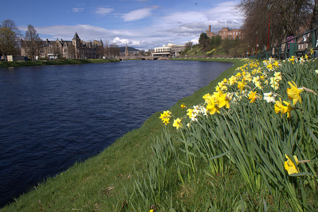
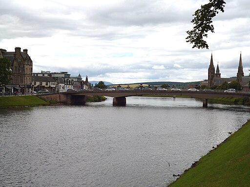
Inverness River and Ness Islands Walk

 Enjoy a short stroll along the River Ness on this popular waterside walk in Inverness. The route starts at the impressive riverside castle and follows the riverside path along the Great Glen Way to the delightful Whin Park. It's a lovely area with peaceful woodland next to the river and the delightful Ness Islands in Whin Park at the end of the walk. The islands are a natural beauty spot with attractive woodland with otters and deer to look out for. In the park you can also enjoy a ride on the Ness Islands Railway. The super miniature railways runs in the summer months and includes a crossing of a 140-foot iron bridge dating from 1837.
It's easy to extend your walk by picking up the Caledonian Canal and following the to path to Loch Dochfour.
River Ness Ordnance Survey Map  - view and print off detailed OS map
River Ness Open Street Map  - view and print off detailed map
River Ness OS Map  - Mobile GPS OS Map with Location tracking
River Ness Open Street Map  - Mobile GPS Map with Location tracking
Pubs/Cafes
The WaterFront pub is located in a great riverside spot. You can enjoy a fine meal with a view over the water after your walk. It was previously known as The Friars Shot, a pub with a history spanning over a century. It was originally named in honour of the Dominican Friars known for casting or "shooting" their fishing nets across the River Ness.
It has since been renamed a couple of times, first as the Black Bull, and more recently as Waterfront. After a significant kitchen fire in December 2011, the Waterfront re-emerged as a popular spot, reputedly offering some of the best value pub food in Inverness. Among its unique dishes is "The Highland Tapas," allowing patrons to sample a variety of local specialties. Located at the end of Huntly Street near the A82 Bridge over the River Ness, the pub is accessible via a pedestrian suspension footbridge from the town centre, offering picturesque upstream views. While there is vehicular access, navigating the one-way system outside the pub can be challenging. The Waterfront is known for its one hand pump serving Cairngorm ales, with Santa's Sledgehammer being a seasonal favourite around Christmas.
You can find them at 70-71 Huntly Street, IV3 5JN.
Further Information and Other Local Ideas
The Inverness Canal and Forest Walk will take you along the canal before heading to Craig Phadrig Forest, which lies just to the west of the city. The forest is a peaceful place for walks and includes a viewpoint with an Iron Age Hillfort.
Near Inverness you could head a short distance north east to visit one of the historic highlights of the area at Culloden Battlefield. There's a circular walking trail here which explores the site of the famous battle of 1746. The site includes an informative visitor centre where you can learn all about this fascinating conflict. On the south eastern side of the battlefield there's also the Clava Cairns and the Culloden Viaduct. The ancient Bronze Age site includes prehistoric burial monuments and the remains of a medieval chapel. It's also a short walk from the eye catching Culloden Viaduct which carries the Highland Main Line over the River Nairn.
A few miles to the west there's the popular village of Beauly. It's a lovely place to visit with a number of independent shops, cherry blossom trees, a pretty square and the ruins of the 13th century priory to see. The Beauly River Walk will take you along the River Beauly with fine views across the Beauly Firth.
For more walking ideas in the area see the Scottish Highlands Walks page.


