Rye to Hastings Walk

 This varied walk between Rye and Hastings includes a nature reserve, a canal-side path, exhilirating cliff top trails, beautiful bays and lovely beaches. It follows a section of the Saxon Shore Way long distance trail so there are good waymarked footpaths for the duration of the walk.
Starting in Rye you head south through the beautiful Rye Harbour Nature Reserve. The reserve is a great place for wildlife spotting and includes saltmarsh, lagoons, grazing marsh, shingle and reedbeds.
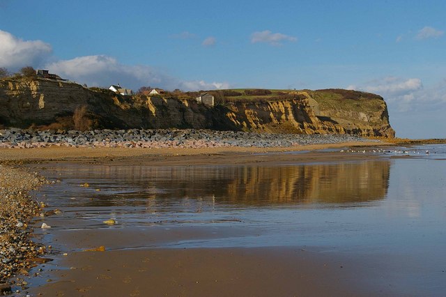
The path will lead you to the small town of Winchelsea where you pick up the Royal Military Canal Path. Constructed in the early 19th century as a defence against a possible invasion by Napoleon, the canal-side path now makes for a nice easy walk. It will lead you all the way to Pet Level where you pick up the coast path to Fairlight Cove. Here you'll find a lovely beach surrounded by cliffs.
The path continues west past the pretty Covehurst Bay before coming to Hastings Country Park. The site includes 600 acres of beautiful parkland with more great wildlife spotting opportunities. Peregrines, black redstarts and fulmars can be seen on the coastal cliffs, while Dartford warblers, stonechats and yellowhammers can be seen on the gorse covered hills.
The final section takes you from the park to High Wickham before finishing in Hastings by the pier.
To continue your walking in the area you could pick up the long distance 1066 Country Walk which follows in the steps of William the Conqueror, taking you to Battle Abbey at the site of the Battle of Hastings.
Rye to Hastings Ordnance Survey Map  - view and print off detailed OS map
Rye to Hastings Open Street Map  - view and print off detailed map
Rye to Hastings OS Map  - Mobile GPS OS Map with Location tracking
Rye to Hastings Open Street Map  - Mobile GPS Map with Location tracking
Pubs/Cafes
There's some good choices for refreshments in the Rye Harbour area. The William the Conqueror pub is located right on the harbour and worthy of investigation. Recently refurbished, it’s a smart, friendly, traditional pub, boasting real ales, hearty pub food and a friendly welcome. There’s a large outdoor area here, with plenty of alfresco seating on the banks of the River Rother. It's a great spot to enjoy lunch while looking out for some of the local wildlife that make this a Site of Special Scientific Interest. You can find the pub near the car park on the eastern side of the reserve at postcode TN31 7TU.
The delightful Avocet Tea Room is located in the same area as well. The tea room also includes a lovely art gallery showcasing the talent of local artists. The gallery is run by award-winning photographer Peter Greenhalf and former journalist Morgan (who makes all the cakes). The gallery reflects the artists’ love of the natural world and is well worth seeing if you have time after your walk.
Right next to Hastings Country Park you'll find the the Coastguards Tea Rooms. There's a new conservatory with a beautiful coastal view with France visible on a clear day. The Tearoom seats 50 people inside and they have additional seating for 30 outside. It's a great place to relax and enjoy a cake when the weather is good. They also have a nice shop with gifts, paintings and arts and crafts. You can find them a short distance from the car park on Coastguards Lane with a postcode of TN35 4AB for your sat navs.
Further Information and Other Local Ideas
At the northern edge of Rye harbour there's the Rye Castle Museum or Ypres Tower. The museum has lots of interesting artifacts and exhibits to see including locally-made medieval pottery, an embroidery depicting many aspects of Rye life and history, medieval artifacts, activities and town maps. You can also climb to the top of the tower and enjoy fantastic views over the harbour and the river. It's a nice place to visit after your walk if you have time.


Above: Ypres Tower or Rye Castle. A worthy addition to your outing.


