Salisbury to Stonehenge Walk

 This walk takes you from the city centre of Salisbury to the iconic Stonehenge. The route runs for just over 9 miles using public footpaths, bridleways and country lanes. Along the way there's nice views of the River Avon and the surrounding Wiltshire countryside.
The walk starts at the world famous Salisbury Cathedral and heads north through the city towards Stratford sub Castle. Here you turn north east to follow a track up to Old Sarum Castle. Here you can see the exposed foundations of the former cathedral and climb the mighty ramparts for splendid views of the surrounding Wiltshire Plains.
After exploring the historic site the route continues north toward Netton and Woodford. Here you cross the river on Woodford Bridge before continuing to Durnford Mill in Great Durnford. Here you can visit the interesting Norman Church, admire the delightful thatched cottages and enjoy refreshments at the Black Horse pub. The converted mill is also very picturesque with its riverside location and weeping willows.
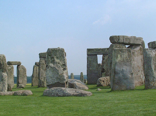
The final section runs north west from Great Durnford to Stonehenge. To explore the Stonehenge site itself you will need to purchase a ticket from English Heritage. The area around the cursus is on open access land so can be visited for free. This large Neolithic cursus monument was constructed several hundred years before the earliest phase of Stonehenge in 3000 BC. See our Stonehenge Walk for more details.
Salisbury to Stonehenge Walk Ordnance Survey Map  - view and print off detailed OS map
Salisbury to Stonehenge Walk Open Street Map  - view and print off detailed map
Salisbury to Stonehenge Walk OS Map  - Mobile GPS OS Map with Location tracking
Salisbury to Stonehenge Walk Open Street Map  - Mobile GPS Map with Location tracking
Pubs/Cafes
On the route you could stop for refreshments at the Bridge Inn in Upper Woodford, just to the south of Stonehenge. The main attraction here is a lovely riverside garden where you can sit out and enjoy lunch with views of the River Avon. You can find it at postcode SP4 6NU.
Also consider the 17th century Black Horse in Great Durnford (postcode:SP4 6AY). There's another nice, large outdoor seating area for the summer months here.
Further Information and Other Local Ideas
Just a few miles south east of the city you can enjoy a climb to Pepperbox Hill. The National Trust owned area includes a distinctive 17th century and some fine views over the Wiltshire countryside to the city. Near here there's also Figsbury Ring. The Iron Age hill fort is another National Trust owned site with good footpaths around the ramparts and more tremendous views.
Just west is Broad Chalke where there's a Norman church, pretty watercress beds and views of the River Ebble which meanders through the picturesque village. Just to the west of Broad Chalke is the neighbouring village of Ebbesbourne Wake where you will find two lovely old pubs, a 14th century church and the walk to Prescombe Down.


