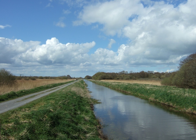
Shapwick Heath

 Explore this lovely nature reserve in the Somerset's Levels. Part of the Avalon Marshes, Shapwick Heath is one of several nature reserves in the area. There's reedbeds, wildflower meadows, fens, woods and lots of open water. It's great for wildlife with egrets, bitterns, otters, great-crested grebes and white admiral butterfly to look out for. There's nearly 1000 acres to explore on a number of a walking trails and a cycle trail. It's a splendid place for a walk with such a wide variety of habitats and wildlife to enjoy.
You can start your walk from the Avalon Marshes Visitor Centre on Shapwick Road. It has a large car park and a wealth of information about the area. It is just a short walk from here to the nice waterside stroll along the South Drain Path. Just south of that is the Sweet Track which runs along ancient wooden trackways.
The reserve is located just a few miles west of Glastonbury. You could visit the site by bike by following National Cycle Network Roue 3 from Glastonbury. You could also follow the River Brue to Meare and Oxenpill at the northern edge of the reserve or the Glastonbury Canal.
To extend your walking you could visit the adjacent Ham Wall Nature Reserve where there are several more trails to try.
To the south there's Westhay Moor, another of the reserves on the marshes.
Postcode
BA6 9TT - Please note: Postcode may be approximate for some rural locationsShapwick Heath Ordnance Survey Map  - view and print off detailed OS map
Shapwick Heath Open Street Map  - view and print off detailed map
Shapwick Heath OS Map  - Mobile GPS OS Map with Location tracking
Shapwick Heath Open Street Map  - Mobile GPS Map with Location tracking
Further Information and Other Local Ideas
Just to the east you'll find the nearby village of Street. Here you can enjoy a lovely climb along the Polden Way to the National Trust's Walton Hill in the Polden Hills. Just to the south of Street you'll also find the neighbouring village of Compton Dundon where you can try the Compton Dundon and Combe Hill Wood Walk. The circular walk includes a climb to Iron Age Hillfort on Dundon Beacon and a visit to the Hood Monument, which is something of a historic local landmark.
For more walking ideas in the area see the Somerset Walks page.


