Tuddenham Mill Walks

 This circular walk explores the countryside around the village of Tuddenham in Suffolk.
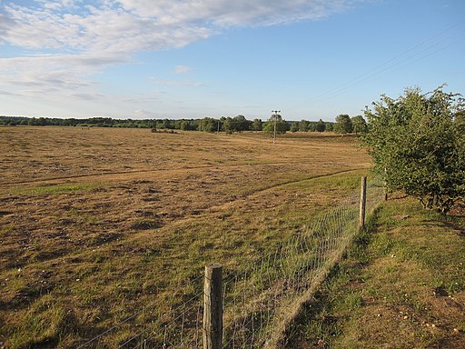
The route starts and finishes at the historic Tuddenham Mill, an ancient watermill surrounded by 12 acres of gardens and Suffolk countryside. Here you can pick up a section of the epic Icknield Way Path and follow the waymarked trail south west through the countryside to Herringswell. The route then returns to Tuddenham on an alternative country lane.
You can then continue east to explore Tuddenham Heath and the Cavenham Heath Nature Reserve. The heaths have miles of footpaths with a large variety of flora and fauna to look out for too. At the eastern end of the reserve you can pick up the Lark Valley Path and enjoy a riverside stroll along the River Lark. Following the trail east would take you into Mildenhall.
Postcode
IP28 6SQ - Please note: Postcode may be approximate for some rural locationsTuddenham Ordnance Survey Map  - view and print off detailed OS map
Tuddenham Open Street Map  - view and print off detailed map
Tuddenham OS Map  - Mobile GPS OS Map with Location tracking
Tuddenham Open Street Map  - Mobile GPS Map with Location tracking
Walks near Tuddenham
- Cavenham Heath - Enjoy a short stroll around this pretty nature reserve near Bury St Edmunds
- Mildenhall - This is a lovely circular walk along the River Lark from the Suffolk market town of Mildenhall
- Lark Valley Path - Travel through the Lark Valley on this interesting and varied walk from Mildenhall to Bury St Edmunds via West Stow Country Park.
- West Stow Country Park - Enjoy waterside walks alongside a number of pretty lakes and the River Lark in this splendid country park near Bury St Edmunds
- King's Forest - This large area of woodland near has miles of cycling and walking trails to enjoy
- Lackford Lakes - This walk visits the pretty Lackford Lakes Nature Reserve near Bury St Edmunds in Suffolk.
- Newmarket - This walk uses sections of the Stour Valley Path and Icknield Way Path long distance trails to take you past the famous racecourse and into the countryside surrounding the Suffolk town of Newmarket.
The walk begins in the centre of town, near the tourist information centre and the former palace of Charles II - Bury St Edmunds - This walk visits some of the highlights of this lovely Suffolk town using sections of the St Edmund Way and Bury to Clare Walk
- Moulton - This attractive Suffolk based village includes several picturesque thatched cottages, views of the River Kennett and a noteworthy medieval Packhorse Bridge
Pubs/Cafes
There is a high quality restaurant at the mill where you can enjoy some refreshment after your exercise. You can sit outside by the river in a very picturesque location.
Dog Walking
The country and heathland trails make for a fine dog walk. The mill is also dog friendly.
Further Information and Other Local Ideas
Just to the south is idyllic Moulton where you can enjoy views of the River Kennet, visit the fine 14th century church and photograph the splendid medieval Packhorse Bridge.


