Tutbury Walks
![]()
![]() This pretty Staffordshire village sits in a lovely position next to the River Dove and the border with Derbyshire in the National Forest.
This pretty Staffordshire village sits in a lovely position next to the River Dove and the border with Derbyshire in the National Forest.
This short circular walk around Tutbury visits the mill and castle in the village.
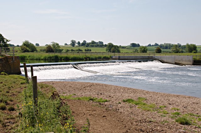
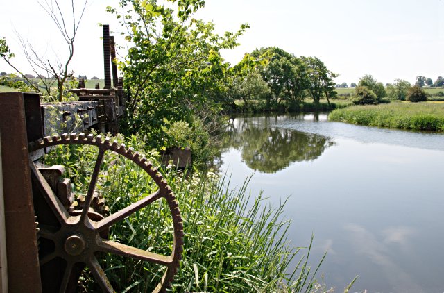
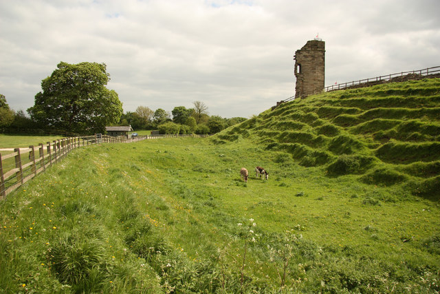
The walk starts at the Tutbury Mill car park just to the north of the village near Tutbury Bridge on the River Dove. From here you can pick up a footpath heading west along the Mill Fleam to a weir. Here you head south and then east to visit the historic Tutbury Castle. Here you'll find the photogenic ruins of the medieval castle surrounded by a lovely Tudor garden. You can explore the ruins from where there are great views over the Derbyshire hills from its elevated position above the Dove. The route then heads through the village where there are some splendid old half timbered buildings.
Postcode
DE13 9LZ - Please note: Postcode may be approximate for some rural locationsTutbury Ordnance Survey Map  - view and print off detailed OS map
Tutbury Open Street Map  - view and print off detailed map
Tutbury OS Map  - Mobile GPS OS Map with Location tracking
Tutbury Open Street Map  - Mobile GPS Map with Location tracking
Walks near Tutbury
- Burton Upon Trent - This Staffordshire based market town has some fine riverside and canalside walks to try
- Burton on Trent to Barton under Needwood Canal Walk - This walk follows a lovely section of the Trent and Mersey Canal from Burton Upon Trent to Barton Marina in the the nearby village of Barton under Needwood
- Trent and Mersey Canal - Follow the Trent and Mersey Canal through Derbyshire, Staffordshire and Cheshire on this long distance waterside walk
- Branston Water Park - Enjoy woodland, wetland and meadow in this lovely park in Burton Upon Trent
- Willington - This south Derbyshire based village has some pleasant waterside walks along the local canal and river
- Mercia Marina - This walk visits the lovely Mercia Marina in Willington, Derbyshire
- National Forest Trail - Explore the National Forest in Leicestershire and Derbyshire on this super figure-of-eight cycle ride
- Foremark Reservoir - This walk visits the pretty Foremark Reservoir near Burton Upon Trent in Derbyshire
- National Memorial Arboretum - This peaceful circular walk takes you through the National Memorial Arboretum and its surrounding countryside in Alrewas, near Lichfield in Staffordshire
- Horseshoe Trail - This cycling and walking trail in Derbyshire takes you on a tour of the countryside, villages and reservoirs near Burton-Upon-Trent and Swadlincote
- Alrewas and Fradley Junction - Enjoy a nice easy canal walk from Alrewas to Fradley Junction and then onto the village of Fradley
- Rolleston on Dove - This Staffordshire village is a pleasant place to start a walk with some lovely country trails through the River Dove valley
- Yoxall - This Staffordshire bases village sits close to the town of Burton Upon Trent and the Rivers Trent and Swarbourn.
Pubs/Cafes
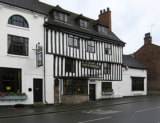
The historic Dog and Partridge is a good choice for some post walk refreshment. The ancient pub has a typical Tudor first floor overhang and black and white half-timbered frame. They serve good quality food and also have a pretty Secret Garden to investigate. You can find them on the High Street at postcode DE13 9LS for your sat navs.
Dog Walking
The trails make for a pleasant dog walk and the pub mentioned above is also dog friendly. You are requested to keep them on leads around Tutbury Castle. There is a tap at the front of the patio area at the castle if you need water for your dog, but they recommend that you bring your own water bowl.
Further Information and Other Local Ideas
The village is located near to Burton Upon Trent where you can visit the pretty lakes at Branston Water Park and the lovely Stapenhill Viaduct on the River Trent.
The neighbouring village of Willington is just to the east. Here you can visit the Gravel Pits Nature Reserve and the Mercia Marina. The site is notable as the largest marina in the UK.
The Rolleston on Dove Walk starts from the neighbouring village which lies just to the south. The historic settlement includes a noteworthy 12th century church and a 16th century pub.
For more walking ideas in the area see the Staffordshire Walks page.
Photos
Tutbury Castle. The site dates from the Norman period. People who have stayed in the castle include Eleanor of Aquitaine and Mary, Queen of Scots, who was a prisoner there. By the late sixteenth century the fabric of the castle began to decay, although James I stayed there a number of times between 1619 and 1624. It was then damaged during the English Civil War. When the Parliament seized control of the castle, they ordered the fortification to be destroyed; demolition work being carried out from 1647 to 1648. The castle often holds spectacular themed events including Vikings, Knights in Armour 1940s and Fairytale weekends.


