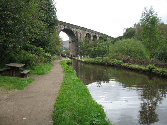
Uppermill Canal and Country Walk

 The pretty village of Uppermill is in a lovely location on the Huddersfield Narrow Canal and the River Tame. It's also located close to the South Pennines and the Peak District making it an excellent base for walking.
This circular walk around the village follows a section of the Huddersfield Narrow Canal before heading to the nearby Dovestone Reservoir on the waymarked Oldham Way. There's much to enjoy with easy waterside paths and some more challenging climbs with the reward of excellent views over the surrounding moors.
The walk starts on the canal in Uppermill and follows the towpath south to Grasscroft with views of the River Tame on the way. Here you leave the canal and follow the Oldham Way and other paths east to visit the popular Dovestone Reservoir.
You can follow the Oldham Way north along the eastern part of the reservoir before passing Aldermans Hill and heading across Brockley Moor. You then turn north along the western edge of Saddleworth Moor to Rocher Brow. Here you turn west to rejoin the canal at Uppermill.
Uppermill Ordnance Survey Map  - view and print off detailed OS map
Uppermill Open Street Map  - view and print off detailed map
Uppermill OS Map  - Mobile GPS OS Map with Location tracking
Uppermill Open Street Map  - Mobile GPS Map with Location tracking
Pubs/Cafes
The Waggon Inn is a good choice for refreshments after your walk. This 19th Century coaching inn includes a comfortable lounge, bar and dining area with a good menu. There's also a lovely outdoor area where you can relax on warmer days. You can find it on the High Street with a postcode of OL3 6HR for your sat navs.
Dog Walking
The hills and woods on the route make for a fine dog walk. The Waggon Inn mentioned above is also dog friendly.
Further Information and Other Local Ideas
You can extend the walk by heading north to Diggle where you can visit the Standedge Tunnel and pick up the Standedge Trail. The impressive Saddleworth Viaduct can also be seen in this area.
The popular Pots and Pans Walk also starts nearby, visiting a series of rock formations and a fine viewpoint.
For more walking ideas around Uppermill see the Greater Manchester Walks, South Pennines Walks and Peak District Walks pages.


