Wadhurst Circular Walk

 This East Sussex town is in a good location for exploring the High Weald AONB on foot. It's also located very close to the lovely Bewl Water and the expansive Bedgebury Forest, which are both great places for walkers.
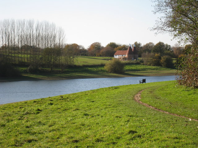
This circular walk from the town takes you around Bewl Water, running for a distance of just over 13 miles and using a mixture of waymarked trails, public footpaths and quiet country lanes. The reservoir is a great place for wildlife spotting so be sure to bring your binoculars. Birds you may spot include Goldcrests, Long Tailed Tits, Wagtails, Skylarks and Lapwings in the woodland. Also look out for Kingfishers, Herons and the Great Crested Grebe on the water.
The walk starts from the car park in the town centre and then follows footpaths north east through the countryside to the lake. Here you pick up the Sussex Border Path to take you around the northern and eastern side of the water. You'll pass Chingley Wood and come close to Bedgebury Forest on the eastern side. On the southern side, public footpaths and country lanes takes you past Tolhurst before returning to the towb.
To extend your walking in the area you could head to the National Trust's Scotney Castle. There's 770 acres of woodland and parkland surrounding the 14th century moated castle near Tunbridge Wells. Near here you can also pick up the historic Lamberhurst Walk which visits the noteworthy Bayham Old Abbey. The site is run by English Heritage and includes substantial ruins dating back to the 13th century.
Wadhurst Ordnance Survey Map  - view and print off detailed OS map
Wadhurst Open Street Map  - view and print off detailed map
Wadhurst OS Map  - Mobile GPS OS Map with Location tracking
Wadhurst Open Street Map  - Mobile GPS Map with Location tracking
Pubs/Cafes
The Boat House Bistro is a great place to stop on the walk to enjoy some freshly caught trout from the reservoir. You can enjoy wonderful views over the lake from the restaurant or the outdoor Terrace too. You will find the Boat House near the car park at the northern end of the reservoir at postcode TN3 8JH.
In the village of you could try The Old Vine Inn on Cousley Wood Rd (Postcode:TN5 6ER). The 16th century pub now includes a fine South American restaurant.
Further Information and Other Local Ideas
To the south east you can visit the worthy village of Burwash. Our circular walk from the village visits on of the area's highlights at the National Trust's Bateman's. The fine 17th century Jacobean house was the home of author Rudyard Kipling during the early part of the 20th century. You can explore the house and the surrounding gardens with some great views of the surrounding High Weald countryside.
To the west is the village of Mayfield where you'll find a 15th century church, views of the River Rother and a fine 16th century pub.
For more walking ideas in the area see the High Weald Walks page.


