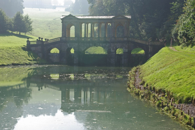
Bath Skyline Walk

 Enjoy wonderful views of the city of Bath on this popular circular walk. The walk has been devised by the National Trust so takes place on waymarked, well maintained footpaths.
The walk begins on Bathwick Hill and then heads south to Widcombe passing Smallcombe Wood. The wood is an excellent place for birdwatching with nuthatch, wrens and blackcap to look out for. The route continues past the stunning Prior Park with its beautiful lakes and Palladian Bridge. You then cross Claverton Down before turning north towards Claverton where you will find the excellent American musuem. The path continues north towards Bathampton where there is a nice woodland section through Bathampton Woods. You then turn south through more woodland to Sham Castle, an 18th-century folly which makes a good spot to rest and enjoy the wonderful views. The final section takes you from the castle to Bathwick Hill and the finish point. It's a splendid walk with varied scenery and consistently wonderful views over Bath towards the Mendip Hills.
At Bathampton you can pick up the Kennet and Avon Canal and try the Bath to Bradford Upon Avon Canal Walk.
The route will take you from Somerset into Wiltshire along the towpath of the canal.
Please click here for more information
Bath Skyline Walk Ordnance Survey Map  - view and print off detailed OS map
Bath Skyline Walk Open Street Map  - view and print off detailed map
Bath Skyline Walk OS Map  - Mobile GPS OS Map with Location tracking
Bath Skyline Walk Open Street Map  - Mobile GPS Map with Location tracking
Pubs/Cafes
On the route you could stop off at the excellent Bathampton Mill. This fine restaurant is located in a lovely spot on the river in the village. There's a lovely large garden and courtyard area where you can relax with views over the water. Inside there's a sylish interior with a log fire and delicious Mediterranean cuisine to sample from the menu. You can find them right on the river on Mill Lane with a postcode of BA2 6TS for your sat navs. There's also a large car park if you wanted to start a walk from there.
Dog Walking
The walk is a nice one to do with your dog. You are asked to please keep them under close control in the farmland areas because of the livestock. The Bathampton Mill mentioned above is dog friendly.
Further Information and Other Local Ideas
On the western side of Bath there's the noteworthy village of Newton St Loe to visit. It includes the attractive Newton College and Newton Park where there's an 18th-century landscaped garden, designed by the famous landscape gardener Capability Brown. There's also a historic 18th century country house and a fine 17th century pub to see too.
On the north western outskirts of the city there's the little village of Kelston where you can pick up the Kelston Roundhill Walk. This popular circular walk takes you up to an ancient barrow where there are wonderful views to the Wiltshire Downs, the Mendip Hills and the Black Mountains of Wales. There's also a fine 17th century pub to visit in the village afterwards.
For more walking ideas in the area see the Somerset Walks page.


