Etherow Country Park

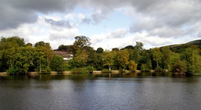
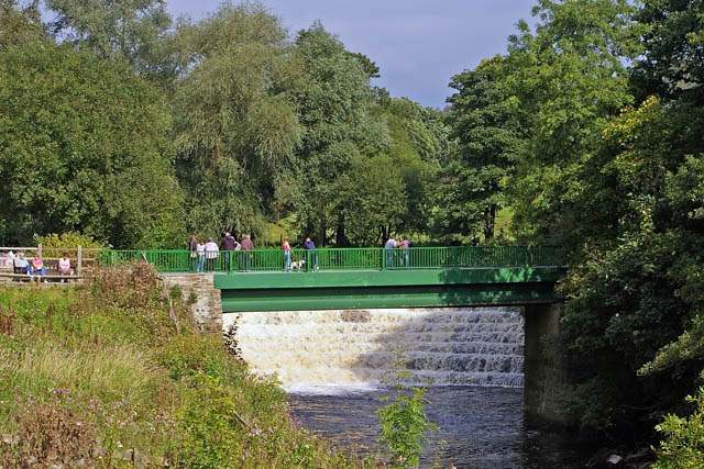
 Enjoy a stroll along the River Etherow and around the large reservoir in this pretty country park near Marple and Stockport. The park also includes a mill pond, a picturesque waterfall, bluebells in Ernocroft Wood and the 32 acre Compstall Nature Reserve. The lake is a good spot for birdwatching with several species of wildfowl regular visitors to the area.
The Etherow Goyt Valley Way and the Goyt Way walking routes run through the park so there is scope for continuing your walk on these trails.
Head west along the river trail and you could visit the lovely Chadkirk Country Estate. Here you'll find a wonderful 16th century chapel, a 60 acre farm and a walled garden. You can also pick up the Peak Forest Canal in this area.
The address for Etherow park is: George Street, Compstall, Romiley, Stockport SK6 5JD. The Romiley Walk visits the park from the train station in the nearby village.
Postcode
SK6 5JD - Please note: Postcode may be approximate for some rural locationsEtherow Country Park Ordnance Survey Map  - view and print off detailed OS map
Etherow Country Park Open Street Map  - view and print off detailed map
Etherow Country Park OS Map  - Mobile GPS OS Map with Location tracking
Etherow Country Park Open Street Map  - Mobile GPS Map with Location tracking
Pubs/Cafes
Next to the visitor centre there's a decent on site cafe for refreshments after your walk. They have a good menu selling a range of meals and snacks.
Dog Walking
The woods and riverside trails are ideal for dog walking so you're bound to bump into other owners on a fine day. The cafe mentioned above is also dog friendly.
Further Information and Other Local Ideas
Follow footpaths north from the park and you will soon come to Werneth Low Country Park. The park includes a splendid hill top viewpoint with excellent views over the canal, Greater Manchester and the Pennine Hills. There's also a fine parkside pub for refreshments.
Just to the west you could pick up the Peak Forest Canal and enjoy an easy walk along the towpath.
Just to the south there's the climb to the Mellor Cross to try. The religous cross marks the site where Methodist John Wesley preached during the 18th century. There are fine views from the elevated position of the site.
Just to the east is the pretty little hamlet of Rowarth. Here you will find the Little Mill Inn, a delightful Grade II listed inn set in a former candlewick mill, with a waterwheel in the adjacent stream. The historic mill is well known locally and includes an outdoor area with ducks and geese on the river, chickens roaming free and rabbits in a large outdoor pen. Our walk from the village climbs to the geologically fascinating Cown Edge Rocks and Robin Hood's Picking Rods.
For more walking ideas in the area see the Greater Manchester Walks page.


