Fan Y Big and the Cribyn

 This walk makes use of the Brecon Beacons Way to take you to Fan Y Big and Cribyn mountains from the Blaen y Glyn Waterfalls. You start off in the Blaen y Glyn car park and climb to the 719 m (2,359 ft) summit of Fan Y Big. This section passes along the spectacular Craig Fan Ddu with wonderful views towards Fan Y Big. From the Fan Y Big summit you continue west along Craig Cwm Cymwyn to the 795 m (2,608 ft) summit of Cribyn. You can extend the walk by continuing west to the summit of Pen Y Fan.
It's a spectacularly beautiful area with wide ranging views across the national park. Also look out for a wide variety of wildlife which includes red kites, sky larks, meadow pipits, peregrines and kestrels.
To continue your walking in the area you could try the Pen y Fan Horseshoe Walk. This fantastic ridge walk starts from the car park in the nearby Taf Fechan Forest and visits the Upper and Lower Neuadd Reservoirs, Corn Du and the Cribyn.
Fan Y Big and the Cribyn Ordnance Survey Map  - view and print off detailed OS map
Fan Y Big and the Cribyn Open Street Map  - view and print off detailed map
Fan Y Big and the Cribyn OS Map  - Mobile GPS OS Map with Location tracking
Fan Y Big and the Cribyn Open Street Map  - Mobile GPS Map with Location tracking
Pubs/Cafes
The excellent Old Barn Tea Room is located just to the south west of the car park near the edge of the Taf Fechan Forest and Pentwyn Reservoir. It's a great place to enjoy a ploughmans lunch or a delicious cream tea after your exercise. The tea room is in a lovely spot with a delightful garden area where you can relax if the weather is fine. You can find it at postcode CF48 2UT for your sat navs. It's also dog friendly if you have your canine friend with you.
Further Information and Other Local Ideas
The epic Cambrian Way passes through the area. The long distance waymarked route starts from the city of Cardiff and runs for nearly 300 miles through the Brecon Beacons, the Cambrian Mountains and Snowdonia before finishing on the North Wales coast at Conwy.
Cycle Routes and Walking Routes Nearby
Photos

The western slope of Fan y Big Viewed from Bwlch ar y Fan. The path rises steeply 120m in about 400m distance. The Diving Board outcrop can be seen high above.

The 'Diving Board', rock strata known as the 'Diving Board' projects out on the summit of Fan y Big. Cribyn is in the background, with Corn Du and Pen y Fan beyond.

A lone figure stands on the summit of Fan y Big, beyond descending into the cloud is Cefn Cyff ridge.

The ghost of Cribyn From Craig Cwm Sere one has an impressive view of the north face of Cribyn. At first glance the shadows give the impression of a ghostly cloaked figure making its way across the mountain.

Cribyn summit. Viewed from the same level on Craig Cwm Sere. The people are dots on the peak. In the distance are Pen Cerrig-calch with the offshoot of Table Mountain on the left and Sugarloaf/ Y Fal in the centre. Temperature inversion has created a cloud "sea" at the 400m contour.

Rock outcrops on the north face of Fan y Big, the ridge in the background is Cefn Cyff.
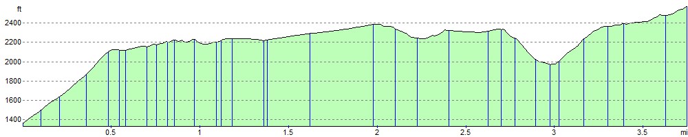
Elevation Profile