Marcle Ridge Circular Walk

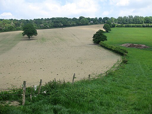
 Climb to Marcle Ridge and enjoy splendid views towards the Malvern Hills on this circular walk in Herefordshire. It's a lovely area with attractive woodland areas and interesting plants such as orchids and spurge laurel to look out for. From the elevated position on the ridge there are super views of the Cotswold Hills, the Wye Valley, the Brecon Beacons and the Black Mountains.
There's a parking area off Glowson Wood Rd where you can start your walk. Please note this car park is privately owned with permission granted by the owners for walkers to use it. As such please respect the space as it is not cleaned or managed by the council. Pick up the footpath here and follow it north through Hoar Wood to Hooper's Oak. The route then turns west and then south to Hyde Common and Lyndalls Wood. The final section takes you along Ridge Hill before returning to the car park where there is a picnic area nearby.
The Three Choirs Way and the Herefordshire Trail both pass Marcle Ridge so it's easy to extend your walking in the area. If you head north west along the Three Choirs Way you could visit Broadmoor Common and Haugh Woods where there's lots more footpaths and wildlife to look out for. Heading north will take you across Marcle Hill to Woolhope Cockshoot.
Postcode
HR1 4RJ - Please note: Postcode may be approximate for some rural locationsMarcle Ridge Circular Walk Ordnance Survey Map  - view and print off detailed OS map
Marcle Ridge Circular Walk Open Street Map  - view and print off detailed map
Marcle Ridge Circular Walk OS Map  - Mobile GPS OS Map with Location tracking
Marcle Ridge Circular Walk Open Street Map  - Mobile GPS Map with Location tracking
Explore the Area with Google Street View 
Pubs/Cafes
Head east and you could visit the Walwyn Arms in the village of Much Marcle. The historic inn dates from the 17th century when it originally doubled as a butcher's shop and slaughterhouse. The pub includes a delicious carvery, a relaxing lounge and a skittle alley. Outside there's a nice garden area for warmer days. You can find them at postcode HR8 2LY for your sat navs. They are dog friendly.
Further Information and Other Local Ideas
The village of Much Marcle is well worth exploring if you have time. It includes many signficant historic buildings such as a 13th century church and Hellens Manor. The Tudor house is one of the oldest dwellings in England, being composed primarily of Tudor, Jacobean and Georgian architecture but with foundations dating from the 12th century. The house is open to the public on certain days and additionally includes a lovely Tudor garden and tea room. You can find them east of the hill at postcode HR8 2LY.
Also in the village is Westons Cider Mill where you can enjoy guided tours detailing the process of cider making. It's set in a 17th century farmhouse and another popular local attraction. The area includes some nice walks around the orchards surrounding the cider mill too. There's veteran trees, wildflower meadows and lots of wildlife to see. Ask at the mill and they will advise on the walks in the area. You can find them at postcode HR8 2NQ.
For more walking ideas in the area see the Herefordshire Walks page.


