Scotney Castle Walks

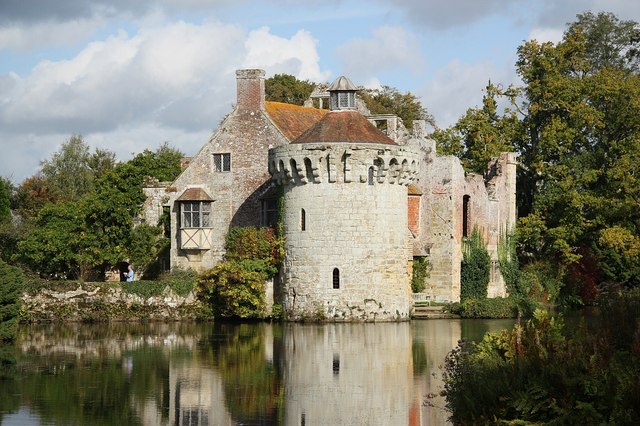
 Explore the 770 acres of woodland and parkland surrounding this 14th century moated castle near Tunbridge Wells. The gardens are stunning with rhododendrons and azaleas and the ruins of the Old Castle at the centre. The new house was built in the 19th century and overlooks the castle. It has grand rooms with fine furniture and paintings.
After explorling the gardens you can follows miles of footpaths into the wider estate. You will pass woodland, ponds and also cross the River Bewl which flows through the grounds.
If you would like to continue your outing you could head to the nearby Bewl Water where you will find a circular walking route around a large reservoir. The Sussex Border Path also runs just to the south of Scotney Castle and can be easily picked up.
Postcode
TN3 8JN - Please note: Postcode may be approximate for some rural locationsPlease click here for more information
Scotney Castle Ordnance Survey Map  - view and print off detailed OS map
Scotney Castle Open Street Map  - view and print off detailed map
Scotney Castle OS Map  - Mobile GPS OS Map with Location tracking
Scotney Castle Open Street Map  - Mobile GPS Map with Location tracking
Pubs/Cafes
The parkland is ideal for dog walking so you're bound to see other owners on your visit. You are requested to keep them on short leads though. You can find water bowls at the tea room where they are allowed in the outdoor section.
Dog Walking
The on site tea room has a good range of snacks and meals with some ingredients coming from their own walled garden.
You could also head into nearby Lamberhurst and visit the noteworthy Chequers. The pub dates back to the 15th century and includes a charming interior with log fires and interesting wall art. Outside there's a lovely garden area for summer days. They do excellent food and can be found on The Broadway at postcode TN3 8DB for your sat navs.
Further Information and Other Local Ideas
Only a mile to the north west you can pick up the historic Lamberhurst Walk which visits the noteworthy Bayham Old Abbey. The site is run by English Heritage and includes substantial ruins dating back to the 13th century.
Just a few miles north east of the castle you'll find the village of Goudhurst. The picturesque little village is located in a lovely elevated spot with excellent views over the Weald. There's also a delightful village pond, rows of ancient cottages and a noteworthy 14th century church to see here. It's a nice little place to visit after you've explored the castle.
Another worthy idea is to head to the town of Cranbrook. The ancient settlement is well worth exploring with a number of fine medieval buildings, a noteworthy church known as the 'Cathedral of the Weald' and a photogenic working windmill to see. There's also an excellent, award winning micropub on the High Street to try. The Cranbrook Walk explores the town before heading to the nearby Sissinghurst Castle. It's another National Trust run attraction in a similar vein to Scotney.
For more walking ideas in the area see the Kent Walks and High Weald Walks pages.


