Skirrid Fawr

 Climb this 486m (1594 feet) mountain in the Brecon Beacons on this challenging walk. Skirrid Fawr (or Ysgyryd Fawr) forms part of the Black Mountains range.
The walk starts in Abergavenny, next to the tourist information centre and follows the Marches Way long distance trail to the summit. Here you will find the ruins of anáiron–ageáhill fortáand St Michael's medievaláRoman Catholic church. There are splendid views across the Brecon Beacons, Black Mountains, Abergavenny and the surrounding countryside.
The walk descends through woodland areas before rejoining the Marches Way and returning to Abergavenny.
If you'd like to climb another black mountain then the iconic Sugarloaf is also near Abergavenny. The Brecon Beacons Way also runs through the area so you could pick this up to continue your walk.
Skirrid Fawr Ordnance Survey Map  - view and print off detailed OS map
Skirrid Fawr Open Street Map  - view and print off detailed map
Skirrid Fawr OS Map  - Mobile GPS OS Map with Location tracking
Skirrid Fawr Open Street Map  - Mobile GPS Map with Location tracking
Pubs/Cafes
The aptly named The Skirrid Mountain Inn is a good choice for some post walk refreshment. It's an historic pub of some note, dating from the 12th century and reputed to be one of the oldest pubs in Wales. The interior of the pub is full of olde-world charm and outside there's a nice garden area if the weather is fine. They also provide good quality accommodation if you need to stay over. Be warned though, the ancient pub is said to be haunted! You can find them at a postcode of NP7 8DH for your sat navs.
Dog Walking
The mountain is a popular dog walk so you'll probably see other fit dogs scrambling up the hill. The Skirrid Mountain Inn mentioned above is dog friendly in the garden area.
Further Information and Other Local Ideas
On the other side of Abergavenny you'll find another popular local climb in the shape of the Blorenge. It's a slightly higher hill, providing more wonderful views over the area from the summit. On the western slopes of the mountain there's also the delightful Keepers Pond. The small lake is a popular place for easy walks, wild swimming and picnics.
The hill is located close to the worthy town of Blaenavon. The historic town is a UNESCO World Heritage Site which includes a fascinating industrial museum and a wonderful heritage steam railway. You could catch the railway south and visit Pontypool where there's the extensive Pontypool Park to visit. You can also pick up the Monmouthshire and Brecon Canal here and follow it to the popular Goytre Wharf.
For more walking ideas in the area see the Black Mountains Walks and the Brecon Beacons Walks pages.
Cycle Routes and Walking Routes Nearby
Photos

Path descending the ridge of Skirrid Fawr. View looks southwards towards the lower stretches of the Usk river valley with the Bristol Channel in the very far distance.

A view of theáYsgyryd Fawr or Skirrid Fawr trig point (486m) at the summit. Situated on the outskirts of Abergavenny Gwent. Known locally as 'The Holy Mountain'. There are remains of an ancient chapel on the summit. The western end of the mountain had a substantial landslide at some time. Locally, stories state the land slide occurred at the exact moment Jesus died on the cross. The photo of the National Trust trig point, looking west towards Sugar Loaf Mountain.

View from landslip on Ysgyryd Fawr towards Sugarloaf. There is a large landslip scar in the Old Red Sandstone on the north-western slopes of Ysgyryd Fawr (Skirrid Fawr) and this block known as 'The Devil's Table' is one of the most dramatic forms resulting from it. It provides a good vantage point over the Gafenni valley towards Y Fal (Sugarloaf)áSO2718áand Y Mynyddoedd Duon (the Black Mountains) beyond.

View towards the summit of Skirrid Fawr looking north. The vale of the river Monnow appears behind the summit of Skirrid Fawr.

Sugar Loaf from the lower slopes

The path near the start
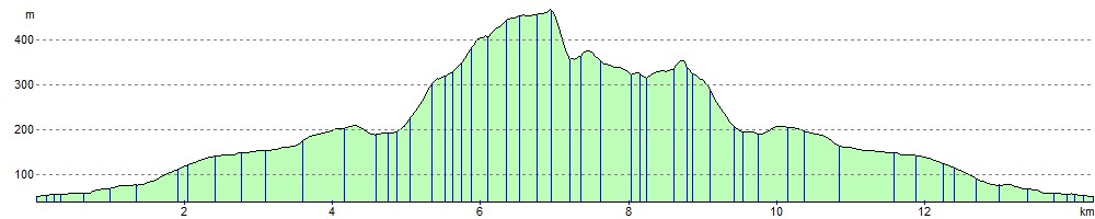
Elevation Profile