Slindon Estate Walks

 The Slindon Estate is a fantastic place for walkers and cyclists with miles of footpaths and bridleways to follow through the 1400 hectare estate. It is made up of a variety of habitats including woodland, downland, farmland, and parkland. All the while there are wonderful views over the Weald, the South Downs and the coast with the Isle of Wight beyond.
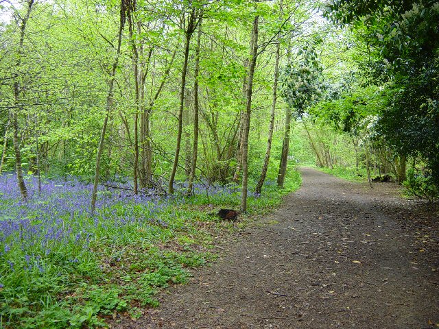
This circular walk starts at the village of Slindon on Butt Lane and climbs towards Bignor Hill and Gumber Corner. Here you pick up the Stane Street Roman Road and the Monarch's Way which leads you into a long woodland section through Nore Wood. It's a lovely section with bluebells, wild flowers and other woodland plants to enjoy. The final section takes you back to Slindon passing the eye-catching Nore Hill Folly.
If you would like to continue your walking in the area then you could head a few miles to the east and enjoy a walk around Arundel Castle and Arundel Park with a riverside stretch along the River Arun.
This route skirts the edge of Eartham Woods which has bluebells and deer to look out for. Houghton Forest is also close by and has more mountain bike trails to try.
The Slindon Estate is located close to Chichester, Arundel and Bognor Regis.
Postcode
BN18 0RG - Please note: Postcode may be approximate for some rural locationsPlease click here for more information
Slindon Estate Ordnance Survey Map  - view and print off detailed OS map
Slindon Estate Open Street Map  - view and print off detailed map
Slindon Estate OS Map  - Mobile GPS OS Map with Location tracking
Slindon Estate Open Street Map  - Mobile GPS Map with Location tracking
Pubs/Cafes
The Slindon Forge has a lovely walker friendly tea room on the estate. They have a really good menu and an Information Centre with interpretation materials about the Slindon estate and the wider South Downs National Park. There's tables inside and out, plus a little shop selling a variety of items. You can find the forge on Reynolds Lane with a postcode of BN18 0QT for your sat navs.
Dog Walking
The parkland and woodland on the estate are ideal for dog walking so you'll probably see plenty of other owners with their pets on a fine day. The Slindon Forge mentioned above is also dog friendly.
Further Information and Other Local Ideas
Near Arundel there's the worthy village of Burpham to visit. The delightful riverside settlement includes picturesque thatched cottages, a Grade I listed Saxon Church and a century-old cricket pitch where W. G. Grace played.
Just to the south is the nearby town of Littlehampton. The town is well worth a visit with its two award winning beaches, some fine architecture and the longest bench in Britain to see.
For more walking ideas in the area see the South Downs Walks page.


