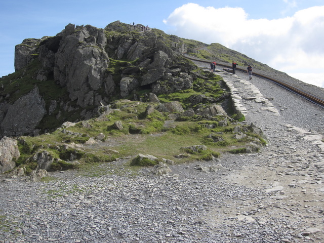
Snowdon Llanberis Path

 Climb to the summit of the highest mountain in Wales on this challenging walk. The Llanberis Path is the longest of the six routes to the top of Snowdon but because of it's gradual elevation it is generally considered the easiest route to the summit. It's very popular with leisure walkers as it runs parallel with the Snowdon Mountain railway which starts at Llanberis. As such you can use the railway to take you up (or down) part of the route.
The path starts in Llanberis near to the Royal Victoria Hotel and climbs towards Hebron Station with great views back towards Dinorwig Slate Quarry and Elidir Fawr. You continue to Halfway House, with wonderful views of Moel Cynghorion, Foel Goch, Foel Gron, Moel Eilio and the Cwm Brwynog valley. At Halfway House you can purchase refreshments in the summer months. The next stage ascends towards Cwm Glas Bach with views of the Llyn Du'r Arddu lake. The final section takes you from Bwlch Glas to the summit where there are magnificent views over Snowdonia, Ireland, the Isle of Man, the Peak District and the Lake District.
If you're looking for more challenging climbs to the summit you could try the Snowdon Miners Track or the Snowdon Pyg Track. The peak can also be reached by following a longer trail to Moel Eilio Foel Gron and Foel Goch.
For an exhilarating circular ridge walk, taking in the Crib Goch ridge, try the Snowdon Horseshoe.
Snowdon Llanberis Path Ordnance Survey Map  - view and print off detailed OS map
Snowdon Llanberis Path Open Street Map  - view and print off detailed map
Snowdon Llanberis Path OS Map  - Mobile GPS OS Map with Location tracking
Snowdon Llanberis Path Open Street Map  - Mobile GPS Map with Location tracking
Explore the Area with Google Street View 
Further Information and Other Local Ideas
For more walking ideas in the area see the Snowdonia Walks page.


