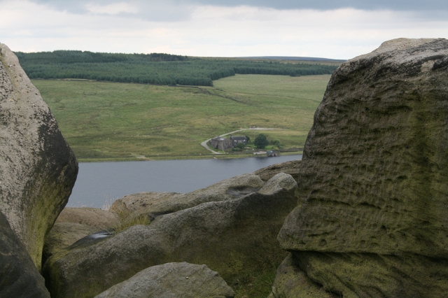
Withens Clough Reservoir

 Enjoy an easy circular walk around this attractive reservoir in the south Pennines. There is a good footpath running around the perimeter of the water with great views of the pretty countryside of Withens Clough and the Stoodley Pike Monument.
There is a parking area just to the east of the reservoir. Park here and then follow the Calderdale Way to the reservoir.
The walk can be extended by following the Pennine Way to Stoodley Pike. Here you will find the Stoodley Pike monument, built in 1856 at the end of the Crimean War. You can climb the stairs of the monument to a viewing platform and enjoy wonderful views over Calderdale.
You could also follow the Pennine Way south west and visit the nearby Warland Reservoir and White Holme Reservoir.
The reservoir is located near to the towns of Todmorden and Hebden Bridge, a mile to the west of Cragg Vale.
Postcode
HX7 5TA - Please note: Postcode may be approximate for some rural locationsWithens Clough Reservoir Ordnance Survey Map  - view and print off detailed OS map
Withens Clough Reservoir Open Street Map  - view and print off detailed map
Withens Clough Reservoir OS Map  - Mobile GPS OS Map with Location tracking
Withens Clough Reservoir Open Street Map  - Mobile GPS Map with Location tracking
Explore the Area with Google Street View 
Pubs/Cafes
After your walk head east to The Hinchliffe Arms pub for some post walk refreshments. There's great food and a nice outdoor seating area to relax in at this walker/cyclist friendly pub. You can find it on Church Bank Ln, Cragg Vale, HX7 5TA.
Also nearby is the Top Brink. The traditional original pub includes stone features, beamed ceilings, brassware & pottery, and a light airy large conservatory to the front with panoramic views. Outside there are several outside eating areas, including a large decked area and a lovely garden area with pretty flower baskets. It's a great place to relax and enjoy the countryside views with your meal. You can find the pub at Lumbutts just a short distance to the west of the reservoir. Postcode is OL14 6JB for your sat navs.
Just to the east there's the The Hinchliffe Arms in Cragg Vale. They do really excellent food and also have outside seating and an outside veranda. The inn can be found at Church Bank Lane with a postcode of HX7 5TA for your sat navs. There is ample parking at the pub too.
Further Information and Other Local Ideas
Head east of the reservoir and you could pay a visit to the interesting little village of Cragg Vale. It's known for The Cragg Vale Coiners, a band of counterfeiters that produced fake gold coins in the late 18th century to supplement small incomes from weaving. Just to the north you'll find Bell House Moor where the house of the leader of the Cragg Vale coiners can be seen. The Cragg Vale Walk starts from the village and visits the reservoir before climbing to the viewpoint at Turley Holes Edge.
Just to the west you'll find the pretty Gaddings Dam. The small reservoir is notable for having the highest beach in Britain.
For more walking ideas in the area see the South Pennines Walks page.


