 |
Ashton Canal |
 |
|
Description |
 Enjoy a waterside walk or cycle along this 6 mile long canal in Manchester. The canal runs from central Manchester to Ancoats,ĀBradford-with-Beswick, Clayton, Openshaw, Droylsden, Fairfield and Audenshaw before finishing at Ashton-under-Lyne where it meets the Huddersfield Narrow Canal. Walkers and cyclists can enjoy the whole route along the towpath. National Cycle Network Route 60 runs along the first section of the canal and a local cycle route takes you the rest of the way. Along the way you'll pass 18 locks, Manchester City Football Stadium, Manchester Velodrome and Philips Park. You can take short detours from the canal to visit some nearby attractions too. For example at Audenshaw you could head just south of the canal and visit Debdale Park and enjoy a walk around Gorton Reservoir. At the velodrome you can take a short trip north of the canal and visit Clayton Vale where there is a nature reserve with miles of walking trails and some great mountain bike trails. Enjoy a waterside walk or cycle along this 6 mile long canal in Manchester. The canal runs from central Manchester to Ancoats,ĀBradford-with-Beswick, Clayton, Openshaw, Droylsden, Fairfield and Audenshaw before finishing at Ashton-under-Lyne where it meets the Huddersfield Narrow Canal. Walkers and cyclists can enjoy the whole route along the towpath. National Cycle Network Route 60 runs along the first section of the canal and a local cycle route takes you the rest of the way. Along the way you'll pass 18 locks, Manchester City Football Stadium, Manchester Velodrome and Philips Park. You can take short detours from the canal to visit some nearby attractions too. For example at Audenshaw you could head just south of the canal and visit Debdale Park and enjoy a walk around Gorton Reservoir. At the velodrome you can take a short trip north of the canal and visit Clayton Vale where there is a nature reserve with miles of walking trails and some great mountain bike trails.
To extend your walk you can continue along the Huddersfield Narrow Canal in Ashton-under-Lyne.


|
|
|
Distance | 6 miles (9.5 km) |
|
|
Difficulty | * |
|
|
Joining Routes | Debdale Park, Manchester Loop, Cheshire Ring Canal Walk, Huddersfield Narrow Canal, Audenshaw Reservoir Walk, Portland Basin, Clayton Vale, Manchester Cycleway |
|
|
Memory Map Route | Ashton Canal.mmo (right click - 'Save As') |
|
|
GPX File | Ashton Canal.gpx (right click - 'Save As')
| |
|
Route Photos |
 Photos are copyrighted by their owners Photos are copyrighted by their owners
|
|
|
Map (Route in Red)
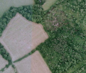
Aerial Photo View of this route
|
|
|
|
Video | |
|