 |
Taff Trail |
 |
|
Description |
 Follow the River Taff, from Cardiff to Brecon, on this fantastic waterside cycling and walking route. Follow the River Taff, from Cardiff to Brecon, on this fantastic waterside cycling and walking route.
You start on the River Taff in Cardiff and head along the river northwards passing the Millennium Stadium and Cardiff Castle. There are also views of the attractive riverside Bute Park and the Weir on the Taff near Maindy as you leave the centre of Cardiff. You soon come to Radyr where you will pass the splendid Forest Farm Country Park and Castle Coch (the red castle) before passing through the village of Nantgarw. The route continues along the river through Glyntaff and on to Pontypridd where you join the trackbed of a disused railway to Merthyr Tydfil. The final section runs from Merthyr to Brecon passing the beautiful Pontsticill, Pentwyn and Talybont Reservoirs. You'll also pass the beautiful Blaen y Glyn Waterfalls before joining the Monmouthshire and Brecon Canal taking you into Brecon.


|
|
|
Distance | 55 miles (88 km) |
|
|
Joining Routes | Pontypridd, Blaen y Glyn Waterfalls, Talybont Reservoir, Pontsticill Reservoir, Castle Coch, Forest Farm Country Park, Monmouthshire and Brecon Canal, Merthyr Tydfil, Bute Park, Pen y Crug, Glamorganshire Canal |
|
|
Memory Map Route | Taff Trail.mmo (right click - 'Save As') |
|
|
GPX File | Taff Trail.gpx (right click - 'Save As')
| |
|
Elevation | 
|
|
|
Route Photos |  |  |  |  | Cardiff Millennium Stadium on the River Taff | Weir on the Taff, Cardiff | Pontypridd | Cefn Coed Railway Viaduct |  |  |  |  | Brecon Beacons view from Dol y Gaer Lake | Talybont Reservoir | Brecon Canal | Brecon Canal Basin, Brecon |
 Photos are copyrighted by their owners Photos are copyrighted by their owners
|
|
|
Map (Route in Red)
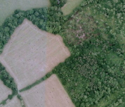
Aerial Photo View of this route
|
|
|
|
Video | |
|