Granite Way Cycle Route

 This lovely, largely off road cycle route runs from Okehampton to Lydford Gorge through the Dartmoor National Park. It runs for about 11 miles along a disused railway path and forms part of National Cycle Network Number 27 but is suitable for both cyclists and walkers.
The route begins in Okehampton and takes you towards Meldon where you will pass the impressive Meldon Viaduct and a delightful bluebell wood.
The viaduct was opened in 1874 and carried the London and South Western Railway (LSWR) across the West Okement River. It was constructed from wrought iron and cast iron and is now a Scheduled Monument. There's great views over the Okement Valley and Dartmoor from the elevated position of the bridge.
The route continues onto the pretty village of Sourton before passing Lake Viaduct where the scenery is particularly lovely. The final section then takes you to the village of Lydford where you will pass the noteworthy castle and church. You then come to the finish point at the impressive Lydford Gorge with its dramatic scenery which includes waterfalls and and a series of whirlpools known as the 'Devil's Cauldron'.
Postcode
EX20 1EH - Please note: Postcode may be approximate for some rural locationsPlease click here for more information
Granite Way Ordnance Survey Map  - view and print off detailed OS map
Granite Way Open Street Map  - view and print off detailed map
Granite Way OS Map  - Mobile GPS OS Map with Location tracking
Granite Way Open Street Map  - Mobile GPS Map with Location tracking
Pubs/Cafes
On the walk you could stop for refreshments at the Highwayman Inn for a great pub experience. The pub is considered England's most unusual inn with a marvellous interior and an interesting mix of ancient artifacts. It dates from the 11th-century and is also said to be haunted! The wonderful inn is located to the west of Meldon Reservoir at Sourton, postcode EX20 4HN.
Further Information and Other Local Ideas
At the start/end in Okehampton The Fountain Inn is a good choice. The inn has a lovely terrace and riverside garden area where you can relax on warmer days. They serve a fine Sunday carvery with a cosy interior and two real fires. You can find them on Fore Street with a postcode of EX20 1AP. The town itself is also well worth exploring with highlights including the 15th century Chapel of St James and the medieval ruins of Okehampton Castle which is now run as a tourist attraction by English Heritage.
In Tavistock you can link up with the 22 mile Drakes Trail. It starts in Tavistock and visits the Tavistock Canal and Grenofen Bridge before linking up with the popular Plym Valley Trail. It's another rail trail with easy off road cycling to enjoy. The route is named after the explorer Sir Francis Drake who was born in Tavistock and has a statue in Plymouth.
Cycle Routes and Walking Routes Nearby
Photos
The cycleway, following the disused Tavistock-Okehampton railway line, crosses Battishill Down north of Lydford.
At this point NCN cycleway 27 (following the disused railway between Meldon and Sourton) is in a cutting just west of Youlditch Farm. Beyond the pool is a small granite post; on this side are the letters "OH", and on the far side, "S". Maybe "Okehampton" and "Sourton"? Surely a coincidence that these are model railway scales?
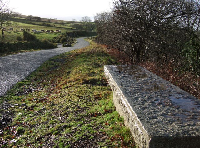
A new granite bench near the southern end of Lake Viaduct on the cycleway that follows the disused Okehampton - Tavistock railway line. In the background, just this side of the two sheep sunning themselves on the track, a fork left takes cyclists back under the viaduct and down to cross the A386.
The trail near Lake. Looking north along the re-used (as a cycleway) Tavistock-Okehampton railway track as it enters a cutting after crossing Lake Viaduct. At this point a path climbs to the left of the cutting to join Sourton Bridleway 14.
Elevation Profile


